This site requires Javascript to be turned on. Please enable Javascript and reload the page.
Thanks for your patience during our recent outage at scalar.usc.edu. While Scalar content is loading normally now, saving is still slow, and Scalar's 'additional metadata' features have been disabled, which may interfere with features like timelines and maps that depend on metadata. This also means that saving a page or media item will remove its additional metadata. If this occurs, you can use the 'All versions' link at the bottom of the page to restore the earlier version. We are continuing to troubleshoot, and will provide further updates as needed. Note that this only affects Scalar projects at scalar.usc.edu, and not those hosted elsewhere.
Asia-Pacific in the Making of the Americas: Toward a Global History
Main Menu
The Spanish Pacific
The China Trade Era
19th-Century US Pacific
Timeline
by Andrea Ledesma
Gallery
Collection of all images, documents, and photos featured on this site.
Acknowledgements
Caroline Frank
a1a5e7e9a2c3dba76ecb2896a93bf66ac8d1635e
Schurman Commission Document, 1900
1
2016-05-06T08:11:57-07:00
Isabella Betita
7d0d562afdd86f5d0b9bdd6b47254a8bdbcb5fa5
8401
2
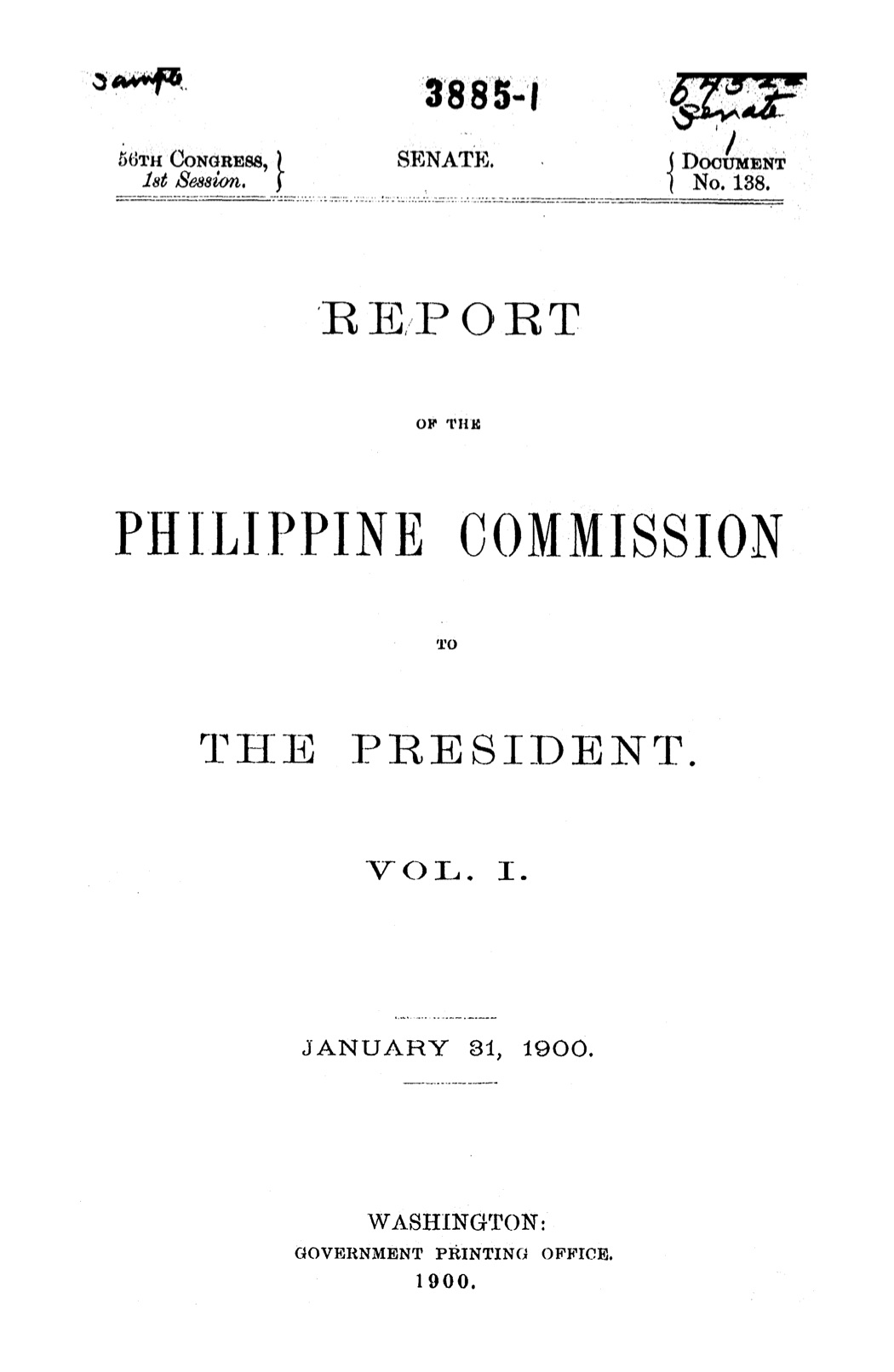
The Schurman Commission, also known as the First Philippine Commission, was formed by President William McKinley on January 20, 1899. The commission was tasked with studying the political climate of the country and make policy recommendations. While the report acknowledged Filipino aspirations for independence, the commission reported that the country was not ready for self-governance. From the University of Michigan Library.
plain
2016-09-02T10:06:20-07:00
Andrea Ledesma
3398f082e76a2c1c8a9101d91a66e1d764540d34
This page has tags:
1
media/ortelius-pacifici-1589.jpg
2016-04-22T12:45:00-07:00
Zachary Ziebell
8eecdb2214ffc2e89ec5ed5f180953625d845cc7
The Spanish Pacific
Elli Mylonas
39
image_header
2018-02-08T22:30:23-08:00
Elli Mylonas
3c69a4505ab77d1fab94c82afa1ef89d9f5787ff
Contents of this tag:
1
2016-02-26T12:37:34-08:00
English and French Seek Pacific Route to Asia
22
Smith Paper_Page 5
plain
2017-02-15T10:17:04-08:00
1
2017-02-08T10:24:26-08:00
Hennepin's Nouvelle France, 1783
6
Louis Hennepin, 1783. Map of North America and the northern part of South America from New France to New Spain. Cartographic elements include Indian settlements, the Great Lakes and St. Lawrence River, part of the Mississippi River, locations of missions and forts, sea banks or shoals, and lines of latitude and longitude. Decorative cartouche includes allegorical figures. An angel holding a shield with a cross smites a fallen man who holds snakes. At right, a redeemed man and woman rise up toward cross and the triumph of Louisiana. One female figure holds the royal French coat of arms, another holds a banner with "Louis." John Carter Brown Library
plain
2017-02-08T12:12:42-08:00
1
2016-06-28T13:56:05-07:00
Indias Ocidentales, 1601 (1575)
5
"Descripcion de las Yndias del occidentals." Madrid, 1601, in Historia general de los hechos de los castellanos en las islas i Tierra Firme del Mar Oceano escrita por Antonio de Herrera coronista mayor de Su Md: de las Indias y su coronista de Castilla ... Decada primera" Map of the western hemisphere with the northwestern part of North America unfinished and showing part of western Iberian pennisula and Africa, part of China, Japan, part of New Guinea, and some of the Solomon islands. Includes the Line of Demarkation. Only four known surviving examples.
plain
2016-09-02T08:16:56-07:00
1
2016-06-02T22:13:02-07:00
Japanese Sailing Map
5
This Japanese sailing map from the early seventeenth century depicts the Indian ocean and the East Asian coast. Numerous Japanese Red Seal ships set sail for the Philippines, propelled by trade or religious refuge. Tokyo National Museum.
plain
2016-09-02T09:53:21-07:00
1
2016-05-06T06:41:18-07:00
Carta Hydrographica y Chorographica de las Yslas Filipinas — Sangley Details
5
Detail of Carta Hydrographica y Chorographica de las Yslas Filipinas (1734), by Pedro Murillo Velarde. The Philippines was a vital part of the Spanish Empire, and the map shows the maritime routes from Manila to Spain and to New Spain. There are twelve engravings on the sides depicting different ethnic groups living in the archipelago and cartographic descriptions of particular cities or islands. From the National Library of Spain.
plain
2016-09-02T10:04:54-07:00
1
2016-06-29T12:44:08-07:00
Merchants Eating In a Boat
5
This image dates from 1596 and depicts merchants in the New World. It is located in Linschoten's Itinerario, a hand-painted book that describes various trade routes and ethnic groups.
plain
2016-09-19T12:41:37-07:00
1
2016-06-02T21:38:45-07:00
The Life of St. Francis Xavier : Apostle of the Indies and Japan
4
by Daniello Bartoli, 1608-1685. Bartoli, a 17th century Italian Jesuit writer, zealously describes St. Francis Xavier's travels to the Indies and Japan on galleons on a mission to convert foreigners to Catholicism. A description of St.Francis Xavier's 1549 voyage to Japan begins on page 326, Book the Third. Here, Bartoli refers to letters sent by St.Francis while in Japan and his ultimately successful efforts to spread Catholicism there. Bartoli writes on the saint's humility, skill with learning foreign languages (a skill he attributes to God) and the positive responses he received while preaching christianity. Translation of his Vita di S. Francesco Saverio della Compagnia di Gesù apostolo delle Indie.
plain
2017-03-01T06:58:03-08:00
1
2016-06-02T22:23:15-07:00
1634 Japanese Red Seal Ship
4
As the Japanese increasingly ventured on voyages for trading purposes nearing the seventeenth century, Red Seal ships became more common. Red Seal ships were military merchant sailing ships that were armed and carried red-sealed permits from Tokugawa Ieyasu, the Japanese ruler of the time. The seals allowed for a controlled system of foreign trade as well as protection against pirates. Tokyo Naval Science Museum.
plain
2016-09-02T09:52:00-07:00
1
2017-02-08T09:46:00-08:00
Spanish military, 1570
4
Full-length portrait in military costume, with pike, standing before ornamental archway, engraved by William Rogers, c. 1570.
plain
2017-02-08T12:10:15-08:00
1
media/Screen Shot 2017-04-12 at 3.52.17 PM.png
2016-03-19T16:37:26-07:00
Will of Juan de Páez
4
plain
2017-04-12T12:53:54-07:00
1
2016-06-28T13:32:54-07:00
Planta de las Islas Filipinas Detail, 1699
4
Detail of map.
plain
2016-09-02T09:19:26-07:00
1
2016-06-29T12:15:46-07:00
Sangley Rebellion
4
"Rare first edition of an important relation describing the 1639-40 revolt of ethnic Chinese Filipinos (Sangleyes) against Spanish colonial powers at the port of Calamba, located some 55 kilometers south of Manila. This organized conspiracy, sometimes called the Second Chinese Insurrection (the first Sangley rebellion occurred in 1603), had been coordinated to begin on Christmas Eve of 1639: Sangley insurgents (some 45,000 Sangleys lived in and around Manila at the time) corresponded with a Chinese pirate named Yquan Sanglus, agreeing that he should surprise the Spanish colonists and capture their galleons arriving from New Spain. Governor Sebastián Hurtado de Corcuera’s (d. 1660) soldiers, supported by two companies of Sangley mestizos, one company of Japanese troops and additional fighters from among the indigenous and free black population, easily put down the revolt during January and February of 1640. The present document is rich with details and records that 5 million pesos worth of damage had been done in the rebellion, that the Spanish sank 11 of 20 Sangley ships, killed 650 Sangley sailors in the initial skirmish and several thousand infantrymen in the weeks that followed. Sangley prisoners questioned by the Spaniards confessed that their leader had offered large rewards, including a Spanish woman as a wife, to any who should bring him a Spanish head. A total of 7783 Sangley fighters surrendered to colonial authorities on 24 February 1640, the peace largely brokered by Jesuits and Augustinians, some of whom had themselves participated in the battle. "
plain
2016-09-19T12:47:17-07:00
1
2016-03-18T14:00:35-07:00
Hennepin’s North America, 1698
4
plain
2017-02-08T12:12:14-08:00
1
2017-02-08T10:07:42-08:00
Descripcion de las Indias del Poniente
4
A 1601 Spanish map of present-day Philippines, Solomon Islands, Celebes Islands, and other South Pacific islands. Also includes part of China.
plain
2017-04-12T14:30:41-07:00
1
2016-06-28T10:11:21-07:00
Francisco Felipe Faxicura
4
Hasekura Rokuemon Tsunenaga was baptized as Francisco Felipe Faxicura on February 17, 1615 in Spain by King Philip III's personal chaplain. Shown in the top right is Hasekura's coat of arms: a crowned shield depicting a Buddhist swastika overlapping two intersecting arrows on an orange background. His coat of arms is seen in various places, including on his ship, San Juan Bautista. This image found in a German translation of: Historia del regno di Voxu del Giapone, first published Rome, 1615, found in the John Carter Brown Library or online at https://archive.org/details/relationvndgrndt00amat .
plain
2017-04-12T15:05:24-07:00
1
2016-06-28T14:31:07-07:00
Cobo's Crab in the Shilu
4
In chapter 8 of Shilu Cobo illustrates how animals nourish themselves, here a crab.
plain
2016-09-02T09:42:32-07:00
1
2016-03-18T13:59:17-07:00
General Map, 1576
4
The woodcut map is captioned: "A general map, made onelye [sic] for the particuler [sic] declaration of this discovery." Found in A discourse of a discouerie for a new passage to Cataia , written by Sir Humfrey Gilbert, Knight, London, c. 1576.
plain
2017-02-15T10:16:16-08:00
1
2016-06-06T17:56:18-07:00
Clergy and Tradesmen, 1596
4
Depictions of Chinese clergy and tradesmen in the 1596 hand-painted "Itinerario" by Linschoten
plain
2016-09-02T08:49:39-07:00
1
2016-06-21T16:03:40-07:00
Manila Bay, 1685
3
Manila Bay, 1685 ,Alain Menesson-Mallet. The left foreground shows peninsula where the Spanish confined Chinese (Sangley) merchants and artisans. From Description de l'univers: contenant les differents systêmes du monde, les cartes generales & particulieres de la geographie ancienne & moderne: les plans & les profils des principales villes, published in 1683. The John Carter Brown Library.
plain
2016-09-02T09:15:52-07:00
1
2016-06-29T12:47:30-07:00
Chinese Merchants
3
This image dates from 1596 and depicts merchants in the New World. It is located in Linschoten's Itinerario, a hand-painted book that describes various trade routes and ethnic groups.
plain
2016-09-19T12:40:39-07:00
1
2016-06-28T13:30:48-07:00
Planta de las Islas Filipinas, 1699
3
Planta de las Islas Filipinas dedicada al Rey N. Señor D. Felipe Quarto en su Real Cons. de Indias. Ano 1699." The 1699 map of the Philippines depicts European and Chinese ships, illustrating the influx of foreign trade Manila received in the seventeenth century. The map was made by Francisco Colín and published in Madrid.
plain
2016-09-02T09:17:55-07:00
1
2016-06-28T14:19:40-07:00
Bilingual pages of Cobo's Beng Sim Po Cam
3
Written in the original Chinese with the facing page translated into Latin by Cobo.
plain
2016-09-02T09:30:31-07:00
1
2017-02-08T10:02:38-08:00
Historia general, 1601
3
Engraved frontispiece of Historia general de los hechos de los castellanos en las islas i Tierra Firme del Mar Oceano, escrita por Antonio de Herrera coronista maior de Su Md: de las Indias y su coronista de Castilla ... Decada terzera. Al Rey Nutro Senor. Includes small engravings of 10 scenes, 4 bust portraits, title and shield. Published in 1601 by Emplenta Real.
plain
2017-02-08T12:10:43-08:00
1
2016-04-29T08:52:58-07:00
Signature of Luis de Encio
3
Luis de Encio signed a document with his Japanese name, Fukuchi Soemon or Hyoemon. Luis de Encio is the he phonetic equivalent to his original Japanese name. In the 1980's, this signature led Eikichi Hayashiya, Japanese ambassador of Spain, to follow the paths of Luis de Encio and Juan de Paez from Japan to New Spain.
plain
2017-04-12T14:28:48-07:00
1
2016-03-25T11:19:01-07:00
1618 Chinese Map of the Philippines
3
Dong Xi yang kao 東西洋考 (On the eastern and western oceans), 1618, by Zhang Xie 張燮, 1574-1640. "...is the most comprehensive Ming description of the countries of Southeast Asia." ( Wilkinson, Chinese History, a Manual, p. 747. "...a maritime geography of south Asia...deals with the history, topography, products, and trade of the lands of southeast Asia, including the Philippines, the Moluccas, Brunei (on the north coast of Borneo), ...Indo-China, Malay Peninsula, Sumatra, Java, southwest coast of Borneo, a total of thirty-eight countries; discusses China's relations with Japan and the Dutch 紅毛番 ...revenue, navigation (with compass directions and distances and rhymed rules for weather prediction), and to a certain eunuch revenue collector Gao Cai, who exacted tribute from merchants...until his recall to Peking in 1615....documents and official communications between the Chinese court and various countries including Japan" -- Cf. Dictionary of Ming Biography: 77-78 (courtesy of The Ricci Institute Library). Nineteenth-century Chinese facsimile of the first edition from Brown University Libraries, The Gardner Collection.
plain
2016-09-02T08:22:35-07:00
1
2016-06-28T14:24:16-07:00
Cobo's Shilu cover page, 1593
3
Published in Manila in 1593. Only one extant copy survives, now in the National Library of Madrid.
plain
2016-09-02T09:35:34-07:00
1
2016-06-28T14:29:23-07:00
European geocentric cosmology
3
Drawings by Juan Cabo from the fourth chapter of Shi Lu . The text and drawing offer the first clear expression of the roundness of the earth ever written in the Chinese language.
plain
2016-09-02T09:36:38-07:00
1
2016-06-29T12:35:06-07:00
Large Map of Asia
3
"This... map embraces all of Asia. The Middle East is very well formed, although the Caspian Sea has the egg-like form it maintained on maps until the 1730s. The Arabian Peninsula is well defined, based on Portuguese sources, and India takes its form after the maps of the Dutch adventurer, Jan Hugyen van Linschoten (1596), which, in turn, borrowed from Portuguese sources. Southeast Asia and the Indonesian Archipelago are derived from charts made for the Dutch East India Company (the VOC), while China is derived from Jesuit sources, although Korea is an oddly elongated peninsula. The geography of the region would remain an enigma to Europeans until the early 18th Century. Japan's Honshu and Kyushu are recognizable, although the area further to the northeast remains a vast mystery. True to the ‘Carte à Figures’ style, which was the hallmark of the great contemporary period of Dutch Baroque cartography, the map is surrounded on three sides by registers of fine vignettes. Along the top of the map are views of Farmagusta (Cyprus), Rhodes (Greece), Damascus, Jerusalem, Aden and Hormuz (Persia). Along the left side of the map are depictions of people in local costume including Syrians, Arabs, Armenians & Persians, Indians, and Sumatrans. On the left side are depictions that include Javanese, Moluccans & Bandans, Chinese, Russians and Tartars. The map is further embellished by a fine title cartouche and ships and sea monsters in the seas. The map was originally conceived by Jodocus Hondius the Younger, as a part of an exceedingly rare Appendix to the Hondius-Mercator Atlas (1630), of which this edition included an extra panel of text at the bottom. The present edition was issued by Hondius’s brother-in-law, Jan Jansson, as part of Atlas Novus (1638). The Jansson edition is distinguishable by the appearance of Jansson’s imprint, within a cartouche, to the upper right, and the removal of the bottom text panel, which was considered to be too cumbersome for inclusion in a folio atlas. The map was originally conceived by Jodocus Hondius the Younger (1594-1629), whose eponymous father played a large part in the rise of Amsterdam as the dominant cartographic production center in the 17th Century. The present edition of the map is by Jan Jansson (1588-1664), who married Jodocus the Younger’s sister Elizabeth. He transformed the Hondius firm into a powerhouse of geographical publications. Jansson most notably published the Atlas Novus (1638), and the Atlas Major (1660), the 11 volumes of which included a town atlas, a hydrographic atlas, an atlas of the ancient world, and Andreas Cellarius’s incomparable celestial atlas. Jansson’s works were rivaled only by those of his arch-nemesis Joan Blaeu. The present map is one of the finest depictions of Asia from the apogee of Dutch cartography. It is also scarce, appearing on the market infrequently." From The Barry Ruderman Antique Maps, co.
plain
2016-09-19T12:48:00-07:00
1
2016-06-29T12:09:30-07:00
Chinese Chuan
3
This image dates from 1596 and depicts a Chinese ship or Chuan. It is located in Linschoten's Itinerario, a hand-painted book that describes various trade routes and ethnic groups.
plain
2016-09-02T08:44:14-07:00
1
2016-06-28T13:53:19-07:00
Intramuros, Manila, 1571
3
Street map of walled city of Manila by Ignacio Munoz, O.P., 1571.
plain
2016-09-02T09:21:56-07:00
1
2016-06-28T14:30:12-07:00
Juan Cabo's Eclipse
3
Cabo uses an eclipse to demonstrate that the earth is round in Chapter 4 of Shi Lu.
plain
2016-09-02T09:37:29-07:00
1
2016-06-29T12:30:40-07:00
Ships Near Port
3
This image dates from 1596 and depicts Spanish ships, or Galleons, near a port. It is located in Linschoten's Itinerario, a hand-painted book that describes various trade routes and ethnic groups.
plain
2016-09-19T12:16:24-07:00
1
2016-06-29T12:40:18-07:00
Image of a Port
3
This image dates from 1596 and depicts a port in the New World. It is located in Linschoten's Itinerario, a hand-painted book that describes various trade routes and ethnic groups.
plain
2016-09-19T12:49:52-07:00
1
2016-06-28T14:06:30-07:00
Santo Tomas Libreria, 1887
3
Established with the arrival of the Dominicans in Manila, who also soon imported printing—in Roman characters on movable type—to the city.
plain
2016-09-02T09:23:47-07:00
1
2016-06-29T12:23:42-07:00
Chinese Merchants
3
These images depict Chinese merchants, drawn by Dutch explorers. They are located in Linschoten's Itinerario, a hand-painted book from 1596, that describes various trade routes and ethnic groups.
plain
2016-09-19T12:36:53-07:00
1
2016-06-29T12:11:40-07:00
Interior of a Spanish Galleon
3
This image depicts the inside of a Spanish Galleon.
plain
2016-09-19T12:54:01-07:00
1
2016-06-29T12:41:49-07:00
Image of Ships on the Pacific Ocean
3
This image dates from 1596 and depicts exploration along the Pacific Ocean. It is located in Linschoten's Itinerario, a hand-painted book that describes various trade routes and ethnic groups.
plain
2016-09-19T12:37:44-07:00
1
2016-06-29T12:29:18-07:00
Port in Acapulco
3
"The beautiful " birds- eye- view" of Mexico City by Juan Gómez de Trasmonte is extremely well -known as almost the only surviving representation of the city in the seventeenth -century . The origin , intentions and history of esta map are , however , less well- known. In fact , classical texts on the subject are inaccurate or incomplete mostly . Incorporating new cartobibliographic evidence , this article reinterprets Trasmonte 's plan from the point of view of four methodological statements : i ) The map is the territory . ii ) The map is not the territory . iii ) Territories are maps and iv ) The maps is the map . Hopefully , This analysis Contributes some innovative methodological principles for studying historical urban cartography ." From "The map is the City?. A new look at the bird's eye view of Mexico City in 1628 by Juan Gómez de Trasmonte"
plain
2016-09-19T12:55:46-07:00
1
2016-04-21T11:48:01-07:00
Descripcion de las Yndias del Ocidentales by Antonio de Herrera y Tordesillas
3
1601 map of the western hemisphere with the northwestern part of North America unfinished and showing part of western Iberian peninsula and Africa, part of China, Japan, part of New Guinea, and some of the Solomon islands. Includes the Line of Demarcation between Portugese and Spanish colonial claims, including the Philippines. Archived in the John Carter Brown Map Collection
plain
2016-09-02T10:01:47-07:00
1
2016-06-29T12:36:40-07:00
The Parían Market, from Itinerario
3
This image dates from 1596 and depicts a marketplace in the New World. It is located in Linschoten's Itinerario, a hand-painted book that describes various trade routes and ethnic groups.
plain
2016-09-19T12:39:17-07:00
1
2016-06-29T12:38:57-07:00
Linschoten's Map of the World
3
This image dates from 1596 and depicts the world as two side by side globes. It is located in Linschoten's Itinerario, a hand-painted book that describes various trade routes and ethnic groups.
plain
2016-09-19T12:57:57-07:00
1
2016-06-29T12:49:59-07:00
The Pacific Ocean with Flying Fish
3
This image dates from 1596 and depicts the Pacific Ocean. It is located in Linschoten's Itinerario, a hand-painted book that describes various trade routes and ethnic groups.
plain
2017-02-15T10:20:13-08:00
1
2016-06-28T14:19:01-07:00
Beng Sim Po Cam
2
"Rich Mirror of the Clear Heart," a 14th-c. Chinese text translated by Juan Cobo, published in 16th century.
plain
2016-09-02T09:29:50-07:00
1
2016-05-06T06:46:38-07:00
Carta Hydrographica y Chorographica de las Yslas Filipinas — Mestizo Details
2
Detail of Carta Hydrographica y Chorographica de las Yslas Filipinas (1734), by Pedro Murillo Velarde. The Philippines was a vital part of the Spanish Empire, and the map shows the maritime routes from Manila to Spain and to New Spain. There are twelve engravings on the sides depicting different ethnic groups living in the archipelago and cartographic descriptions of particular cities or islands. From the National Library of Spain
plain
2016-09-02T10:04:04-07:00
1
2016-07-23T16:09:01-07:00
The San Juan Bautista
2
Originally owned by Date Masamune, an influential feudal lord in the Tokugawa court, the San Juan Bautista carried Hasekura Tsunenaga Rokuyemon, a samurai who led Masamune’s embassy to Spain and Italy, and Sebastián Vizcaíno, a Mexican diplomat. Vizcaíno was demoted to a simple passenger on the San Juan Bautista as Haskeura’s embassy sailed the ocean. A replica of the ship is shown here and found in Ishinomaki, Japan.
plain
2016-09-02T09:54:44-07:00
1
2016-05-06T08:11:57-07:00
Schurman Commission Document, 1900
2
The Schurman Commission, also known as the First Philippine Commission, was formed by President William McKinley on January 20, 1899. The commission was tasked with studying the political climate of the country and make policy recommendations. While the report acknowledged Filipino aspirations for independence, the commission reported that the country was not ready for self-governance. From the University of Michigan Library.
plain
2016-09-02T10:06:20-07:00
1
2016-03-19T15:54:20-07:00
Conquest of the Philippines, 1698
2
Frontispiece, Fray Gaspar de San Agustin, Conquistas de las Islas Filipinas: la temporal por las armas..., y la espiritual por los religiosos, Madrid, 1698. Note China toward the horizon in the center of the page, to which the islands of the Philippine archipelago seem mere stepping stones.
plain
2016-09-02T08:32:59-07:00
1
2016-06-28T13:39:56-07:00
Juan Cabo, 19th Century
2
Portrait from a nineteenth-century magazine published in Manila
plain
2016-09-02T09:20:15-07:00
1
2016-06-28T11:06:39-07:00
Map depicting the bay of Acapulco in 1632, detailing Japanese ship
2
Spanish captain Nicolás de Cardona sailed to Acapulco in 1614, the same year as Hasekura. He draws his then surroundings on the map and supplies a legend in his 1632 book, "Descripciones geográphicas e hydrográphicas de muchas tierras y mares del Norte y Sur en las Indias, en especial del descubrimiento del Reino de la California,"or "Geographic and hydrographic descriptions of many northern and southern lands and seas in the Indies, specifically the discovery of the kingdom of California.” The book is written in 1632, but the drawings on the map represent Cardona's catalogue of his surroundings during his 1614 expedition. He depicts a Japanese ship on the bay of Acapulco, believed to be the San Juan Bautista. Takashi Gonoi explains this likeliness in page 53 of "Hasekura Tsunenaga" 支倉常長, Yoshikawa Kōbunkan, 2003.
plain
2016-09-02T09:55:50-07:00
1
2016-05-06T09:08:03-07:00
Wong Kim Ark’s Departure Statement, 1894
2
After a visit to China in 1894, San Francisco-born Wong Kim Ark was denied reentry to the United States and detained by customs in California. At the U.S. District court, Wong filed a habeas corpus action against his detention. However, the U.S. attorney argued that Wong was a citizen of China because his parents were born in China. From the National Archives Catalogue.
plain
2016-09-02T10:07:13-07:00
1
2016-06-28T11:18:48-07:00
Cardona's legend for map of Acapulco bay
2
The legend supplied by Cardona shows letter D, 'a ship from Japan' corresponding with an drawing of what is likely San Juan Bautista, Hasekura's ship which landed the same year, 1614.
plain
2016-09-02T09:56:22-07:00
1
2017-02-08T12:30:56-08:00
Potosi
2
Forma de los ingenios enquese muelen los metales de plata en la Ribera de Potosi el vno de dos Cabeças yelostro de una. Arzáns de Orsúa y Vela, Bartolomé, 1676-1736 (creator); leaf 91 from Historia de la villa imperial de Potosí by Bartholome Arzans de Orzua y Vela. This is a detailed manuscript account, published by Brown University in 1965, of “that mining center where the wealth and poverty, avarice and generosity, religiosity and bitter hatreds, cruelty and intrigues all flourished” (John Phelan, The Hispanic Historical Review 47:4, Nov. 1967).
plain
2017-02-08T12:32:02-08:00
1
2016-06-29T12:21:46-07:00
Ships Near Port
2
This image dates from 1596 and depicts Spanish ships, or Galleons, near a port. It is located in Linschoten's Itinerario, a hand-painted book that describes various trade routes and ethnic groups.
plain
2016-09-02T08:47:41-07:00
1
2016-07-23T19:46:42-07:00
Documentation of Hasekura’s Roman Citizenship
2
Hasekura underwent a successful voyage and was well received by the King Philip III in Madrid and Pope Paul V in Rome. Shown above is documentation of Hasekura’s citizenship dated November 20, 1615.
plain
2016-09-02T09:57:10-07:00
1
2016-06-28T14:07:53-07:00
Nicolai Copernicus's de Revolvtionibus orbium coelestium, 1543
2
First published in Nuremberg in 1543 (2nd edition pictured), the book presents Copernicus's heliocentric theory, a brave departure from the accepted Ptolemaic geocentric universe. See the book here.
plain
2016-09-02T09:24:44-07:00
1
2016-04-21T16:56:24-07:00
Juan Correa, "St. Francis Xavier Baptizing" c. 1700
2
Templo de Santa Maria de Cuevas, Chihuahua, Mexico. The painting depicts St.Francis Xavier baptizing a Japanese king (identified by his crown, face, and style of clothes and hair) as an indigenous, likely Mexican couple and their child watch. This painting suggests the interest in the Japanese and their expansive conversion to the Christian faith.
plain
2016-09-02T09:48:22-07:00
1
2016-04-29T12:48:17-07:00
Guadalajara Cathedral
2
Juan de Paez was appointed steward of tithe incomes for the Guadalajara Cathedral . With close ties to the Cathedral, Juan de Paez was ultimately buried at the Altar of Santo Cristo upon his death. His wife was later buried beside him. The Guadalajara Cathedral was built in 1541 and then rebuilt in 1618 due to a fire and again in 1854 due to an earthquake.
plain
2016-09-02T09:59:07-07:00
1
2016-06-29T12:26:08-07:00
Parían Market
2
" Market Manila, called the Parian . Juan Francisco de Ravenet and Bunel . Collection of drawings and prints of the Malaspina Expedition 1789-1794 . MN This is the only known drawing of Chinatown Manila, shortly before its demolition was ordered . Many of the characters depicted were the subject of a portrait by the same artist. " Known Drawing, 1521 1898 , Little Manila , Philippines 1521 , Single Drawing, Drawings , Spanish Philippines , Manila , Manila Call
plain
2016-09-02T08:58:34-07:00
1
2016-06-28T14:15:27-07:00
Doctrina Cristiana, 1593
2
Woodcut. Doctrina Christiana is the first published book in the Philippines in 1593 at the Imprenta de los Dominicanos de Manila.
plain
2016-09-02T09:25:49-07:00
1
2016-06-02T22:27:41-07:00
1608 Red Seal License
2
Red Seal Licenses were often granted by Tokugawa Ieyasu, leader of Japan and the Japanese military during this period.
plain
2016-09-02T09:50:53-07:00
This page is referenced by:
1
2016-03-25T11:20:09-07:00
American Colonial Period and the Schurman Commission
23
plain
2017-02-16T07:18:37-08:00
The gradual disappearance of the “Chinese mestizo” as a “third” ethnic group became permanent and made official by legislative fiat under the American colonial government. In place of a three-way ethno-legal classification system for Chinese, Chinese mestizos, and indios, American policy nationalized ethnic classifications to create a “Filipino”-“alien/non-Filipino” binary.[31]the Schurman commission to gather information regarding the different “races” on the Islands, including the "Negritos,” the “Moros,” the “Chinese,” and “Chinese and European mestizos.” The task the Commission faced was a daunting one, especially in a place where “all the races are represented in these islands.”[32] The Commission’s aim was to identify, describe, classify, or categorize the various indigenous groups of people in the Philippines, including the Chinese mestizos. To this end, the Commission spent some time interviewing various prominent people in Manila, ranging from foreign merchants, local residents, and Chinese merchants about who the “Chinese mestizos” were. The Chinese mestizos were seen as a “dangerous” element of Philippine society, since Emilio Aguinaldo and many other revolutionaries were Chinese mestizos. William Daland, an American who had been in the Philippines for thirty years, called the Chinese mestizo the “worst class” of Philippine society because: …they have always been taken so; they are treacherous and unreliable, but they are smart; the touch of Chinese blood seems to make them more cunning." [33]
[31] It should be noted that it was not the Americans who invented the “Filipino” as a category to classify the majority of their colonial subjects. During the latter part of the nineteenth century, ilustrados had already propagated the idea of calling natives of the Philippines “Filipinos,” although the term could be interchanged with Tagalogs, the ethnic group that most of the revolutionary leaders belonged to (Kramer 2006, 78-9).Report of the Philippine Commission to the President , Vol. 3 1900, 331