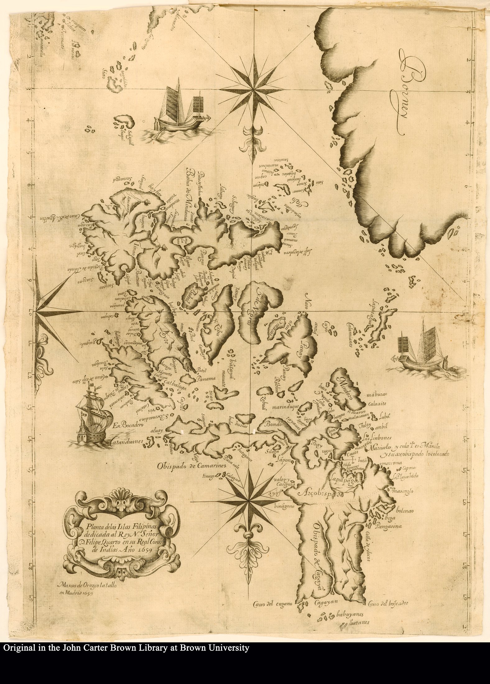
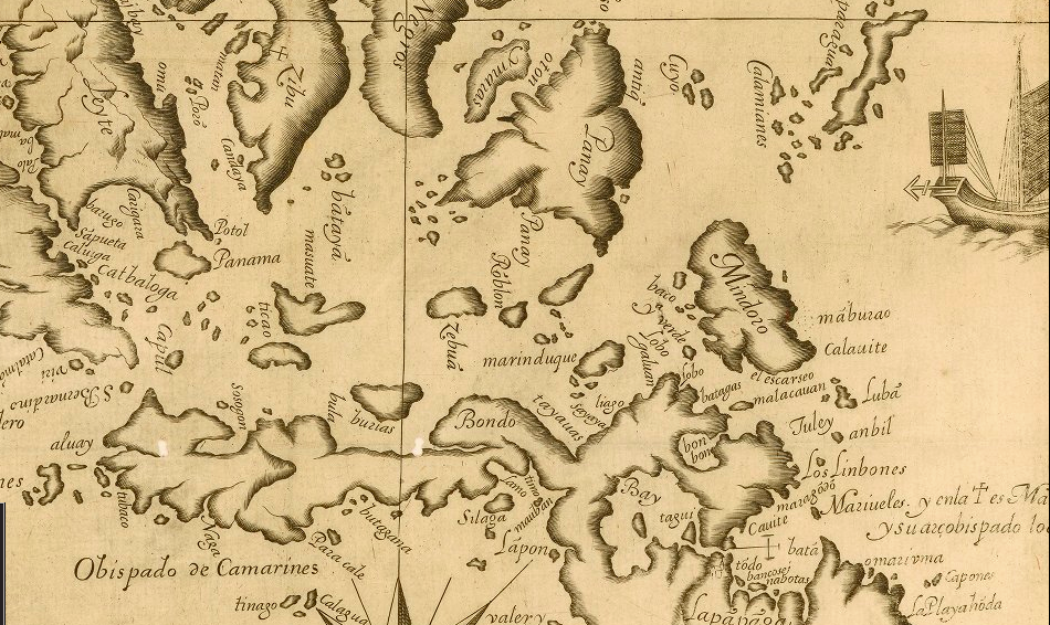
Planta de las Islas Filipinas, 1699
1 2016-06-28T13:30:48-07:00 Zachary Ziebell 8eecdb2214ffc2e89ec5ed5f180953625d845cc7 8401 3 Planta de las Islas Filipinas dedicada al Rey N. Señor D. Felipe Quarto en su Real Cons. de Indias. Ano 1699." The 1699 map of the Philippines depicts European and Chinese ships, illustrating the influx of foreign trade Manila received in the seventeenth century. The map was made by Francisco Colín and published in Madrid. plain 2016-09-02T09:17:55-07:00 The John Carter Brown Library Andrea Ledesma 3398f082e76a2c1c8a9101d91a66e1d764540d34This page has tags:
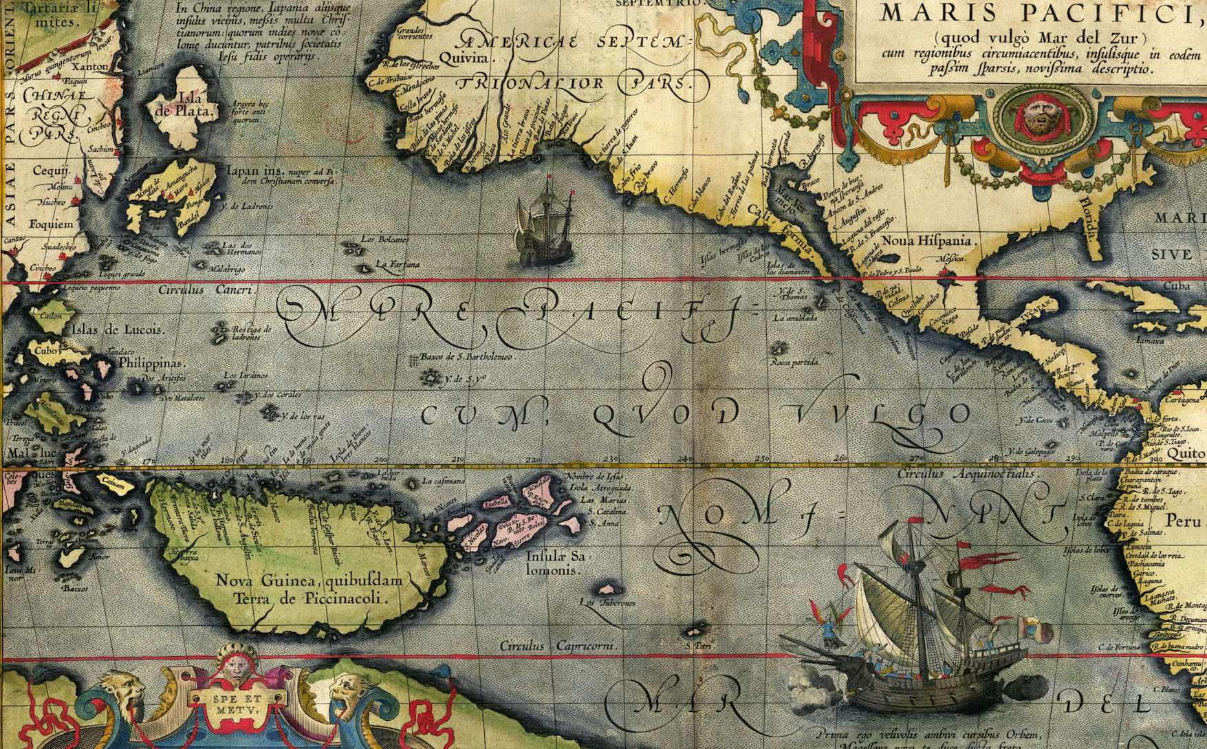
- 1 media/ortelius-pacifici-1589.jpg 2016-04-22T12:45:00-07:00 Zachary Ziebell 8eecdb2214ffc2e89ec5ed5f180953625d845cc7 The Spanish Pacific Elli Mylonas 39 image_header 2018-02-08T22:30:23-08:00 Elli Mylonas 3c69a4505ab77d1fab94c82afa1ef89d9f5787ff
This page is referenced by:
-
1
2016-02-26T12:37:34-08:00
Introduction: Spanish colonization of Las Filipinas and establishment of Manila
15
Cervera
plain
2017-02-02T07:53:59-08:00
It is well known that spices were the original commodities that lured Portuguese and Spaniards to rush to East Asia, followed by trade with La Gran China. After Turkey sealed off the traditional land route (which Marco Polo and early Jesuits had taken to China), the Portuguese sailed eastward around the tip of Africa to reach Asia, while Spaniards, with the advantage of an American base in Mexico (New Spain) had the advantage of crossing directly westward across the Pacific.
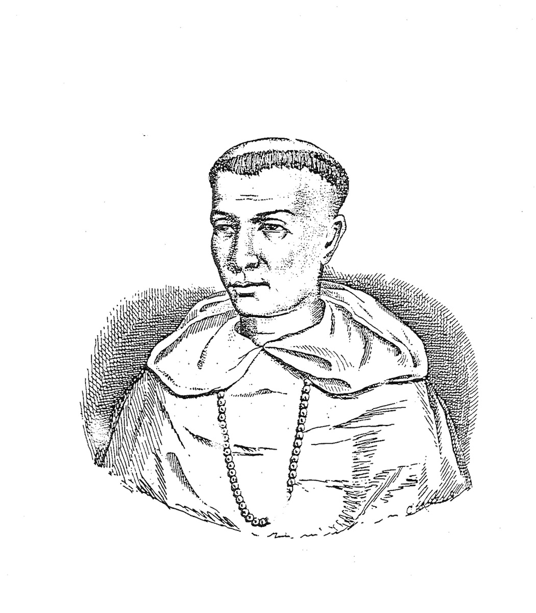
Early exploratory voyages undertaken from Spain by Magellan, Elcano and Loaisa (1519-26) were followed by three more launched from Mexico under Saavedra Cerón, Grijalva, and López de Villalobos (1527-42). These voyages persuaded Emperor Charles V that the time had come to send an expedition to set up a colony in Asia. He commissioned longtime Mexico resident Miguel López de Legazpi to lead the colonizing enterprise in 1564, with the further imperative to find a return route (tornaviaje) from Asia back across the Pacific to Mexico, that is, a transpacific roundtrip. Fortunately, he had the service of a brilliant navigator, the Augustinian friar Andrés de Urdaneta, who left Cebú Island (Zibu on the adjacent map) and followed trade winds and currents northward close to Japan before veering eastward to the California coastline and then south back to Acapulco, Mexico.Urdaneta’s galleon in this first transpacific roundtrip returned laden with Chinese silk, porcelain, and other luxury goods that the Chinese junk traders in the Philippines had provided in return for Mexican silver. This voyage constituted the first of a global trade system called the Manila Galleon Trade that would last over two and a half centuries. Not long after, the Spaniards opted for trade with China over the Spice Islands of the Moluccas, when Legazpi transferred the seat of Spanish colonial government in 1571 from Cebú to Manila on Luzón island, which was within easier reach of the coast of Minnan or southern Fujian, the source of most of the Chinese junk traders and later settlers already dubbed sangley by the Filipino natives. Within this historic context, two scientists and missionaries, the Augustinian Martín de Rada and the Dominican Juan Cabo, both fixed their eyes on China from their seat of operation in Spanish Manila.