English and French Seek Pacific Route to Asia
The English search for the Northwest Passage to Asia exemplified European rivals’ attempts to outmaneuver competitors in access to key trading markets in the globalized early modern world. Just as Spaniards bypassed the Portuguese-controlled Indian Ocean route to East Asia by forging a connection between Asia and the Americas in the Pacific, the English sought a route to Asia in order to bypass the Spanish-controlled trade routes through the Pacific Ocean; they were to be ultimately disappointed in their search for the Northwest Passage. Meanwhile, though, England commissioned privateers to attack Spanish shipping—to plunder Manila Galleons and other ships carrying the riches of the Spanish American Empire—along key commodity. [13]
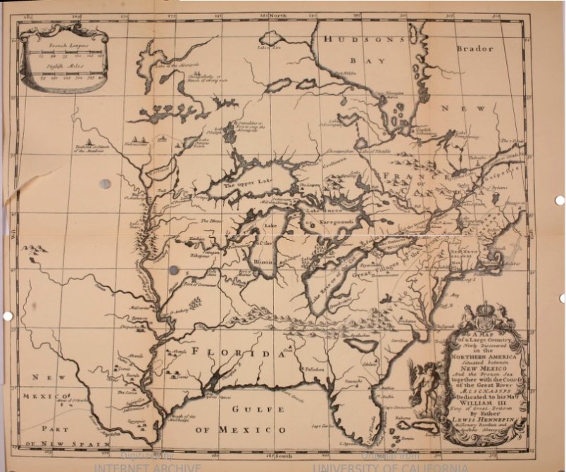
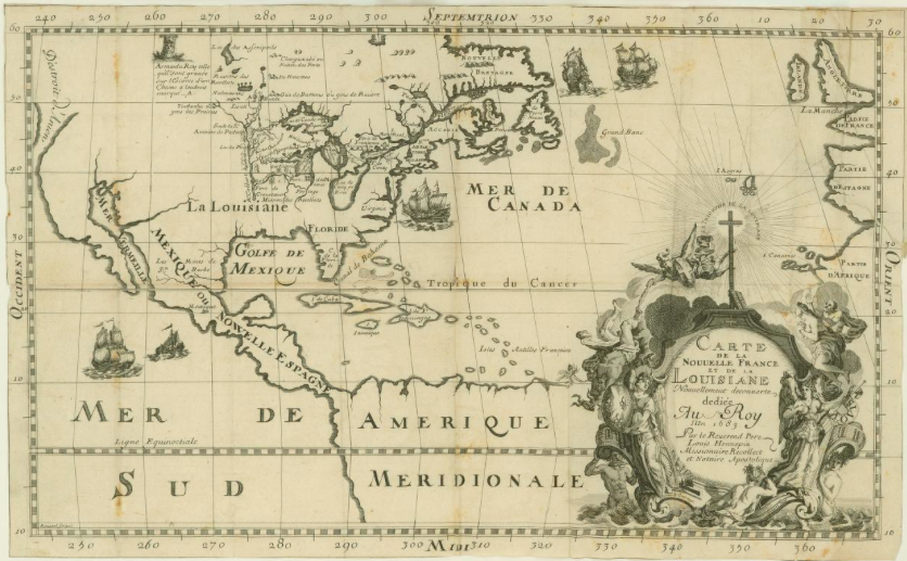
The French, too, sought routes to China in order to bypass Spanish-controlled territories in the Americas and the Spanish Pacific. Subsequent explorations of the North American interior made clear, however, there was no Northwest Passage. By the end of the seventeenth century, French explorers had mapped the continent well into the interior, as revealed, for example in the Franciscan missionary Louis Hennepin’s map of the New World. [See Louis Hennepin, Nouvelle Decouverte (1698)] First published in 1683, Hennepin’s maps reflected his voyage into the interior of North America along the Illinois River, where the French had established a settlement in 1675.[14] Financed by Louis XIV, Hennepin sought the confluence of the Illinois and Mississippi Rivers as part of efforts to claim, and map, territory amidst the competing claims of rival European empires. By the late seventeenth century, however, it was clear to Spain’s rivals like the French and English that the Spanish-controlled Manila Galleon routes across the Pacific—along with Portuguese—dominated Indian Ocean trade routes – were the only existing maritime routes for accessing the China trade.
________________________
[12] Sir Humphrey Gilbert, “A general map, made onelye for the particular declaration of this discovery,” in A discourse of a disccouerie for a new passage to Catala (London: Henry Middleton, 1576). 18 x 29 cm. John Carter Brown Library, Brown University, Map Collection, 02128-1.
[13] Kris Lane, Pillaging the Empire: Piracy in the Americas, 1500-1750 (Armonk, NY and London, UK: M.E. Sharpe, 1998); Schurz, The Manila Galleon.
[14] Louis Hennepin, “Carte de la Nouvelle France et de la Louisiane nouvellement découverte, par le révérend père Louis Hennepin” (1683), 30.5 x 49cm. John Hay Library, Brown University, digitized reproduction of original, Bibliothèque nationale de France, Paris, département Cartes et plans, CPL GE DD-2987 (8781).