Cahokia
Overview
Cahokia is a Mississippian cultural site located in Collinsville, Illinois, about thirteen miles from modern-day St. Louis, Missouri. Occupied from around AD 800-1350, estimates of the population at its height range from 10,000 to 25,000 people, making it equivalent to London and Paris at the same time. This massive city, composed of monumental architecture that still strikes awe into visitors, arose from a small settlement of only a few houses, eventually becoming a full-blown city dominating an entire region with extensive trade connections all over Eastern North America.
Environment
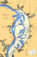
Cahokia sits within an area now known as the American Bottom, which lies in the Mississippi River Valley floodplain, just south of where the Missouri River flows into the Mississippi River. Thanks in part to the meandering nature of the mighty Mississippi, the American Bottom contains an interesting mix of floodplains, oxbow lakes, and streams flowing from nearby uplands. Woodlands composed of cottonwood, willow, and maple trees lay scattered around the lakes and streams of the floodplain; denser forests composed primarily of hardwoods such as oaks and cedar can be found in the nearby bluffs.
Economy & Food Subsistence
Cahokia, like almost all Mississippian cultural sites, was primarily driven by maize agriculture. Different from earlier cultural periods which were predominated by semi-sedentary horticulturalists relying on local plant and animal resources, Mississippians at Cahokia were sedentary agriculturalists. The rich soil of the American Bottom Region helped produce widespread cultivation of maize and other crops, such as beans and squash, that comprised a majority of the population's diet. The varied environmental zones available to those living in the American Bottom meant that a large amount of wild resources could be exploited through hunting, fishing, and gathering wild plant populations.
Cahokia was able to become such a dominating city partly through its ability to take advantage of a complex trade network connecting the polities and sites of the Mississippian world. Cahokia owed much of its importance to the manufacture and trading of local salt and chert, which could be obtained from the nearby bluffs bounding the American Bottom. The city was also a major trading center from which artifacts traveled massive distances all over the Mississippian world.
Technology
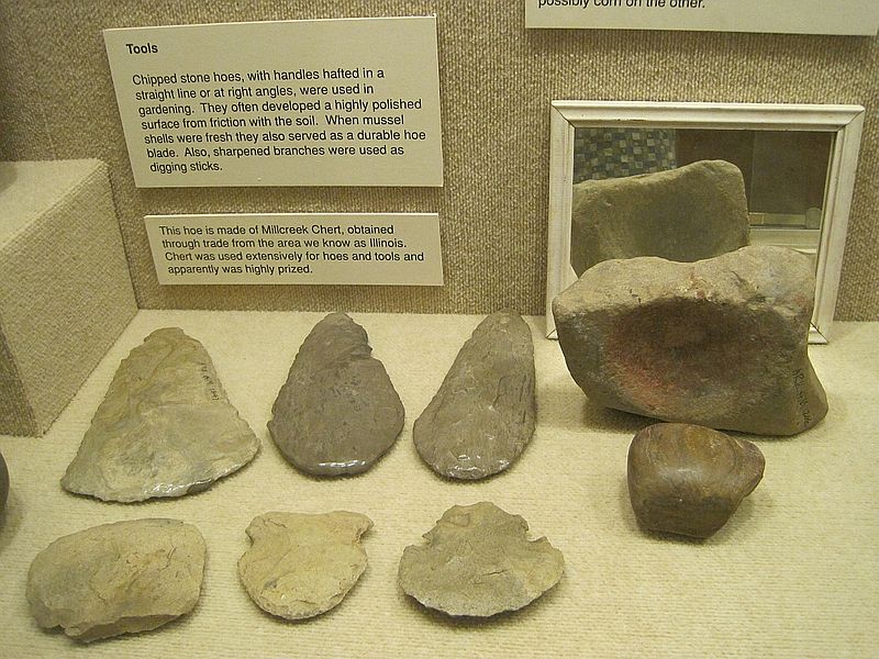
Local chert was an important lithic resource for people living within the Cahokian area. An important stone tool for Mississippian people was the hoe. First appearing with the emergence of maize as a dietary staple, stone hoes made out of local cherts were more effective than hoes made from wood or freshwater mussel shells. Other important lithic tools that could be found in a Cahokian's tool kit were large thin Ramey knives for cutting and scraping, as well as microdrills used to dig holes through shells to make beads.
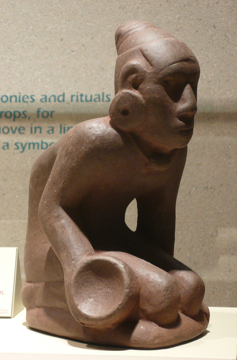
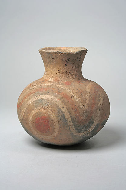
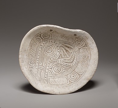
New ceramic forms also appeared at Cahokia during the emergence of the Mississippian cultural period. One diagnostic sign of Mississippian pottery is its tendency to be shell tempered. Shell was burned, crushed, and then mixed into the clay before it was shaped and heated to create a ceramic vessel. Increased variations in surface treatments and decorations also occurred during the height of Cahokia's habitation.
Social Organization
As maize farming started to become more important to the emerging Mississippian diet, a rapid change in the Mississippian social organization also seems to have occurred. Populations quickly started to expand at Cahokia around A.D. 1050, in what has been dubbed the "Mississippian Big Bang" by many researchers. While many argue over population size at Cahokia during its height in the Stirling phase (A.D. 1100-1200), most estimates fall within 10,000 to 20,000 people. Craft specialization occurred, with several parts of the site containing what appear to be areas for manufacturing specific items, such as beads. This evidence indicates that certain people could make a living without having to directly produce their own food. Smaller communities away from Cahokia appear to have been under the influence of the emerging leadership of Cahokia, and would trade agricultural surpluses for craft goods produced by the specialists.
Cahokia possessed over 100 large earthen mounds, several plazas, and a two-mile long palisade around the central part of the site. This central precinct consisted of a large plaza, defined on the edges by 18 mounds which were in turn surrounded by the palisade. Within these walls were the residential areas of the elites and the center of Cahokia's economic and political power. Control over the exchange network within the region and contacts with distant lands meant that a select group of individuals at Cahokia had some control over raw materials and iconographic symbols, making the controller powerful in the ability to redistribute the limited goods.
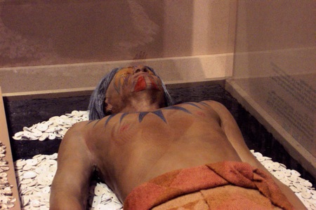
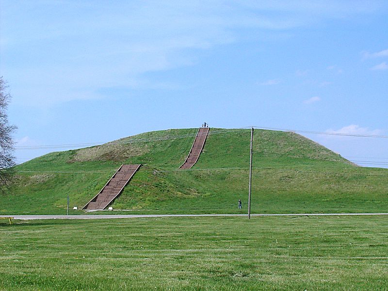
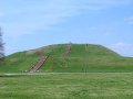
One of the most recognizable features of the site now is monumental architecture in the form of the large, earthen mounds. The amount of manpower and resources needed to construct these mounds must have necessitated quite an immense amount of planning and control. For example, Monks Mound, the largest at the site, covers over 14 acres and stands almost 100 feet tall. Remains of structures are usually found on the top of these flat-topped platform mounds, indicating that elites lived and governed from these locations. Some mounds, such as Mound 72, were important sacred spaces as indicated by the elaborate mass burials found within them.
Ideology
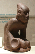
One burial in a small ridge topped mound (Mound 72) at Cahokia provides us evidence of a burial of a very important person associated with some ideological symbols. The “falcon warrior” was buried on top of a bed of thousands of shells in the shape of a bird figure, and was found with hundreds of arrowheads. These projectile points consist of distinct stylistic variations and materials associated with groups in places as far away as Oklahoma, Tennessee, southern Illinois, and Wisconsin. This exchange network connecting Cahokia and the rest of the Mississippian world helped to spread the common symbolic themes and motifs that have become part of the shared ideology making up what archaeologists have dubbed the Southeastern Ceremonial Complex. Along with this one elite burial was a mass burial of other individuals, some indicating that they were human sacrifices. Several symbols can be repeatedly seen throughout artwork found at Cahokia, including: the open hand, the winged serpent, circle and cross, and the falcon warrior. All of these motifs can further be found, with some local variations, across most of the Mississippian world.
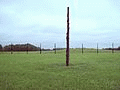
One more important feature at Cahokia is the existence of at least five woodhenges. These large circles of tall wooden posts placed in the ground could have held several important functions. The most obvious is that the posts are laid out according to solstices, and are thus indicative of a large solar calendar. Ceremonies, especially ceremonies associated with when to plant maize, would have depenended on these woodhenges. Furthermore, woodhenges
held a special sacred meaning. The circular shape could have indicated the sun that the device was measuring. The sun was also associated with the chief, who lived closest to it on the top of Monks Mound, and the symbolism possibly helped to establish his authority over these important ceremonies.
Questions:
First and foremost, is Cahokia a state? The theorist Childe offered a list of 10 criteria to identify states in the archaeological record. Cahokia exhibits many of these criteria, such as a large urban population, monumental architecture, science (woodhenges), craft specialization, and the importation of raw materials. However, Cahokia had no known writing system. If a society doesn’t have writing, does that mean it is not complex? How might the discovery of a writing system impact how archaeologists determine complexity?
All images were found on Wikimedia commons (except when indicated otherwise).
Header Image: Cahokia Mounds State Historic Site (Painting by Michael Hampshire)
Background Image: Herb Roe