Kinzua Dam's Environmental Impacts
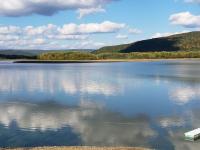
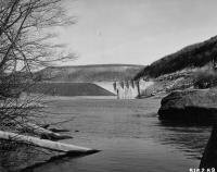
Kinzua Dam was built by the U.S. Army Corps of Engineers between 1960 and 1966. Once it began operations in 1967, Ohi:yo' was only able to move up, spilling past its banks and inundating our land.
For the past five decades portions of Ohi:yo' have operated as a reservoir in the summer months. Come fall of every year, much of the water reserves are lowered at the discretion of the U.S. Army Corps of Engineers. Ohi:yo' now follows a new cycle, forming new shorelines with deadly ecological effects.
The main environmental impacts of Kinzua Dam are:
- Harmful Algal Blooms (HABs)
- Riparian Zone Degradation
- Invasive Plant Species
- Degraded Fish Habitat
- Sedimentation