Working with ArcGIS Web Scenes
Importing an ArcGIS web scene
You can learn more about creating web scenes at the ArcGIS website. Here’s how to import your scene into Scalar.
- Create the web scene using ArcGIS tools.
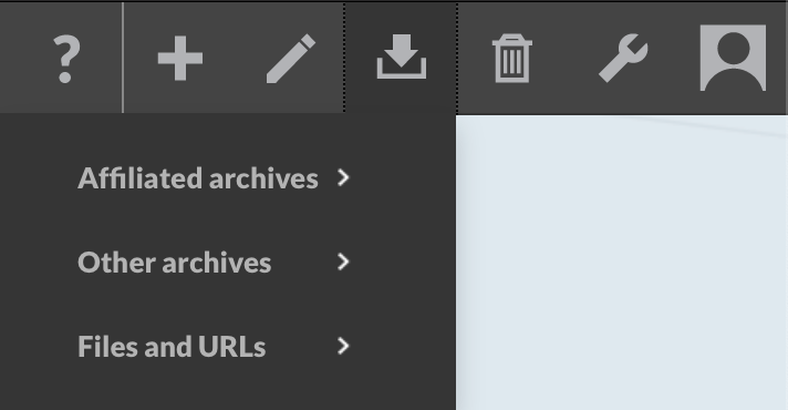
- Click the import icon in the Scalar header and select “Files and URLs” and then “Link to media files”.
- Open your web scene in a separate window and click the Share button (it looks like a box with an arrow coming out of it).
- Uncheck the “Short link” box, copy the URL, and paste it into the “Media file URL” field in Scalar.
- Fill out the rest of the form and then click “Save and view”.
You should now be able to view, link, annotate, and embed your ArcGIS scene like any other Scalar media.