Scalar's 'additional metadata' features have been disabled on this install. Learn more.
Ghost Metropolis: Los Angeles from Clovis to Nixon
Main Menu
Regimes: Ruling the Los Angeles Region from the Late Pleistocene to the 21st Century
Places and Paths of Los Angeles
Manna From Hell: Power and Politics from Region to World Power
Shadows: Visual Cultures and Mass Media of a Regional and Global Power
Segregated Diversity: The Geosocial Formation of Social Justice in the Late Twentieth Century
Richard 37th: Nixon, Los Angeles, and World Power
The American 1989: Los Angeles at the Climax of the 20th Century
Narrative Essay
Bibliographies, Filmographies, Gazeteers, Indexes
Mapping the Past: Theory, Methods, Historiography
Path
Credits
Root
Phil Ethington
e37d40405599cccc3b6330e6c4be064cc03ef7a5
The Four-Level Interchange, 1954
1 2013-11-01T21:34:02-07:00 Phil Ethington e37d40405599cccc3b6330e6c4be064cc03ef7a5 677 3 The Four-Level Interchange, 1954 Photo: Ralpha Morris, California Department of Transportation. Click here to go to view in map. plain 2016-10-14T15:05:04-07:00 Phil Ethington e37d40405599cccc3b6330e6c4be064cc03ef7a5This page has tags:
- 1 2018-08-15T06:56:34-07:00 Phil Ethington e37d40405599cccc3b6330e6c4be064cc03ef7a5 1950s Phil Ethington 2 Decadal Tag vistag 2018-08-15T07:23:42-07:00 Phil Ethington e37d40405599cccc3b6330e6c4be064cc03ef7a5
- 1 2018-08-15T16:21:51-07:00 Phil Ethington e37d40405599cccc3b6330e6c4be064cc03ef7a5 Topos: Spatial Views of Los Angeles Phil Ethington 2 structured_gallery 2018-08-15T16:22:27-07:00 Phil Ethington e37d40405599cccc3b6330e6c4be064cc03ef7a5
This page is referenced by:
-
1
2013-07-14T16:12:05-07:00
Circulation and Centrality: Networks of Motion from Footpath to Freeway to Flight Path, 9,000 BP to the 21st Century
114
image_header
2017-08-13T23:30:09-07:00
Cities and metropolises are hotbeds of motion. Cities and their internal places are nodes through which people and things circulate: their density can be visualized as the pressure of collective movement as people try to get to the center and back out again. Los Angeles, like every city or metropolis, is geographically static (its nodes and topography never move horizontally on the Earth's surface). The trick is to see movement as that which gives purpose, value, and meaning to all the fixed furniture, buildings, apartments, roads, and backyards. Those teeming millions of Angelenos from hundreds of language cultures, are the living metropolis, the reason any of it has value.
So much is true of all cities. But every city grows up defining utterly unique places, utterly unique regions, and those urban places embody, produce, and transmit the diversity of the world: Everyone wants Paris, London, Mumbai, Shanghai, San Francisco, and Los Angels to be different, unique places. Ghost Metropolis seeks to map the ultimately unique ways that Los Angeles put its distinctive stamp on the world. The world put its stamp on Los Angeles as well, to be sure. Especially since the Spanish conquered it as an imperial outpost, the flow of global civilization into and out of Los Angeles has been one of its most defining features.
Just how people, things, ideas circulate between and within cities is a matter of supreme importance for understanding any place. Circulatory networks etch the paths of intensive human labor at the scale of minutes, hours, days, months, and years. At the scale of generations and centuries, early paths become major highways and arteries. People and their institutions take root around those paths and the central places where they intersect.
Foot and Wheel Roads
The shape of Los Angeles today reflects the shapes inscribed over many centuries by many generations. The 110 Harbor Freeway, constructed 1948-1953, follows the path of a road that was already thousands of years old when the Spanish arrived. That path, about 23 miles in length, is labeled "Very Ancient Road" in Kirkman and Harriman's 1937 reconstruction of historic thoroughfares in the Los Angeles Basin. (See Detail of 1937 map). style="line-height: 20.8px;" Millingstone People inhabited the Los Angeles Basin for about 9,000 years, followed by another 2,000 years of Uto-Aztecan rule before the Spanish arrived. The LA Basin was highly inscribed by these centuries of circulation between the principal Southern California settlements, threading through canyons, along rivers and ridges, between hills, and through passes like the later-named Sepulveda Pass. Spanish conquerors most certainly used these footways as the basis for their horse-and-cart-carrying "Caminos Reales" ("Royal Roads"--that is, official roads of the Spanish Empire) and "Mission Roads" (that is, road that connected the Roman Catholic missions run by the Franciscan order) Those roads, in turn were paved and graded during the Anglo period for the Age of the Automobile. Fast forward to the mid-Twentieth century, and witness that the Caminos Reales of the Los Angeles Basin provided the paths for the Ventura (US 101) Hollywood (101), and San Diego Freeways (5) Freeways. Those join with the rest of the renowned LA freeway network in a tight ring around the original Spanish Land Grant of "Four Square Leagues" centered on La Placita.. This centrality has always assured that the highest densities of land value, highest concentrations of financial capital, highest traffic flow densities, and highest concentrations of state officers (Federal, California, County, and Los Angeles City governments), are co-located here.Note
This ever-growing network of arteries historically converged on a very durable core: "Yang-na" (Indigenous), "El Pueblo..." (Spanish/Mexican), "Downtown LA" (Anglo). This circulatory network converged on that core many centuries prior to the end of the 18th century, when the Spanish empire represented by the fourth Gubernador de Alta California, Felipe de Neve (1724–1784; governor 1775-1782) chose that site for its Pueblo in 1781. The centrality of Downtown LA today derives its power from this deep historical inscription.Note
Prior to the high-speed "freeways" of the mid-20th century, the "highways," prior to the 1950s were mainly the multi-lane paved arteries: Figueroa, Pico, Santa Monica, Long Beach, Alameda, Whittier, Wilshire, Mission, San Fernando, Manchester, and many more. Regional maps from 1910-20s show the footprint of the Spanish-Mexican period in meandering mission roads and caminos reales roads that connected the ancient dense settlements along the canyons and basins of the region, most certainly etched into pre-existing indigenous Uto-Aztecan paths.
Gridded over this ancient network of place-connecting "Old Roads," (as Kirkman and Harriman called them in their 1937 reconstruction) are the half-square mile Anglo arterials. The grid in urban planning is doubly neoclassical in Los Angeles: from the Spanish Law of the Indies, and from Jefferson's Enlightenment/capitalist Northwest Ordinance. The Anglo-American grid is one that does not always connect pre-existing settlements, in the way that ancient roadways do. In capitalist urbanism, the value polarity is reversed: the roadway is the valuable spatial form, conferring value on the land as a commodity. Nineteenth-century American city governments served as subsidizers of private investors and developers. Thus, the initial (post-1848) Anglo grid of rectilinear North-South and East-West arteries originally appeared preposterous. Graded with space for 8 traffic lanes (sufficient in the 21st century to carry up to 300,000 vehicles per day), these giant roads in the 1880s looked like a gratuitous dredging of the pastoral landscape.
Together, the ancient and the Anglo highways convered on two centers: the old Spanish-Mexican Plaza (known for generations as "La Placita"), and the newer Anglo-Commercial "Downtown," centered at Central Park (later renamed Pershing Square). For many years, automotive and horse-drawn vehicles jostled side-by-side. Already by 1915, the Auto Club of Southern California printed a map of LA's Downtown "Congested District," showing the effect of so much traffic converging at this central place, within the 1781 Royal Grant of four square leagues.
Standing back to view the region asa whole, fold-out map produced by the Auto Club also in 1915 shows how automobile-carrying old roads (Mission, San Fernando) plus the major Anglo arteries linked more than twenty urban concentrations throughout Southern California, all converging on Downtown LA. These two Auto Club maps help to explain each other: the congestion at the center reflected the bottle-neck of so many arteries converging there. That center, in turn, hosted the administrative centers that organized communication, investment, power, and the wider distribution of goods throughout the region.
Rail Roads
It is often thought that the Age of Automobile succeeded the great Age of Railroad, but in fact as mass people movers, they overlapped from about 1900 to 1940, and served different purposes. Automobiles were limited to local, metropolitan, and regional and travel, while Railroads provided most inter-state and inter-regional travel, and "light rail" (trolleys, streetcars) provided about the same range as automobiles.
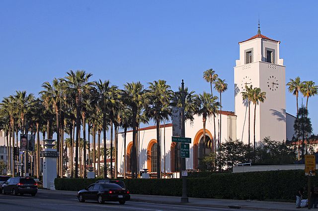
Railroads (meaning inter-urban here) and ocean-going passenger ships hauled most of the millions of people entering and exiting the Southern California Region annually by the beginning of the 20th century. Roads outside of most major cities in the United States were still very difficult for automobiles to traverse. Besides, Los Angeles is ringed by deserts and high mountain chains, so only the adventurous would have attempted long-distance auto travel to Los Angeles before the 1920s. The two principal rail lines into and out of Los Angeles after the 1880s were the Southern Pacific and the Santa Fe. Each had its own Downtown terminal.
The Southern Pacific's central Downtown terminus depot migrated several times as its flow increased. The first location was the River Station, (two successive structures, 1876-88, 1888-1901) in what is today known as the Cornfields, a space north of New Chinatown next to the Los Angeles River. The SP upgraded their facilities with the Arcade Station, from 1888 until 1914. The Arcade was replaced again by the Beaux Arts Central Depot, which opened in 1918.
The Santa Fe Railroad's "La Grande" railway station between 1st and 2nd Streets on Santa Fe Ave, adjacent to the Los Angeles River, was for three generations the second major railway gateway into and out of Los Angeles. Built in 1893, the same year as the Bradbury Building, it's architects gave its central open chamber a "Moorish" dome and the rest of it a medieval Crusader's castle. For 44 years, from its opening in 1893 until it was closed in 1938, millions of people flowed into and out of this shared space.
Having two major transcontinental railroads converge on Downtown at two separate major railway became a serious burden by the end of the booming 1920s, during which decade tens of millions arrived by rail as the permanent population of Los Angeles grew by two million residents. Siting and building a major unified (that is "Union"") passenger station, linking all the intercontinental, regional, and local rail systems, became a major public choice on the ballot in 1926. The location was a master-stroke of the Los Angeles elite's racial and spatial imagination. The "Arroyo Set" of Romantic civic leaders wished through urban planning to focus public attention on the now-quaint Olvera Street, and on the Plaza (now as a Yankee-supervised fiesta space to supercede its role in the 19-teens as a revolutionary mass-meeting space). That and the sensible goal of siting a Union Station on Alameda St as a central thoroughfare argued for the parcel on the east side of Alameda just opposite Olvera St and La Placita.
The planned Union Station site, however, was currently occupied, by (Old) Chinatown. That was no accident either. While Christine Sterling (mastermind of Olvera Street as a tourist attraction and branding landscape for Los Angeles) idolized a "Spanish" (erasing the public figure of the darker-skinned indigenous Mexicans and mixed-race "cholos" of the large Angeleno Mexican working class), the Otis-Chandler oligarchy had long wished to eradicate the whole of Chinatown. Union Station, designed by architects John Parkinson and Donald B. Parkinson in a Spanish style to match the now-romanticized Missions, killed both birds with one structure.
Shrewdly bargaining with Chinatown's civic/business leaders to establish a "New" Chinatown several blocks to the North, on the much more pleasant and higher ground of Broadway north of Sunset, the Union Station planners eventually razed more than ten dense city blocks of (Old) Chinatown to build what would prove to be the last great metropolitan passenger rail station in the United States.
Union Station arrived in 1939 just in time for the Age of the Automobile. while that accolade makes it sound like it became obsolete, the story is not so simple nor even true. While rail ridership did steadily decline from the 1950s until the 1980s, the regional Metropolitan Transit Authority (MTA) eventually breathed new life into Union Station by expanding it to become the hub of the entire late-20th century public rail system, providing ideal transfers between intercontinental, inter-urban, and urban streetcar systems.
Angelenos and visitors to Los Angeles during the years from the 1890s to the 1940s navigated a diverse landscape of multiple transportation modes. The great wide-gauge Santa Fe and Southern Pacific passenger railways brought the masses into and out of the metropolis, but "light rail," both inter-urban and intra-urban lines, criss-crossed the region, branching outward from the central node of Downtown LA. The most renowned is the gigantic Pacific Electric Railway, a business venture and simmering hotbed of labor strikes from its inception in 1901, though its peak in the 1920s-30s, until its demise in 1961.
Running, at its peak, 2,160 daily trains over 1,000 miles (1,600 km) of track at its peak coverage in the 1920s, the "PE Red Cars" provided reliable and affordable regional transformation. It was reputedly the largest inter-urban mass transit system int eh world. Capitalized by the SP heir Collis P. Huntington and the banker I.W. Hellman, the actual purpose of their mass transit system was to endow market value on the vast tracts of Los Angeles Basin land that they sought to develop as residential communities. While it was a marvel of clean, efficient, and affordable public transit (privately held), the Red Cars were essentially a "Free Lunch." That very term, "free lunch," was coined by Southern California real estate developers, who offered free lunches on weekends as part of picnic marketing events to sell plots on the wind-swept subdivisions that defined "suburbia" in the San Fernando and San Gabriel Valleys, especially. predictably, then, Huntington and Hellman lost interest in the Pacific Electric once they had sold off and developed the bulk of their holdings by the late 1930s, and gladly sold it off, just when its service began to sag, with very slow travel times and fewer open lines.
Thanks to a long-lived folk legend, many think that they know about the the disappearance of the Red Cars and mass rail by the 1960s, General Motors and the petroleum industry, it is alleged, bought up and tore-up the PE tracks to favor rubber-wheeled, gas-guzzling buses and automobiles. GM did indeed, buy up and tear-up much of those lines. But few people rode the Red Cars by the 1950s. The Pacific Electric was built "at grade," meaning, it had to share streets and intersections with automobiles, trucks, and buses. That cheap-build arrangement was fine in the 1920s, for the original purpose of providing access to far-flung suburban real estate developments by Huntington and Hellman.
By the late 1940s and the 1950s so many vehicles crowded the Los Angeles Basin that PE Red Car riders spent frustrating hours in traffic jams. The two transportation modes were already strained by congestion by the mid-1930s, when the State Highway Department conducted a systematic traffic density survey, and produced an excellent map-visualization of traffic flow in the Los Angeles metropolis. Reading this map in detail, following a very clear legend, we can see which stretches of the major arteries experienced the highest vehicle volume per day. The maximum in 1934 was 21,000-40,000 per day. At the peak zones surveyors counted 20-40,000 vehicles per day (approx 2,000 per hour): Mid-Wilshire west of downtown; Figueroa approaching north and south of Downtown, Sunset Boulevard and Brooklyn Ave (today Cesar Chavez Ave); Ventura Blvd in the San Fernando Valley.
These areas are of great interest because they point directly to the zones of greatest circulatory activity, which in urban economics, translates directly into highest land values (called "ground rent" by economists). This intensive circulation inscribed central place power into the metropolitan landscape. These same areas are among the highest traffic densities and land values in the 21st century.
The historian Scott Bottles showed long ago, no GM-led conspiracy was even necessary to kill mass transit. Ironically, the masses who bought and drove automobiles, not the industry leaders who profited from them, killed light rail by abandoning them for cars that then crowded the streets so much that the Red Cars, like 1920s relics, could barely move. Besides, a 1,000-mile streetcar system depend for its construction, operation, and maintenance on an army of thousands of workers, and those workers were rarely happy with their pay or conditions, striking regularly during life of the Pacific Electric Railway (especially in 1903, 1918, and **). Declining ridership and chronic labor rebellion soured any investor's interest in the famed light-rail system by the late 1950s, and the last line closed in 1961. -
1
2013-07-14T16:39:36-07:00
Crossroads of the LA Metropolis: The Four-Level Interchange and Bunker Hill, 1930s-1960s
56
Narrative Essay
plain
2018-03-21T03:34:37-07:00
This essay reconstructs the inscription of social power in the central crossroads of the Los Angeles metropolis. This "center" is the most densely occupied, traveled, traversed, and inhabited place in the entire Southern California region. All roads have led to it and through it for many centuries. When the Spanish occupied the region they inscribed La Placita, "the little plaza," the central place of all Latin American towns and cities. Nodes within one kilometer of La Placita thereafter became the central reference points for an increasingly vast network of roads, shipping routes, freeways, and air travel. During the first period of Anglo-American domination of Los Angeles (7th Regional Regime 1881-1940), the new rulers inscribed other major crossroads nearby, such as Pershing Square and the arterial intersection of Figueroa and Sunset. These crossroads were then overlaid by a new mega-structure, the world-destroying and world-reshaping Four-Level Interchange: the original focal point of the regional freeway system.
This central zone of Los Angeles has been a crossroads in the reshaping of social power, a central site for the inscription of Cold War injustice into the living landscapes of Los Angeles. This essay recounts these re-inscriptions through a networked narrative mapping of the Four-Level Interchange and nearby Bunker Hill.
Freeways. What is "free" about them? Los Angeles embodies dreams of freedom in myriad forms. An immigrant cosmopolis of titanic proportions, a global entrepôt , and a factory for the culture industry, it is also the signal site of modernist urban design, planning, and practice. Its freeways are justifiably seen as one of its central contributions to “civilization.” But the freeways also embody deep contradictions. These ways are ‘free’ from interruption by traffic lights and pedestrians, but they are also an attempt to break free from society itself. No social relations detain the commuter, and neither do any particulars of historical and social development. The intended universality of the freeway resides in the familiar sameness of the lanes, the signage, the rules for entrance and exit—even the oddly colorless concrete of which it is made. Norman Bel Geddes, the designer-prophet of the freeway system, predicted these structures in Magic Motorways of 1940: “Their grades are constant, never excessive. Their curving radii are constant, always generous. All over the United States, the motorways are uniform and function in exactly the same way.”[2] Yet the universal, functional aesthetic of International Style modernism can only temporarily abolish the spontaneous profusion of the unique and the particular—those unplanned social relations that people form in the everyday.
Freedom is a mighty abstraction; the freeway is a colossal material reality. The ride down the exit ramp is a ride back to earth--to society as it exists in history. Greeting the “citizens” (what the folks living on the street call everyone else) are the “homeless” (what the folks who have regular jobs, houses, and apartments call those who live on the street). Few drivers are aware that the men and women who panhandle at the freeway ramps typically live under those very freeways. Living ‘under the bridge trolls” of folklore. Four Houseless of the Metropolis, Curtis, Joseph Guajardo, Ron Wells, "You Can Call Me Whatever You Want," and Ron Wells, for example, ask for tribute when you pass through their small and humble domains.[3]The massive metropolitan-scale reconstructions of this downtown intersectional site displaced but did not defeat Joseph Guajardo, who grew up within sight of his under-freeway home, in a house built approximately 1900, razed as part of a 1980s scheme to clear the land for a major development. After clearing several city blocks, hundreds of former homesites were left fallow, their broken foundations and retaining walls protruding from the hillscape rising gently from Beaudry St, just west of the mighty Harbor Freeway.
The four-level interchange in downtown Los Angeles is where the Hollywood-Santa Ana (U.S. 101) and the Harbor-Pasadena (U.S. 110) Freeways intersect. It marks the point where the name of the 101 changes from the Hollywood to the Santa Ana Freeway, and where that of the 110 changes from the Pasadena to the Harbor. The Four-Level is thus the original downtown freeway intersection, and the freeways gain their names from their destination outward from this point.[4]
The first high-speed freeway interchange in the world, Los Angeles’s four-level interchange opened fully for traffic on 22 September 1953, and made its cinematic debut that same year in the Paramount Pictures classic War of the Worlds, based on H.G. Wells’s novel of 1898.[5] When the fourlevel opened, it fulfilled the visions displayed at the General Motors “Futurama” exhibit, designed by Norman Bel Geddes for the 1939 New York World’s Fair. The exhibit was a nineteenth-century diorama recast as a futuristic movie set. Bel Geddes, until then primarily a Broadway set designer, depicted elevated freeways on which commuters could rocket from home to work and back without stopping at scores of stoplights, pedestrian crosswalks, or other street-level annoyances. Futurama visitors were given a pin that read “I Have Seen the Future.” That future was supposed to be 1960. Bel Geddes was projecting the modernist aesthetic of planned urban landscapes conceived to accelerate movement and cleanse the old built environment of its irrationality.[6]
In 1939, visitors to the Futurama exhibit hovered in guided cars above a giant model of the future, presented as serious entertainment. In that same year, planners and designers converged to build a giant scale model of Los Angeles into which the modernist vision was soon to be inserted by another set of designer-planners, including the architects William Pereira and Hal Pereira (brothers), who were also motion picture art directors for Paramount Pictures.
Adjacent to the freeway icon of late modernity stands Bunker Hill, about two hundred feet lower in altitude than it stood in the 1950s, before bulldozers began (in 1961) to scrape it clean and top it off to make way for the proudly sterile assemblage of office towers (Wells Fargo Tower, IBM Tower, Library [First Interstate] Tower, Arco Tower, Bank of America Tower, etc.), condominiums, and cultural centers (Ahmanson Theatre, Mark Taper Forum, Dorothy Chandler Pavilion, Museum of Contemporary Art, Disney Concert Hall) that stand there today.[7] The Roman Catholic Cathedral of Our Lady of the Angels is only the latest, and also the most unfortunate, addition.[8] Mike Davis writes:
“With historical landscapes erased, with megastructures and superblocks as primary components, and with an increasingly dense and self-contained circulation system, the new financial district is best conceived as a single, demonically self-referential hyper-structure, a Miesian skyscape raised to dementia.”
Analogous to San Francisco’s Nob Hill, Bunker Hill had been a prime location for the wealthy to roost during the boom cycles of the 1880s and 1890s. Soon, however, the noise and tumult of the rapidly expanding city below, along with the allurements of estate-style living in the developing peripheral districts, drew the ruling class away. By the 1920s and 1930s, these Bunker Hill homes were primarily used as rental properties, catering to immigrants from Mexico and Europe. Business leaders, straining to expand the central business district northward, first looked covetously at the immigrant-mixed-race neighborhood in the 1920s and refined an audacious plan to level the entire hill. This “Bigelow Plan” was completed only weeks before the Crash of October 1929, and then lay dormant.[9] The actual conquest was not begun again until the late 1940s and early 1950s, the years of modernism’s apogee. Scientific planners created, in Gaston Bachelard’s words, “indifferent space subject to the measurements and estimates of the surveyor.”[10]
During the New Deal, state bureaucracies coldly abstracted the social space around them, officially classifying millions of persons by racial or class categories during an era of massive redevelopment that did not slow down until the late 1970s.
In his radio script for the 1938 broadcast of ‘War of the Worlds,’ performed by Orson Welles for Mercury Radio Theater On the Air, Howard Koch registered a protest against the modernist invasion of living spaces, linking it to the fascist threat abroad. The panic of so many listeners can only indicate that they felt that threat very close to home.[11]
Yet across an immense ethereal gulf, minds that are to our minds as ours are to the beasts in the jungle, intellects vast, cool and unsympathetic, regarded this earth with envious eyes, and slowly and surely drew their plans against us.[12]
What did the modernist planners regard with “envious eyes”? The daily heart of a once-thriving neighborhood is reimagined in the series of nostalgic images by Theodore Hall.
This montage juxtaposes the 1940 Works Progress Administration (WPA) model of downtown Los Angeles with documentary photographs made in 1957 by Theodore Hall, an amateur photographer who lived on Bunker Hill. The area he documented here –Third Street between Olive and Grand—was the central shopping block for residents of this neighborhood from the late nineteenth century through the late 1950s, a place where residents made their daily rounds to the grocery store, newsstand, and dry cleaner.
Hall knew full well that redevelopment plans were under way to raze the sites he photographed. He consciously simulated a hypothetical resident’s point of view as he strolled, camera in hand, toward the Budge Basket Complete Food Market. The sequence begins with a long shot of the corner of Third and Grand, which Hall titled “The Hill’s Business Center.” The next, titled “Street Scene,” is shot from the north side of Third Street, looking toward subjects depicted in the frame below, which Hall annotated as “’Red,’ well-known newspaper vendor on West 3rd, near Grand.” Finally, Hall entered the Budge Basket and held his camera low, behind the back of a young girl buying milk from a seasoned liquor dealer. The contrast of the little girl on a milk errand surrounded by so many commodities of adult vice may be read as Hall’s sympathetic but bittersweet, noir-influenced understanding of this neighborhood. For, as Hall made these images, a furious debate was raging over the desirability or necessity of razing it. When the bulldozers finally began their work in 1961, nearly ten thousand persons called Bunker Hill their home.
While Hall’s nostalgic images are paeans to a fated neighborhood culture, the 1940 WPA model is an artifact of bureaucratic giantism and the machinery of redevelopment that located targets for massive structural eradication, human displacement, and expropriation. Thousands of house-by-house, block-by-block drawings by WPA-employed graphic artists became patterns for model builders, and the model became the planning base for a vast apparatus of design firms; federal, state, and local planning authorities; the city engineering department; and construction firms.[13]
The three-dimensional WPA/LA Bureau of Engineering Model of the City of LA stands for other ‘models,’ or representations, of many different genres that together constituted the social distance explored here. Creators of 1930s crime fiction, New Deal home-refinancing bureaucrats, and real estate agents worked together with city planners, often without really knowing it, to alienate whole populations (and ultimately themselves). Far from annihilating these aliens, however, this collective agency embedded them into the landscape.
To evict and destroy Bunker Hill, planners needed to constitute it as a worthless place with people to match, and this representation is nowhere more succinctly drawn than by the master of detective fiction, Raymond Chandler, in his 1942 novel the High Window. He calls it an “old town, lost town, shabby town, crook town...In the tall rooms haggard landladies bicker with shift tenants. On the wide cool front porches, reaching their cracked shoes into the sun, sit old men with faces like lost battles.”[14]
The Community Redevelopment Agency (CRA) had the authority to demolish whole neighborhoods, but only if they could successfully designate them as ‘slums.’ Was Bunker Hill a slum? The Apartment Association of Los Angeles (composed of apartment owners, not dwellers) vigorously opposed the Bunker Hill Redevelopment Project and specifically contested the “slum” designation in 1956, in a counter study showing that out of a total of 142 buildings, only 21 had a “questionable” future.[15] Even as plans to raze Bunker Hill crystallized in the mid-1950s, some developers were rehabilitating the sturdy Victorian and Edwardian homes, boasting that the tall stone foundations and first-growth redwood timbers had preserved the structural integrity of the buildings.”[16]
A remarkable "data map" made by the LA City Housing Authority and the WPA, for the each block of Bunker Hill in 1940, directly contradicts the racist reporting of the US Government's Home Owner's Loan Corporation "Area Survey," which slanders the neighborhood as "thoroughly blighted." in 1939.
For several decades, Paramount Pictures had planned to produce War of the Worlds as a world-war and then cold-war allegory.[17] The movie was eventually produced by George Pal, the great founder of stop-action animation, who had escaped from the path of the invading Nazis in 1939. In Pal’s 1953 production, the Martians reach Earth inside huge cylinders containing streamlined, manta-ray shaped flying machines, which immediately and without any explanation begin destroying Los Angeles. “The inhabitants of Mars, it seems,” reads a review of the movie’s premiere in Cue, “having run out of lebensraum on their own dying planet, cast about for a nice new world to settle.”[18]
Pal’s Martians were clearly informed by his personal experience fleeing Nazi destruction. He had created the “Puppetoons,” carved wooden puppets that were animated by replacing thousands of premade body parts between frames, in Holland, wisely accepting an invitation from Walt Disney to decamp to Hollywood just before the Blitzkreig. (He subsequently made a series of satirical/tragic shorts called the Screwball Army,” in which Nazis nuts and bolts invade an idyllic Holland). But Pal was not the only maker of War of the Worlds who had a personal experience with the subject matter. The War of the Worlds art directors were Albert Nozaki, who invented the Martian spaceships, and Hal Pereira, who created the miniature model of Los Angeles so convincingly destroyed by the ‘heat rays’ of the invading spaceships. Nozaki had been fired by Paramount the day after the attack on Pearl Harbor and was interned at Manzanar concentration camp for the duration of the war. After the war, he got his job back, but the emotional scars of his own racial alienation must certainly have accompanied him to the Paramount studios each day. Nozaki was a target of racial cleansing again in 1949 when Nozaki was expelled by the purportedly left-progressive Crestwood Hills development because of a racial covenant to the property deed.[19]
Hal Pereira’s story is somewhat more complex. He had succeeded his brother, award-winning architect and filmmaker William L. Pereira (1909-1985), as Paramount’s chief art director. William Pereira, who massively transformed the urban landscape of Los Angeles, was equally at home designing movie sets as he was planning cultural centers and campuses. By the early 1950s, while Hal Pereira was building and destroying the cinematic model of Los Angeles, William, then head of an international architecture and planning firm, was using the WPA’s 1940s model of Los Angeles to plan the destruction of Bunker Hill.
These worlds of creation, destruction, and creative destruction came together when the Four-Level interchange made its cinematic debut in Pal’s War of the Worlds, as (alienated) Angelenos flee the invading aliens across the freeway’s newly completed spans. In all three versions of the work—the 1898 novel, the 1938 radio broadcast, and the 1953 film—Martians bridge immense spatial distances, which stand for the vast social distances that allow one species or nation or racial group remorselessly to annihilate or expropriate another.
William Pereira, whom we have also met directing the wartime camouflage of the aircraft factories, was the quintessential cold-war architect of aerospace-age Los Angeles. In 1950 he joined Charles Luckman, then the young president of the Lever Soap Company, and “the wonder boy of sales promotion,” to establish a global architectural firm specializing in huge projects. While designing the new modernist landscape for Bunker Hill in the 1950s, Pereira and Luckman master-planned the Cape Canaveral missile base and the $300 million NATO air and naval base in Franco’s Spain.[20]
The private dwelling that Pereira designed for himself is perhaps the most sincere self-portrait: A steel-and-glass Roman villa, complete with a bust of Caesar Augustus reflecting in the dark pool made ominous and equally prominent with the house in Julius Shulman’s remarkable photograph.
Standing under the spaceship-inspired Theme Building on 25 June 1961, during the Berlin Wall crisis, Vice President Lyndon B. Johnson ominously began his dedication of Pereira and Luckman’s new Los Angeles International Airport with a stern warning to Soviet Premier Nikita Khrushchev not “to underestimate the United States’s determination to honor its pledges to the brave and freedom-loving people of West Berlin.” William Pereira later fittingly chose a landing spaceship as the defining icon—a landing spaceship-for the Los Angeles International Airport, completed in 1961. Calling this “the first terminal area specifically designed for the jet age,” Federal Aviation Agency Najeeb E. Halaby predicted at its opening that the new airport “may well achieve some of the worldwide renown...as—who knows—Disneyland.”[21]
Meanwhile, in the previous month, the Community Redevelopment Agency had accelerated its use of a $42.7 million loan from the federal government to purchase all the private property on Bunker Hill. Eviction of the more than nine thousand Bunker Hill residents had finally begun.[22] They joined the thousands already displaced by the construction of the harbor and Hollywood Freeways in the previous decade. Not long after the celluloid Martians destroyed the aging structures of Bunker Hill, bulldozers and wrecking balls began to accomplish the actual task. Guajardo has been fleeing ever since, ironically taking up residence under the very freeways that destroyed his original home.
All institutions, no matter how global, ideological, or imaginary, and regardless of the countless and unrecorded acts that replicate them, must be anchored somewhere in space and time. The fourlevel and Bunker Hill redevelopments both anchored and embedded a phase of alienation that “still radiates disaster triumphant” from those very sites a full half-century later, forming an ‘interchange’ between the great forces of history and the banal movements of daily life.[23]
Ghost neighborhoods haunt these ruptured landscapes and torment their houseless residents. The haunting resides in the failure to recognize the social Other, and the torment is fixed in the concrete. Torn from the social fabric, these remnants defiantly stand their ground and confront the ‘citizens’ with their ‘homeless’ souls.
[1] This essay is drawn largely from Ethington, “Ghost Neighborhoods: Space, time, and Alienation in Los Angeles,” in Charles Salas and Michael S. Roth, eds, Looking for Los Angeles: Architecture, Film, Photography, and the Urban Landscape, (Los Angeles: Getty Publications, 2001
[2] Quoted in Dimendberg (1995): 123.
[3] Actual names used by permission. Ron Wells, an unemployed plumber and native of New York City, is a community leader. Joseph Guajardo was born in 1947 and raised in a house, now demolished, within sight of his current home under the freeway. Interviewed by the author, 24 January 1999.
[4] The full story of the four-level interchange lies primarily in the massive and mostly untapped Los Angeles City Archives. For a brief account, see Roth (2000: 24); and Arthur Krim, “The Four Level Stack as Los Angeles Icon” (paper presented at annual conference of the Society for Commercial Archeology, Los Angeles, April 1996).
[5] California Highways and Public Works 33 nos. 1-2 (1954): 8-9.
[6] On Bel Geddes, see Dimendberg (1995), on the 1939 New York World’s Fair, see Benedict (1983): 13-16; and Jackson (1995): s.v. “world’s fairs.”
[7] Davis (1990): 229.
[8] Ethington (2000).
[9] The original “Bigelow Plan” was conceived by C.C. Bigelow, president of the Southwestern Investment Corp. of Los Angeles. By 1928 Bigelow had produced a complete engineering report. This early plan is summarized in “Razing of Bunker Hill, Los Angeles,” Western Construction News, 10 July 1929, 339-40.
[10] Bachelard, (1994): 14.
[11] Denning (1997): 262-402.
[12] Howard Koch, “War of the Worlds,” original radio script, Mercury Radio Theatre, CBS Broadcast, 30 October 1938. In Hadley Cantril (1940).
[13] Jack Bivash, head of Pereira and Luckman’s Bunker Hill project, remembers using the 1940 model of Los Angeles as the basis for the 1950s redevelopment plans. Interviewed by the author, 22 October 1999.
[14] Raymond Chandler, The High Window (1942; reprint, New York: Vintage, 1992), quoted in Klein, History of Forgetting, 51-52.
[15] Western Housing, July 1956, p. 10.
[16] “Sixty-Five-Year-Old Bunker Hill House Converted into Modern Apartments,” Western Housing, January 1954, p. 8.
[17] Roy J. Pomeroy, film treatment for War of the Worlds, 15 November 1926; Harold Matson and Pat Duggan to H.N. Swanson, 31 October 1938, telegram; and synopsis of War of the Worlds, 28 November 1940, all in Special Collections, Margaret Herrick Library, Academy of Motion Picture Arts and Sciences, Los Angeles. Conscious intent to allegorize the Cold War and the atomic threat is confirmed by the film’s director, Byron Haskin, in Haskin (1984): 202-3. See also Hickman (1977): 56-77.
[18] “War of the Worlds,” review of War of the Worlds (Paramount Pictures film) Cue, 15 August 1953.
[19] Zellman and Friedland (2001).
[20] William Pereira’s filmography includes the following credits: As Producer: From This Day Forward and Johnny Angel (both 1946); for Art Director, Aloma of the South Seas and New York Town (both 1941); for Production Designer, Since You Went Away and Jane Eyre (both 1944); for Special Effects, with Cecil B. DeMille, Reap the Wild Wind (1942). Biographical information from Los Angeles Examiner, 4 May 1942 and 13 August 1950; Los Angeles Times, 6 and 7 April 1959.
[21] Johnson and Halaby quoted in Los Angeles Examiner, 26 June 1961.
[22] “Bunker Hill Purchases Speeded,” Los Angeles Examiner, 17 May 1961.
[23] Horkheimer and Adorno ([1944] 1972): 3.