Galapagos Marine Reserve
Geographical Extent
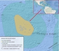
The Galapagos Islands are located 600 miles off the coast of Ecuador, these islands are the second largest Marine reserve in the world. The reserve includes 133000 km^2 of sea surface and inland water. The entire area with in the 40 nautical miles measured from the coasts of the farthest islands. The Galápagos Marine Reserve Coordinates 0.0536° S, 90.7692° W.Scientific Basis
There is a vast Biodiversity of land and sea animals. The island has some of the highest levels of endemism then anywhere else on the planet. This area alone has 80% of the Land birds, 97% of reptiles and land mammals, 30% of the plants and 20% of all marine species that are found no where else in the world. Recorded to date there are:- Mammals: 32 species recorded
- Reptiles: 28 species recorded
- Darwin Finches: 13 sub-species recorded
- Sea Birds: 42 species recorded
- Shore Birds: 34 species recorded
- Water Birds: 21 species recorded
- Land Birds: 49 species recorded (Quasar Expeditions 2016)
For a list of all the animals, fungi, plants and ecological groups as well as information on biodiversity see the Charles Darwin Foundation's website and the Galapagos Islands website.
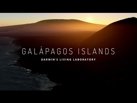
See the below video from Google that highlights the unique ecology of the Galapagos Islands.
Major Management Decisions
In 1998 the Ecuadorian government approved revision of the Management Plan. The revision of the plan included: Political Constitution of the Republic, Laws: General and Specific, Regulation, Decrees, Ministerial Accord, Resolution, By-Laws, Statue, Management Plan, Classification of protected areas (biosphere reserve, Whale Sanctuaries and Marine Reserve).During this revision the “Law of the Special Regime for the Conservation and Sustainable Development of the Galapagos Province.” came into being. The revision outlines regulations regarding Fishing, Marine Tourism, Science and Military Strategies and Navigation within the marine reserve. This revision is explored in detail in the Management Plan for Conservation and Sustainable Use of the Galapagos Marine Reserve.
Management Authorities
The national level of authority is:- Ministry of Environment
- Ministry of Defence
- Ministry of Trade and Fisheries
- Ministry of Tourism
- Galapagos Chamber of Tourism
- Galapagos Artisanal Fisheries Sector
- Conservation Sector
The Participatory Management Board (PMB) is at the local level. They are:
- Galapagos Artisanal Fisheries Sector
- Galapagos Chamber of Tourism
- The Charles Darwin Research Station
- Naturalist Guides Association
- The Galapagos National Park Directorate.
Recent Developments and Current Status
The monitoring of marine invasive species is global problem. The GMR is extremely susceptible to these due to the increase of tourism and the climate change. As a result the Monitoring Marine Invasive Species project was initiated. The Galapagos Climate Change Initiative is working toward an understanding of how the climate change will effect the El Nino and as a result affect the terrestrial and the marine life of the GMR. Marine Managed Area Science allows us to study the effects of the warm and cool currents effect of the marine life. Started in 2004 and has established the effectiveness of the Marine Managed area.Marine Rapid Response Network was put in place to detect sick or injured animals and marine wildlife, as well as deceased.
Managing Fisheries in the Galapagos Marine Reserve is a major concern even though the reserve is closed to commercial fishing, legally artisanal fishery is aloud. This fishery exploits the area that produces the most capital.
For more information on the above please see the following:
- The Galápagos & Eastern Pacific Newsletter from the World Wildlife Foundation.
- Adapting to Climate Change in the Galápagos Islands by the World Wildlife Foundation.