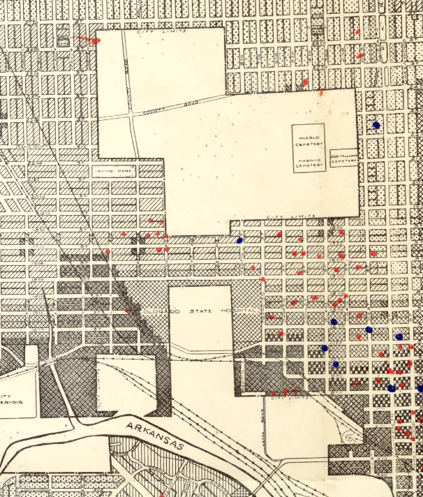
| content | sioc:content | The Colorado State Mental Hospital is located in western Pueblo which has now become an area dominated by modern housing. Originally the vast emptiness surrounding the Hospital made it one of the only discernable features of this area, but now the densely populated area around even makes it difficult to find. The map below shows the campus of the Colorado State Hospital as well as a large unused swathe of land to the north. The constant expansion of the hospital resulted in them quickly using all their available space on their original property.
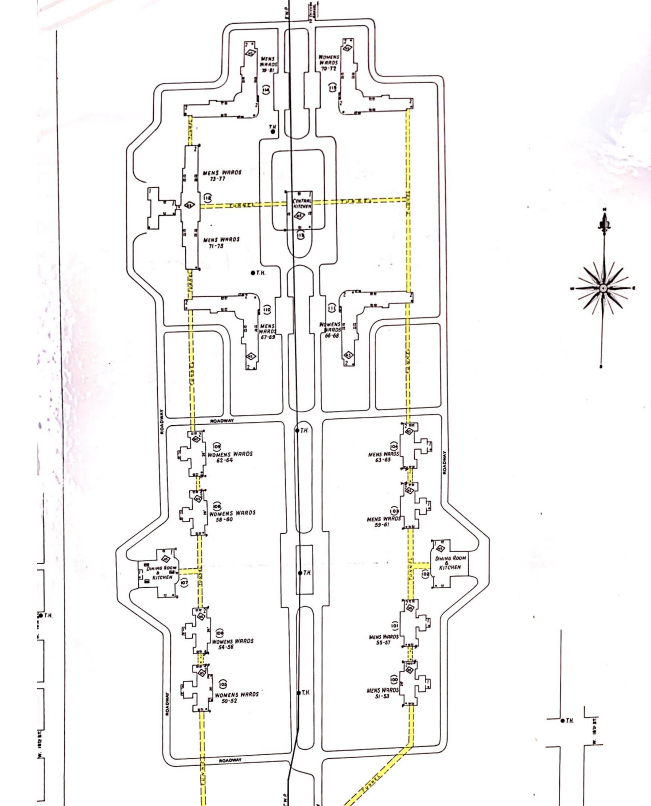
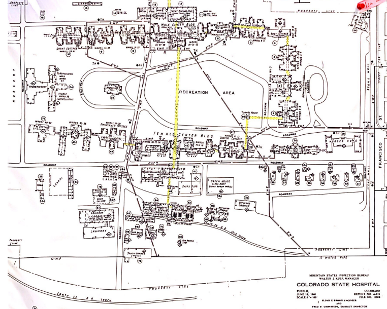
The expansion of the hospital was the chief reason they eventually spread their campus to the north throughout the 40's and 50's. The map above was drawn in 1936 and interestingly does not show that the State Hospital had mad their move to the northern field. Today however, most of the campus that remains in function is located to the north, a few blocks away from the original campus. The split nature of the campus presented some interesting dilemmas for the staff at the hospital. Patients, resources, food, and personnel were constantly being transported between the two sections of the campus, which is separated by about 5 city blocks. Tunnels were eventually built between the campuses that made this easier, though their dark hallways made it possible for patients to hide there for extended periods of time during escape attempts. Today, the tunnels are sealed and unused due to asbestos.
The first image in the media gallery shows the campus and surrounding neighborhood. The second and third images are a detailed look at the two sections of the Hospital campus. The first image is the northern section near the cemetery: the second section is indicated by "Colorado State Hospital" on the first map.
|