The Spanish Pacific as the West Indies
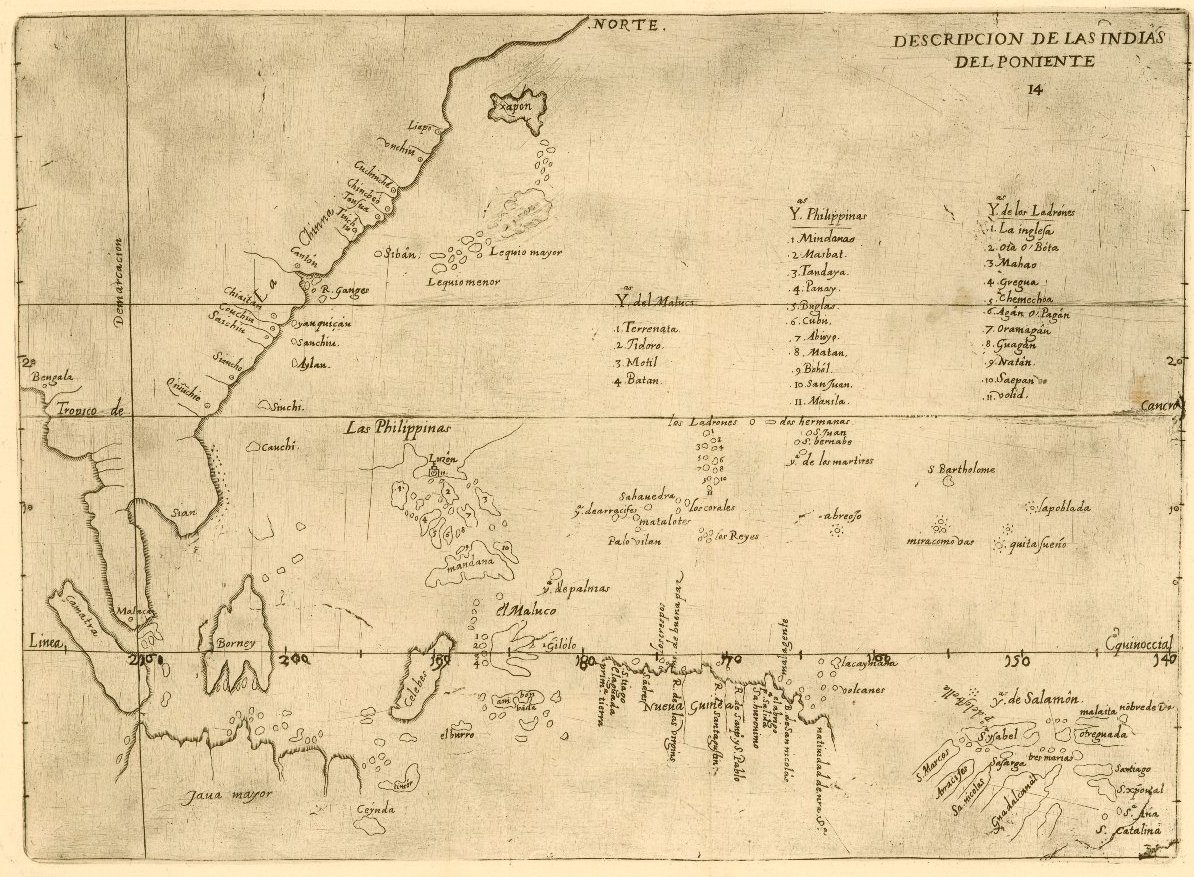
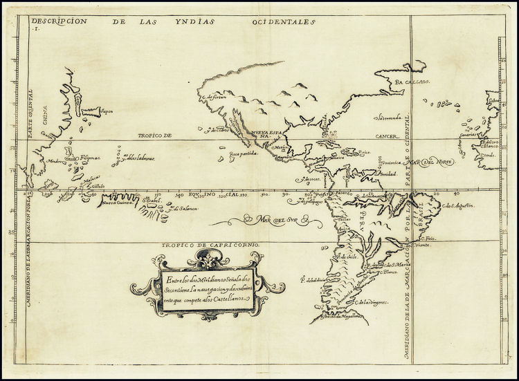
Note the dividing meridian line between the East and West Indies, which Velasco has drawn on the map’s western border: Velasco placed the Pacific Ocean within the West Indies, or Spain’s sphere of influence, while leaving a curiously small portion of the Americas in the East Indies, to represent Portuguese Brazil.
[1] Robert Richmond Ellis, They Need Nothing: Hispanic-Asian Encounters of the Colonial Period (Toronto, ON: University of Toronto Press, 2012), 18. See also Javier Morillo-Alicea’s conceptualization of the Caribbean and Philippines as the “Spanish Imperial Archipelago.” Morillo-Alicea, “Uncharted Landscapes of ‘Latin America’: The Phllipines in the Spanish Imperial Archipelago,” in Christopher Schmidt-Nowara and John M. Nieto-Phillips, eds., Interpreting Spanish Colonialism: Empires, Nations, and Legends (Albuquerque, NM: University of New Mexico Press, 2005).
[2] Reed, Colonial Manila, 15, 25. For a history of reducción in Peru, Viceroy Francisco de Toledo’s General Resettlement, see Jeremy Ravi Mumford, Vertical Empire: The General Resettlement of Indians in the Colonial Andes (Durham, NC: Duke University Press, 2012).
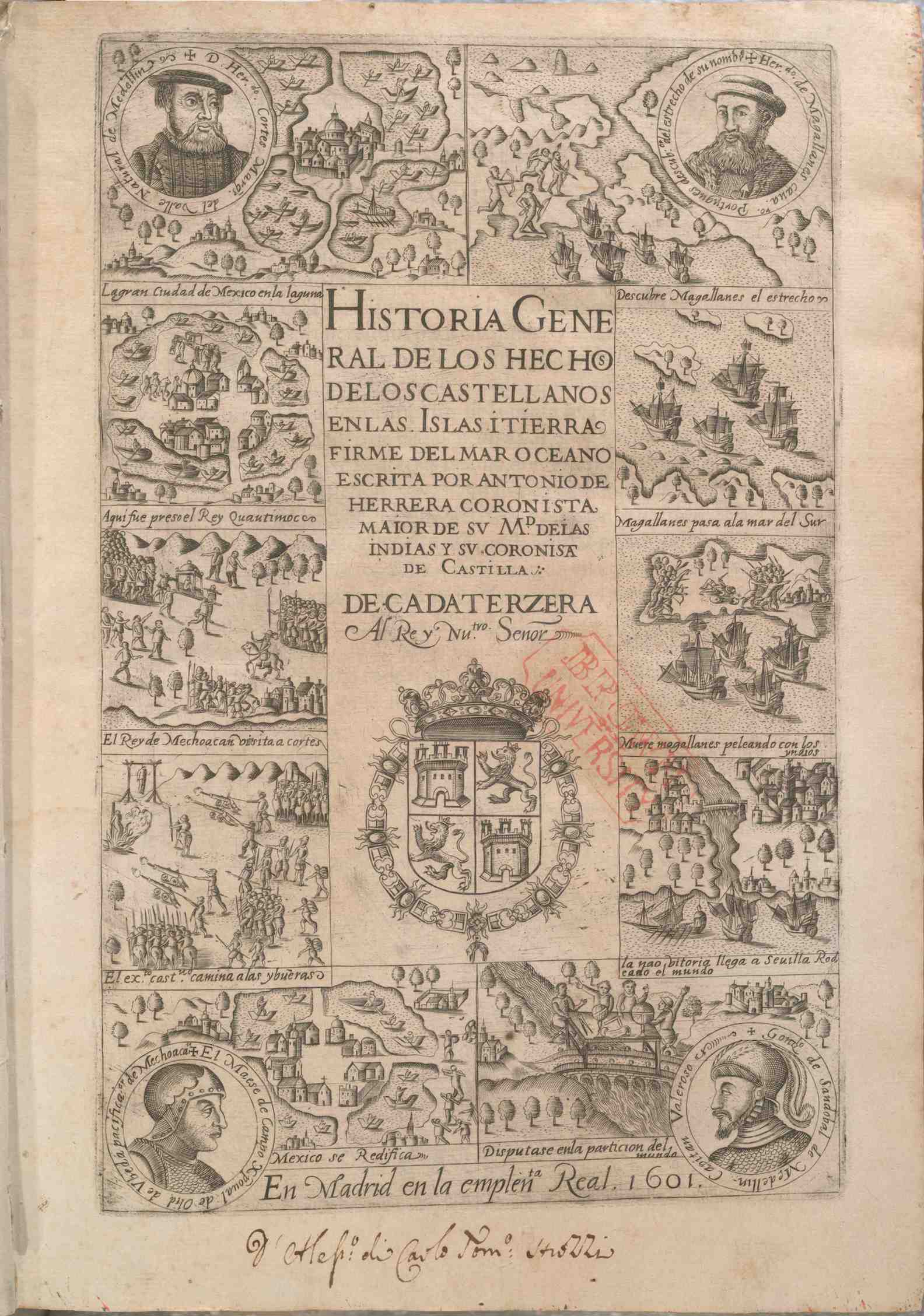
[3] Juan López de Velasco, “Descripción de las Indias del Poniente,” and “Descripción de las Yndias del occidentales, in Antonio de Herrera y Tordesillas, Historia general de los hechos de los castellanos en las islas (Madrid: Emprenta Real, 1601), 3, 73. John Carter Brown Library, Brown University. “Del Poniente” means “west” after the Spanish for sunset.
[4] López de Velasco, “Descripción de las Yndias del occidentales,” in de Herreray Tordesillas, Historia general, 3.