Water
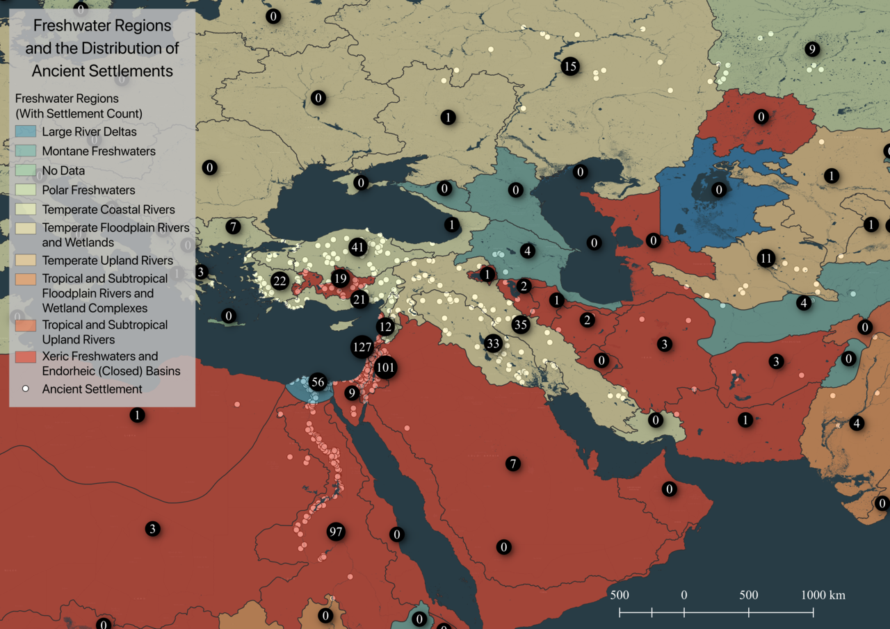
Figure 6 shows Freshwater Ecoregions of the World (FEOW) data and the associated number of ancient settlements appearing within each region.1 A visual comparison of Figure 5 and Figure 6 reveals the importance of topographic contours to ecoregional distinctions. The clarification of the distribution of settlements across these zones in Table 3 highlights the importance of river watersheds to agricultural centers.2
The top half of entries in the first column of Table 3 read as an inventory of major sources of water in the ancient Near East. Scott observes that regular flooding of rivers like the Tigris, Euphrates, and Nile provided not just irrigation, but the deposition of alluvial soils.3 He writes, “If reliable and non-catastrophic floods allowed, flood-retreat agriculture could be practiced on the easily worked and nutritious silt (in Egypt along the Nile as well), in which case the density of the population might be even greater. Much the same can be said for the earliest state centers in China (Qin and Han Dynasties), in the loess soils along the Yellow River, where population density reached levels rare for preindustrial societies.”4 Scott’s comments emphasize the significance of seasonal natural irrigation to the complex interplay between environmental variables that create and maintain agriculturally ideal contexts.
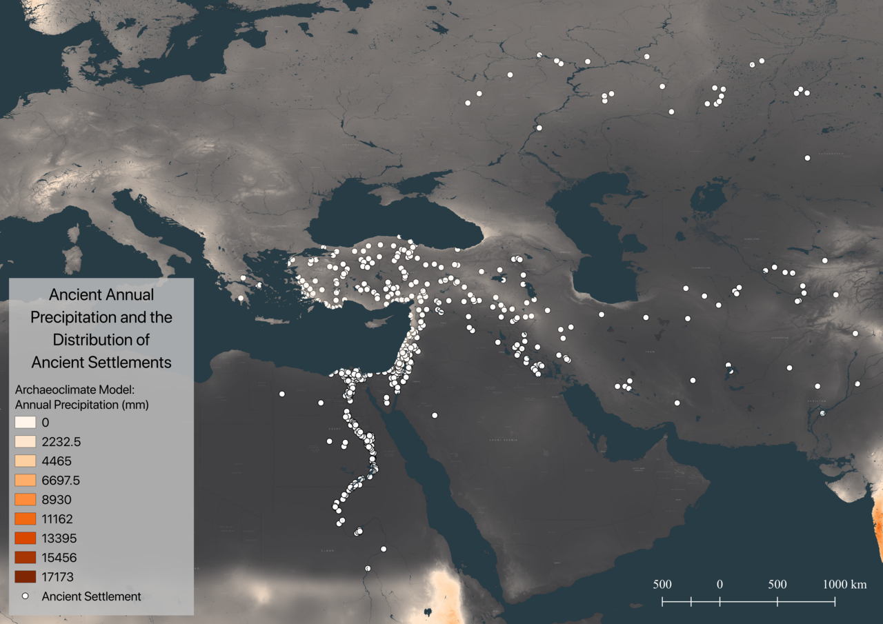
Rain is another significant form of regular natural irrigation that is also key to seasonal patterns of flooding. Figure 7 compares the ancient settlement dataset with a paleoclimatic model of annual precipitation 6000 years ago (mid-Holocene).5 The model of precipitation in Figure 7 appears to approximate the modern distribution of agricultural land cover in Figure 3. Further, the pattern of settlements in Figure 7 does seem to fall within the general shape of the model. Although technological innovations in irrigation have allowed agriculture to expand throughout history, it is difficult to deny the relationship of rain and river flooding to the development of settled agriculturalist societies.
1 Data from: “The Nature Conservancy, Freshwater Ecoregions Of the World (FEOW),” accessed November 17, 2018, http://maps.tnc.org/files/metadata/FEOW.xml; “Freshwater Ecoregions Of the World,” accessed November 17, 2018, http://www.feow.org/.
2 In order to conserve space, Table 3 includes only the soil types associated with a minimum of one percent of ancient settlement data.
3 Scott, Against the Grain: A Deep History of the Earliest States, 124.
4 Scott, 124.
5 Data from: R.J. Hijmans, “Downscaled Paleoclimate Data | WorldClim - Global Climate Data,” WorldClim, accessed November 16, 2018, http://www.worldclim.org/paleo-climate1; R.J. Hijmans, et al., “Very High Resolution Interpolated Climate Surfaces for Global Land Areas.,” International Journal of Climatology 25, no. 15 (n.d.): 1965–78.
This page has paths:
- Agriculturally Marginal Landscapes Edward N. Surman