Mapping Cyberspace to Physical Space (in a Few Easy Steps)
By Shalin Hai-Jew, Kansas State University
In the early heady days of the Internet and Web, people used to apply a kind of magical thinking about “cyberspace.” People would set up websites claiming that these were sovereign countries and sell passports to these spaces in exchange for real money. They would talk about ways to invisibly explore all sorts of identities, with no real-world repercussions. They would describe interactions online as so much fleeting ephemera. There was talk of a global village in which people would help solve issues in real time (Holeton, 1998). There were hopes that people “over there” would be somehow much different than people “over here.” The rhetoric was high-minded and hopeful.
Some of the promise of the Web has come to pass. People are sharing information broadly and interacting across boundaries. They are sharing knowledge across geographical boundaries.
However, what about a cyber-domain without any ties to the world? Invisible exploration without ties to personally identifiable information (PII)? People who are somehow not people simply because of another location? Not so much.
Back to Planet Earth
It turns out, as the quieter voices have insisted all along, that the Internet is a human construct built on a physical communications structure of telephone wires and cables traversing the earth and under seas. [Back in 2012, Andrew Blum’s Tubes conveyed the sense of the physical understructure enabling the Internet. Blum presented on his book in a TEDTalk in 2012 titled “Discover the physical side of the Internet”.]
Prof. Bill E. Genereux's (K-State / Salina) student, Justin Noggle, created a video book review of Tubes, in a video hosted on YouTube.
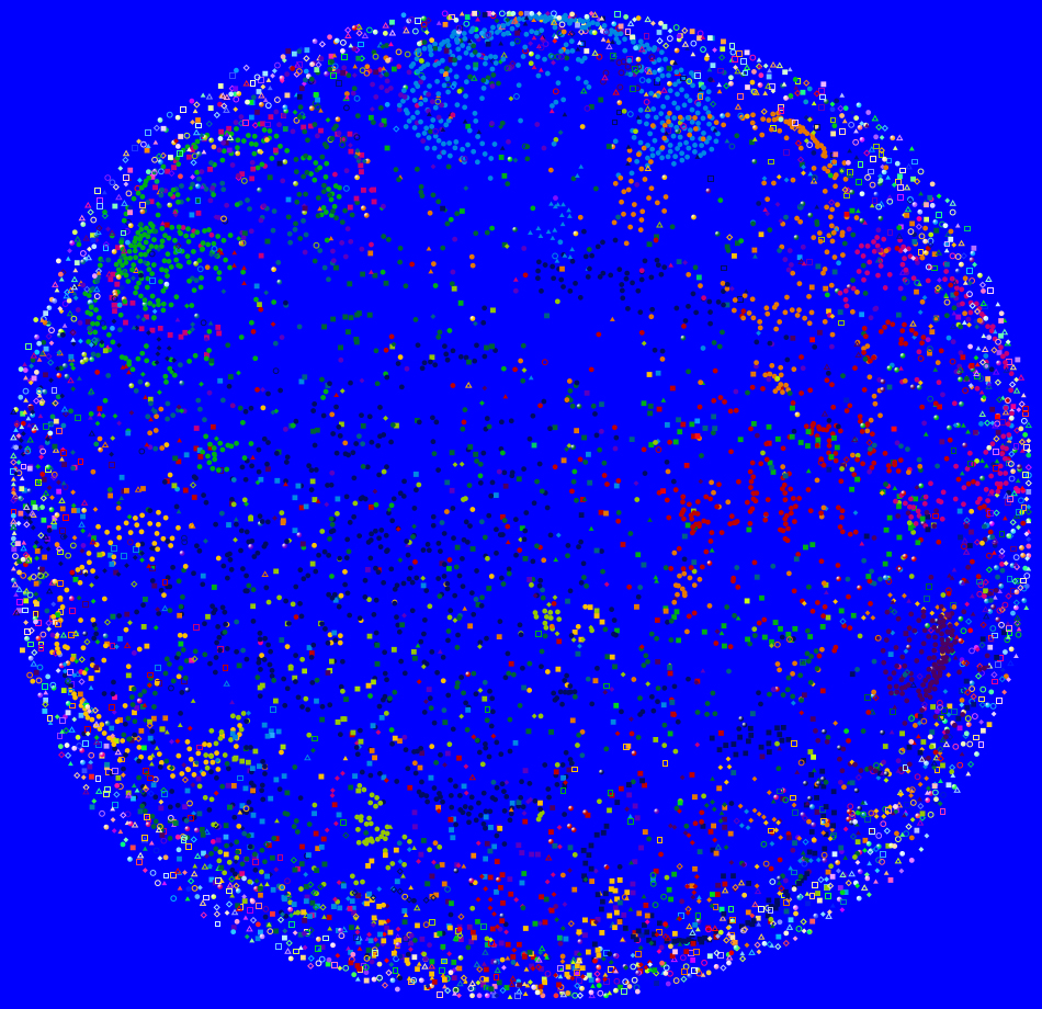
Much of what is available online in cyberspace may be related back to Earth, with varying degrees of fuzziness and accuracy. Why this matters is because physical space is overlaid with all sorts of information: geographical, climatological, historical, economic, political, cultural, and otherwise. Locating online information to physical space means that that online information may be matched up with potentially other related information that may be used to extract meaning.
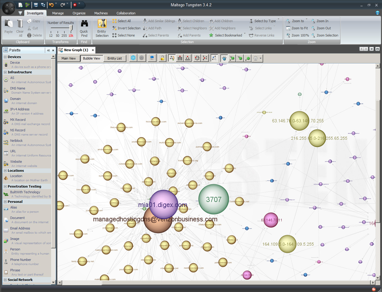
Maltego Tungsten™
Maltego Tungsten™ (now Maltego Chlorine 3.6.0) is a penetration testing tool that enables the mapping of a variety of information on the Surface Web (online information with static Web addresses). [It does not currently enable access to the dynamic data on the Hidden (Deep) Web, but there are tools that enable the automated surfacing of those resources.] One of the tool’s capabilities then is to (geo)locate online information (websites, servers, Net blocks, email addresses, online aliases, telephone numbers, Twitter accounts, Facebook accounts, and such) to physical location.
The data that is returned through various Maltego Tungsten 3.4.0 “machines” and “transforms” may be quite noisy and challenging to disambiguate; however, it is a powerful software tool that enables a breadth of awareness and analysis.
Maltego Carbon 3.5.3 and Chlorine 3.6.0: Two New Features Spotlighted
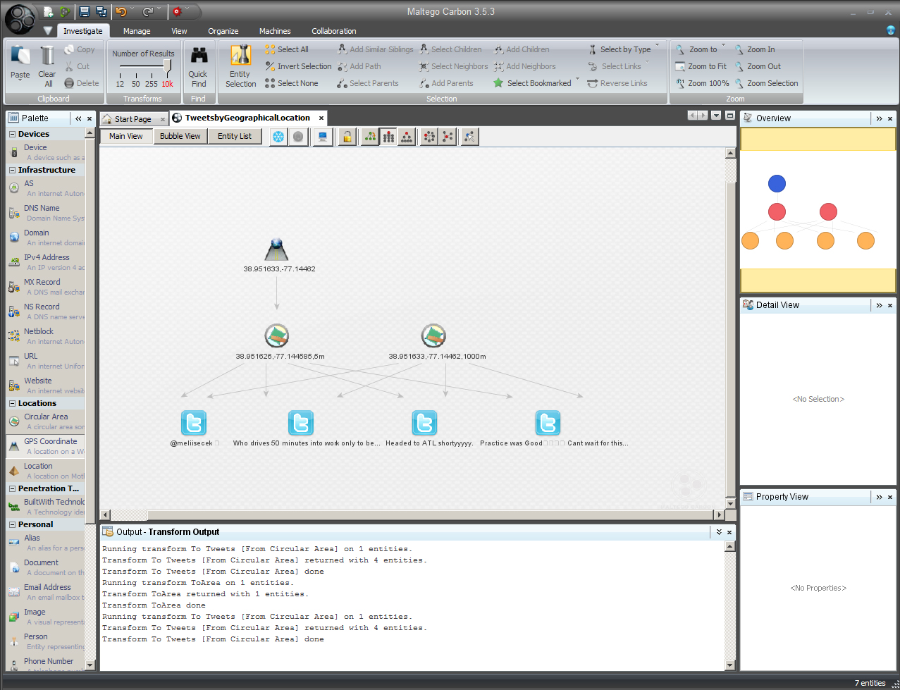
Spotlight 1: Moving from Physical Location to Local Tweets. The release of Maltego Carbon 3.5.3 involves a few new features, including a few more geolocational capabilities. These include the ability to specify a physical location with GPS coordinates and then extracting some local Tweets. (One of the main hindrances to acquiring larger sets of Tweets is the fact that so few Tweets are geolocation-specific in terms of locational metadata.)
Another location-based approach involves a new "transform" function (accessed by Palette -> Locations -> Circular Area). This function enables the defining of a physical location and a circular area surrounding that location. This tool then captures the microblogging messages (Tweets) that have occurred in that area.
In terms of the actual area, the GPS coordinates were placed in Google Maps. It turns out that the GPS presets may be to a spot at CIA headquarters. (This may be a Paterva developer "shout-out" to American intelligence. Maybe.)
The ability to explicitly extract Tweets by location is a major step forward for the uses of locational information extracted from social media platforms. For example, this enables the capturing of some textual and image communications (and audio and video multimedia) of those who are physically in spatial proximity to an unfolding real-time event.
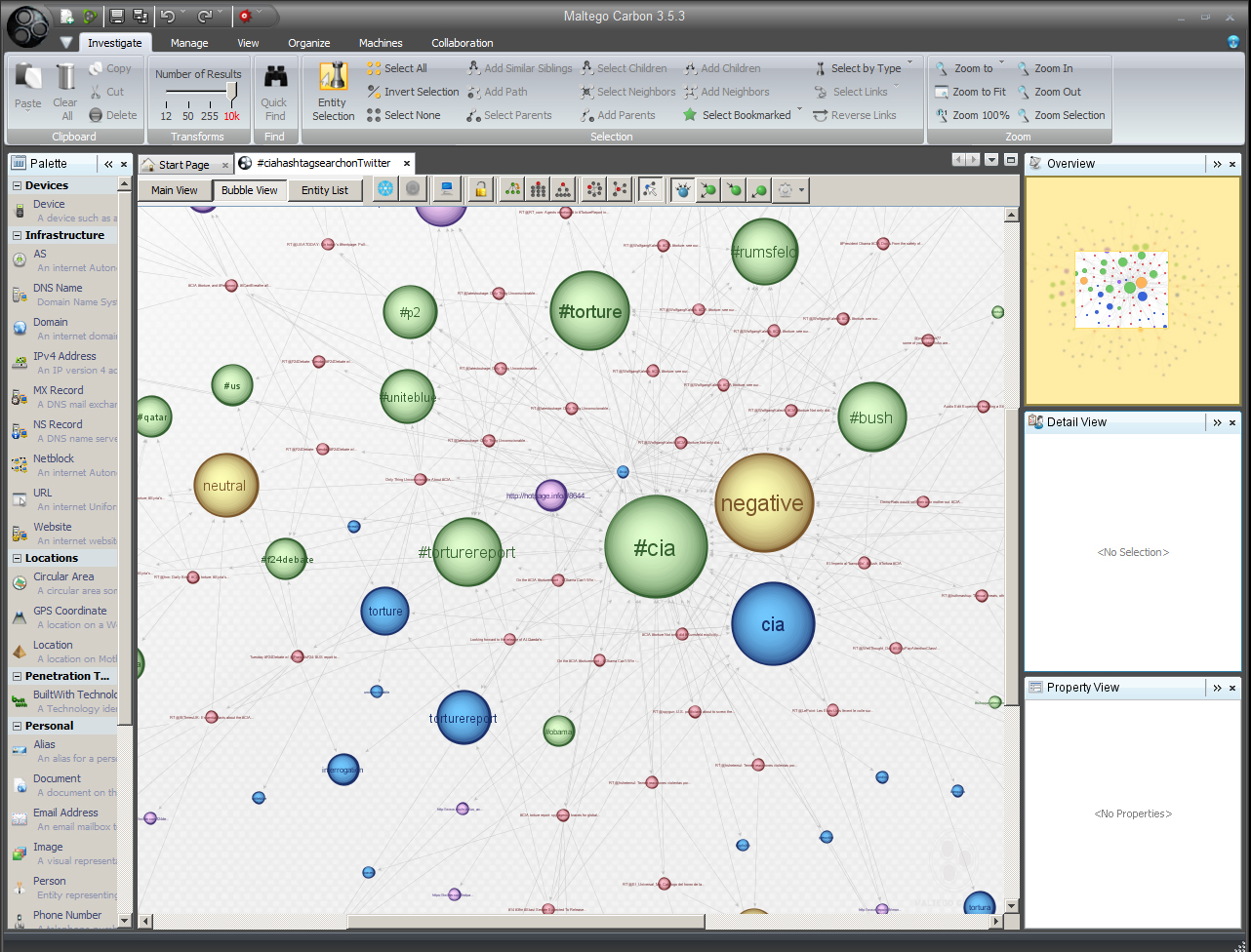
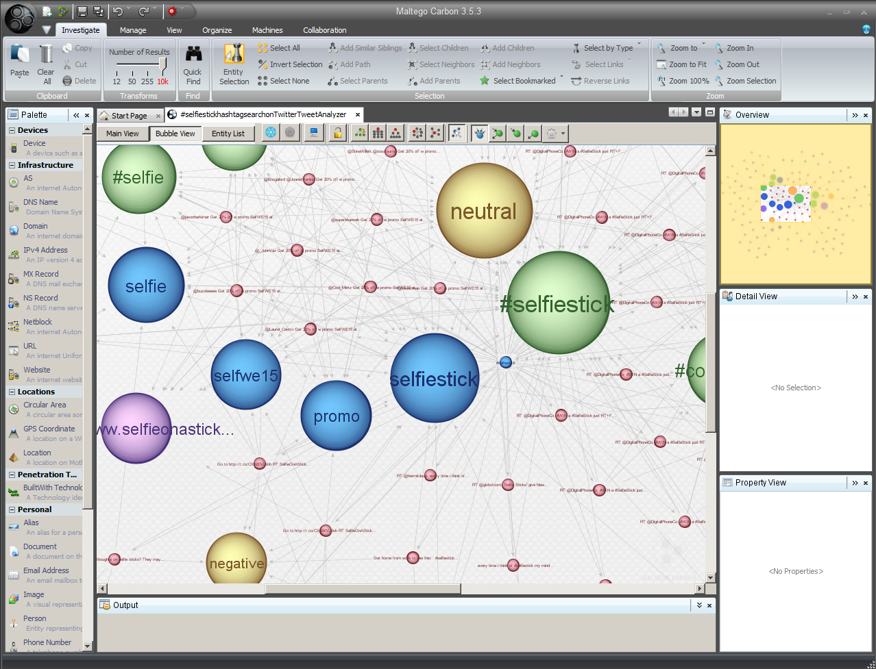
Spotlight 2: Tweets and Sentiment Analysis: Another feature of this tool involves the ability to capture trending issues and to automatically machine-identified sentiment: positive, negative, and neutral. Linked verbiage also may be used to infer sentiment.
In combination, if properly structured, a query could extract the messaging (and sentiment) around certain breaking issues in a particular location. The following one was about the #selfiestick phenomenon.
In the research literature, a number of researchers and research teams have explored using geo-based messaging and multimedia posted to social media to aid support efforts to communities and individuals experiencing disasters (whether natural or human-made). "Geostreams" of microblogging messages have been studied for years now as a possible indicator of the movement of flu through populations in a spatio-temporal (and possibly predictive) way. There was a recent study about inferring societal happiness based on geolocated digital images. In other words, there are creative ways to use the mapping of cyber information and messaging to physical spaces.
For more on Maltego Carbon 3.5.3, refer to Conducting Surface Web-Based Research with Maltego Carbon.
Exploring the Cyber-Physical Confluence in Geolocation
A slideshow "Using Maltego Tungsten(TM) to Explore the Cyber-Physical Confluence in Geolocation" is available on LinkedIn’s SlideShare. (For a short time there, this and another Maltego Tungsten slideshow were in the top 25% of SlideShare most-viewed slideshows.)
References
Blum, A. (2012). Tubes: A Journey to the Center of the Internet. New York: HarperCollins.
Holeton, R. (1998). Composing Cyberspace: Identity, Community, and Knowledge in the Electronic Age. Boston: McGraw Hill.
About the Author
Shalin Hai-Jew works as an instructional designer at Kansas State University.
| Previous page on path | Cover, page 12 of 21 | Next page on path |
Discussion of "Mapping Cyberspace to Physical Space (in a Few Easy Steps)"
Add your voice to this discussion.
Checking your signed in status ...