Maps of Beijing
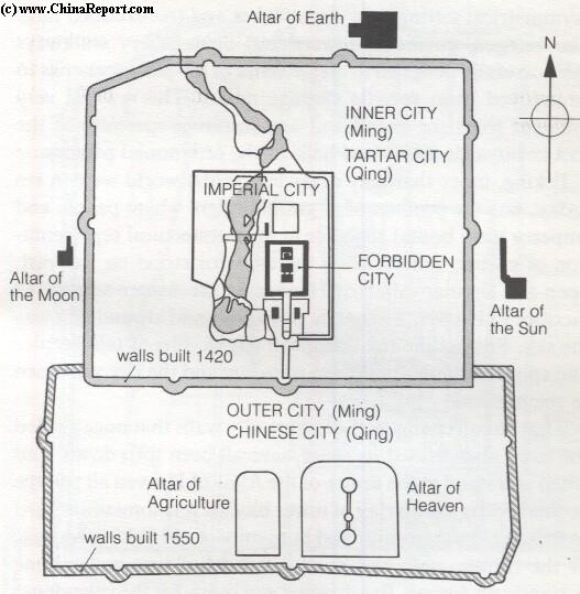
Take a look at this map of the Ming Dynasty City.
You can see the way that the city spreads out from the center.
This continues to this day as the city has grown and spread out to cover much more territory than its dynastic self. You can still see the way that it grows from the palace and the old city. The center of Chinese power may have shifted slightly to the west, to the Zhongnanhai government complex, or to the south, in the symbolic portrait of Mao at the Tiananmen gate, but the main idea is the same. Power is at the center of the capital and flows downward from there, to the provinces, to lower officials, to the population, and so on.
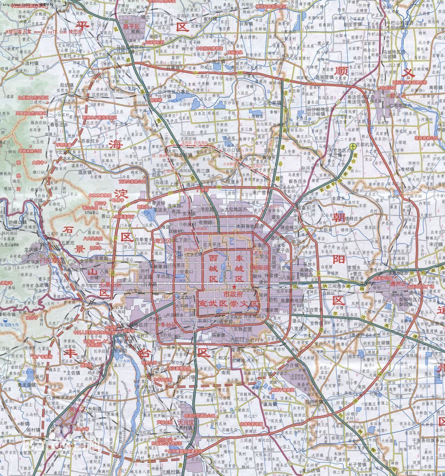
You can clearly see the way the city has continued with the same basic structure that existed during the Ming. What you can also see is that Beijing is now immense, spreading out in all directions. From this map, though, you can’t tell much more about what life in this city is like. The view is from too far away. You can see major roads, lakes and rivers, and maybe some mountains, but not much else. It is not on a human scale, this map, and that perhaps fits some other parts of Beijing’s history.
This map is from the height of the Cultural Revolution. The red map cover with sun rays emanating from the Tiananmen gate reinforces who wields power. Another important feature of this map is the way that the names of famous historical places where changed to fit the revolutionary era, for instance roads were rechristened things such as "Road for Eternal Revolution" from their classical names. This shows the way that power can change the naming of the city.
You can see the way that the city spreads out from the center.
This continues to this day as the city has grown and spread out to cover much more territory than its dynastic self. You can still see the way that it grows from the palace and the old city. The center of Chinese power may have shifted slightly to the west, to the Zhongnanhai government complex, or to the south, in the symbolic portrait of Mao at the Tiananmen gate, but the main idea is the same. Power is at the center of the capital and flows downward from there, to the provinces, to lower officials, to the population, and so on.
Lets take a look at current Chinese map of the city and analyze what we see.
This map is from the height of the Cultural Revolution. The red map cover with sun rays emanating from the Tiananmen gate reinforces who wields power. Another important feature of this map is the way that the names of famous historical places where changed to fit the revolutionary era, for instance roads were rechristened things such as "Road for Eternal Revolution" from their classical names. This shows the way that power can change the naming of the city.
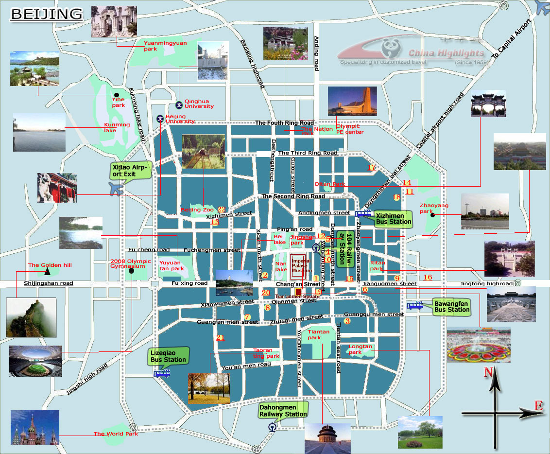
Beijing is still the center of Chinese politics and this is an important dimension of any spatial analysis of the city. The city has more roles now too and other maps represent this. 2008 was the year of the Beijing Olympics and a key year for tourism. Tourism is now incredibly important, drawing on both the past and historical sites like the Great Wall or the Beijing's famed Hutongs, to new landmarks like the Bird's Nest Stadium and Rem Koolhaas' CCTV Tower.
This is another way to represent the city, but it still doesn't offer a full portrait. It confines it simply to places of interest. These have cultural and historical importance, and thus go deeper in some ways than the earlier maps, but they still lack any representation of the people, the environment, or the geographical space of being in Beijing. Beijing is a city of 20 million people, some natives and some not. There are hundreds of millions of internal migrants who come from the provinces and settle in Beijing, working menial jobs and living in informal encampments or small dormitory rooms, hidden in the cracks between the city (where the eye of the resident or tourist are not looking). We need some sort of map to represent them.
The following art and design project by Edward Gouldy does something like this, capturing the migrant space that exists in the Chinese city.
What other representations of the city can we make? Beijing has many layers and many ways to approach it. Here are some alternate views that I found that better capture some of these important layers.
First is the subway, the underground city that connects the massive metropolis above. Any navigation through Beijing needs to utilize the subway, and in the past decade the subway has grown at a massive rate. When I first lived there in 2005, there were only 3 lines and now there are more than 10. They spread through the city and connect outward to suburbs that don't exist, which are now just cleared villages or empty fields but predicting a future of continued growth. You can read the future in the subway map. But you can also read the past. Beijing is a place of deep history and nowhere can this be more seen than in some particular place names, which go back hundreds of years (and sometimes refer to real locations that are no long gone). There is an alternate city in just the place names of subway stations. In my years in Beijing I traveled on all these lines, all these lifeblood veins, traveling out to all four corners of the city, dreaming it as I moved underneath it.
This is an interesting representation of Beijing's energy, as seen from capturing the lights from above. It is the image as you fly into the city, on those rare nights when the sky is clear enough, and see the sprawling streets and lights below.
Speaking of visibility, this is not something Beijing is famous for. In fact its air quality is infamous with days of heavy smog and sand descending on the city and covering the sun with an eerie darkness. This needs to be represented too and perhaps the relevant, present, map of Beijing (circa 2013-14 of the anthropocene era) is one that captures the smog. Like these below:
and
In Beijing one's being is immersed in the hyperobject of pollution, which is connected to the hyperobject of the city. One cannot escape either, or comprehend either, but in particular slices. It can be immense and alienating, but it also can be filled with a certain wonder. I remember on the smoggiest day of last year, when the pm 2.5 reached over 700, wandering through some ancient hutongs and seeing a temple from the late Ming rise up out of the mist. It seemed cut off from time, and the busy avenues at the end of the block. Ghostly appearing as if from one of Pu Songling's Liaozhai stories. Critical mapping should find ways to represent such experiences.
The final representation of the city is my own, tagged places on a google map of my life in the city. These include places I went often in the past three years, capturing the view from lived life on the ground. As of now I have kept the map to the two neighborhoods out beyond the 4th Ring Road that I spent the most time, and haven't extended my tagging deeper into the historical city (the core inside the 2nd Ring Road). These neighborhoods are Haidian, centered around Wudaokou and Zhongguancun, and Wangjing. Haidian is the University area, and I have spent most of my Beijing time living at Tsinghua and Peking Universities. Wangjing is the Korean expat area, on the way to the airport, where my brother lived for some of the time I was in Beijing. Central to that neighborhood is a North Korean restaurant where we often spent time together.
These neighborhoods represent the lived experience of being somewhere. I have tagged 100+ locations of places I would pass, restaurants I would visit, places where things happened, and included small and concise annotations. As this project goes on I will add more to this city, the Beijing that I lived through and that I know, and that I now miss.
What is a city but something that exists between lived reality and imagination? I can still move through Beijing even though I am not there, utilizing the map of experience-its image recorded in my memory. There are layers, stories, fragments of imagination, roads that worked, and of roads that failed to move forward, all constitute a map of an ever changing city.
| Previous page on path | Welcome to the Northern Capital, page 5 of 7 | Next page on path |
Discussion of "Maps of Beijing"
Add your voice to this discussion.
Checking your signed in status ...