Critical Maps Little Tokyo
Here are a collection of maps available within the Little Tokyo Area. Each of the maps provide a different interpretation of Little Tokyo.
Maps Provided by Metro Station Civic Center
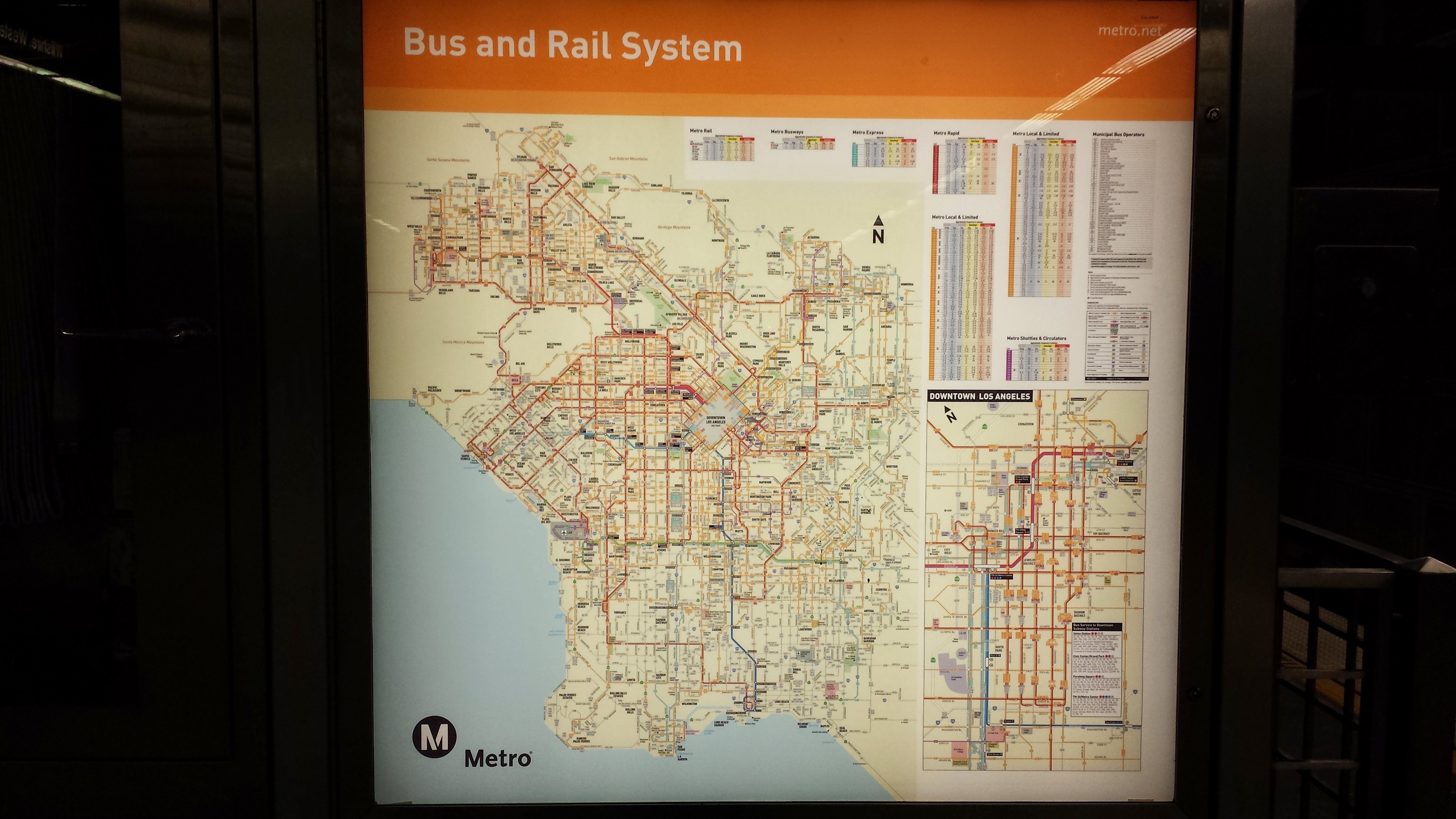
This is a map of the Bus and Rail System.
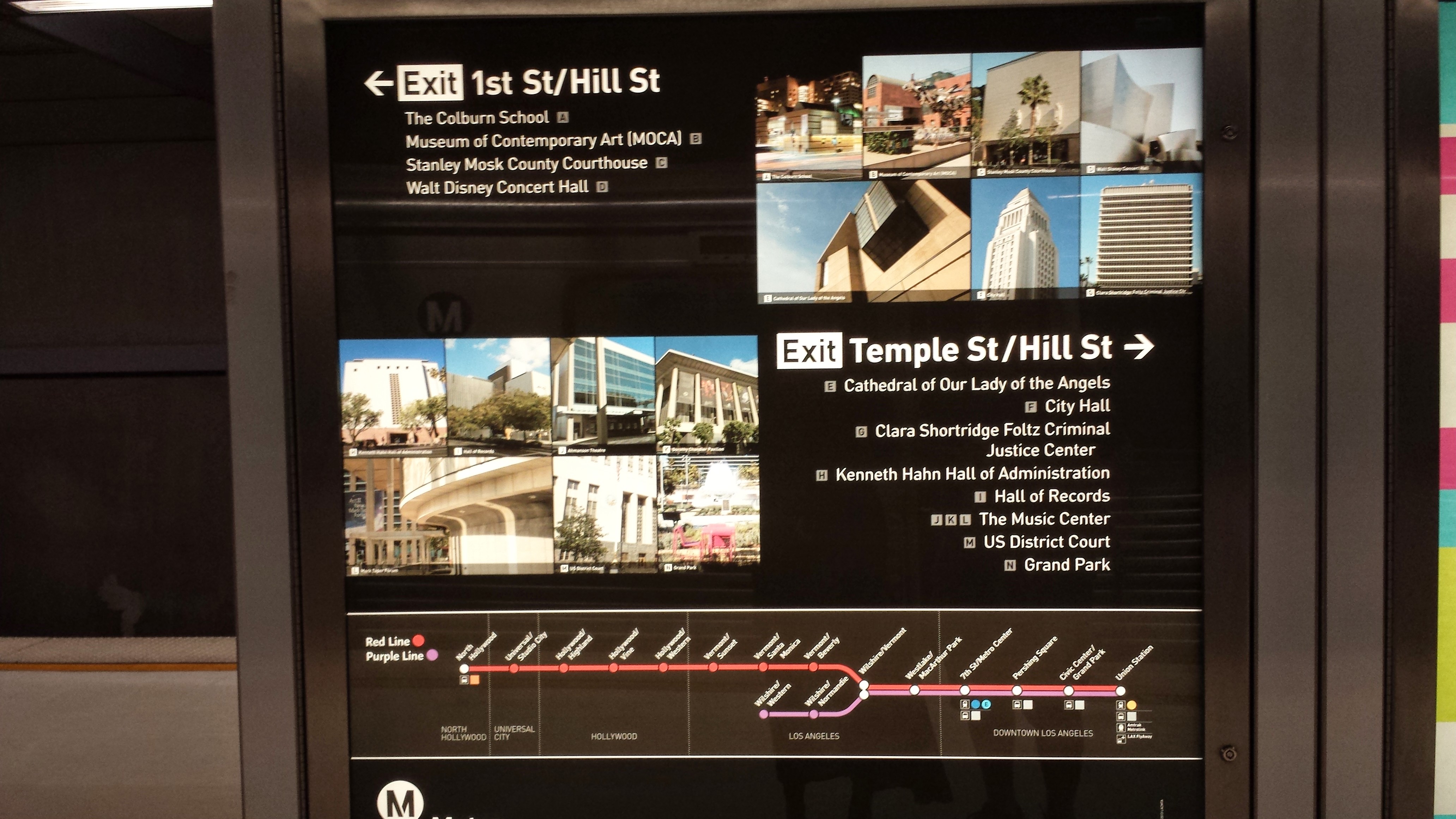
This map shows the Subway station stops and highlights certain places. Little Tokyo is not represented even though it is within walking distance.
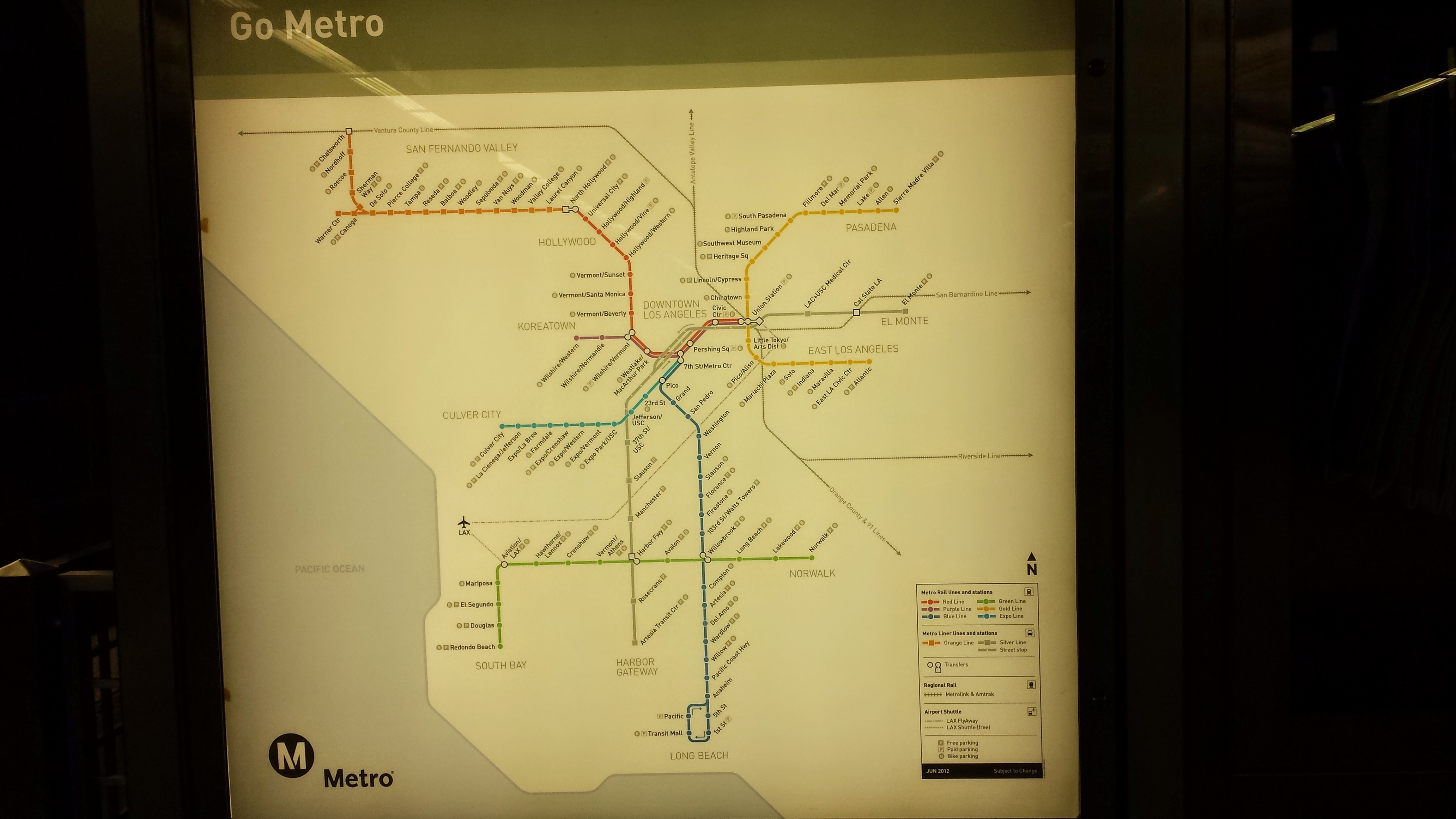
This is another map that is available at the Metro Civic center station. Little Tokyo is once again not represented as one of the highlighted places near by.
This is a map of the subway stations. I used the purple line to get to Little Tokyo.
Maps Provided within the streets of Little Tokyo Area
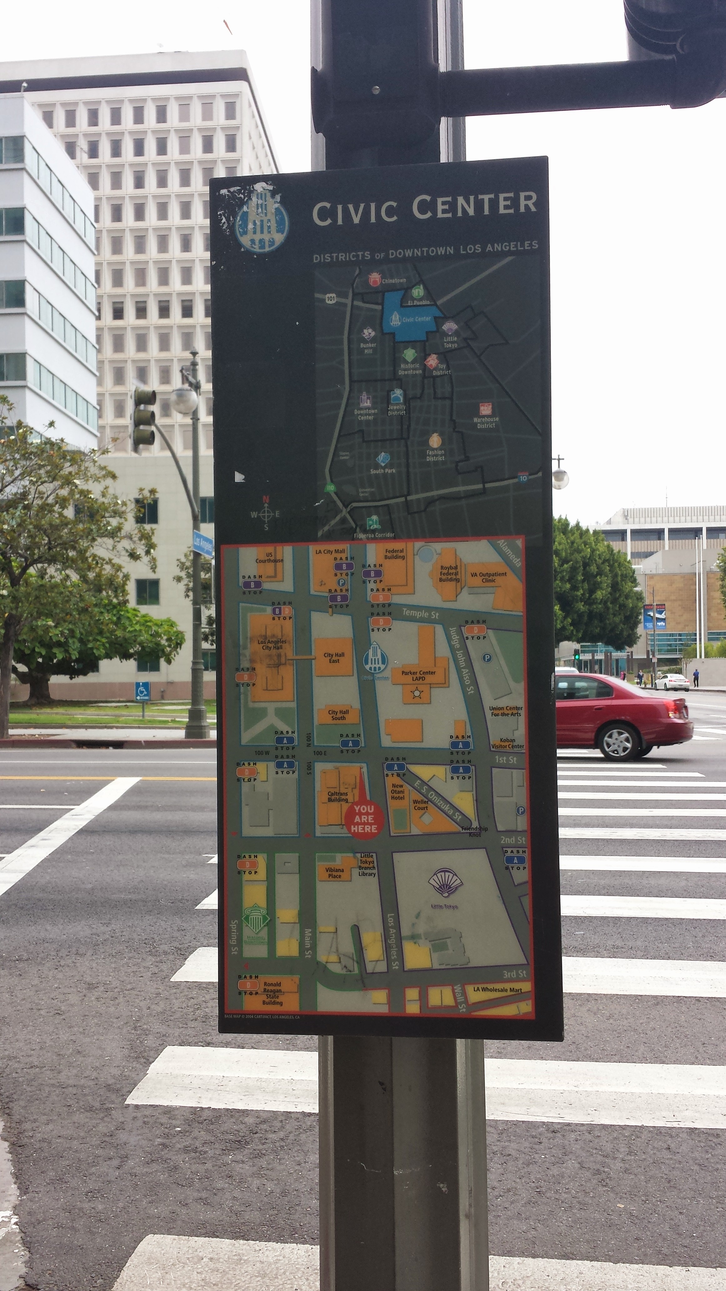
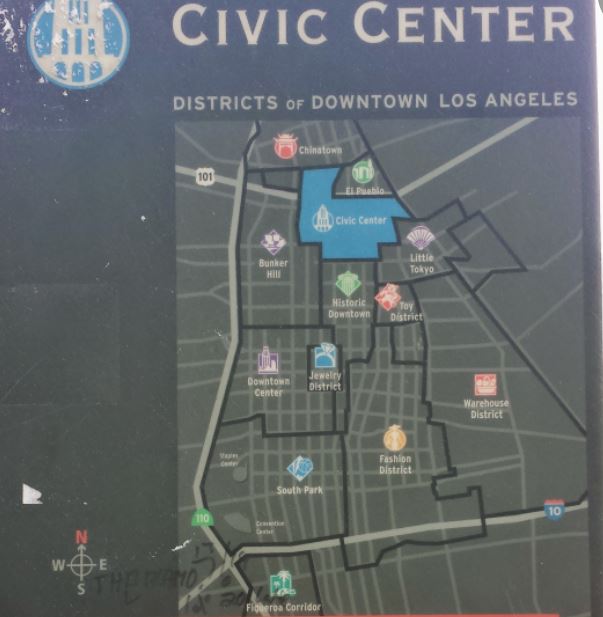
This is a map located within civic center area.
As you can see Little Tokyo is represented as one of the districts on to top part of the map. District portion of the map.
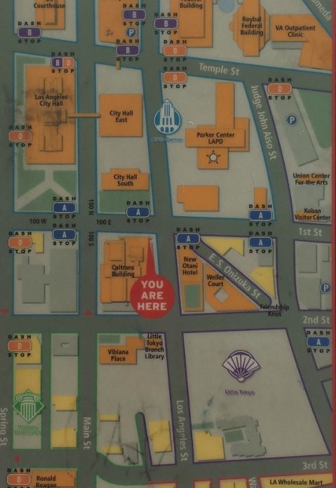
Little Tokyo is also represented on the bottom part of the map where the buildings and streets are highlighted. Street portion of the map.
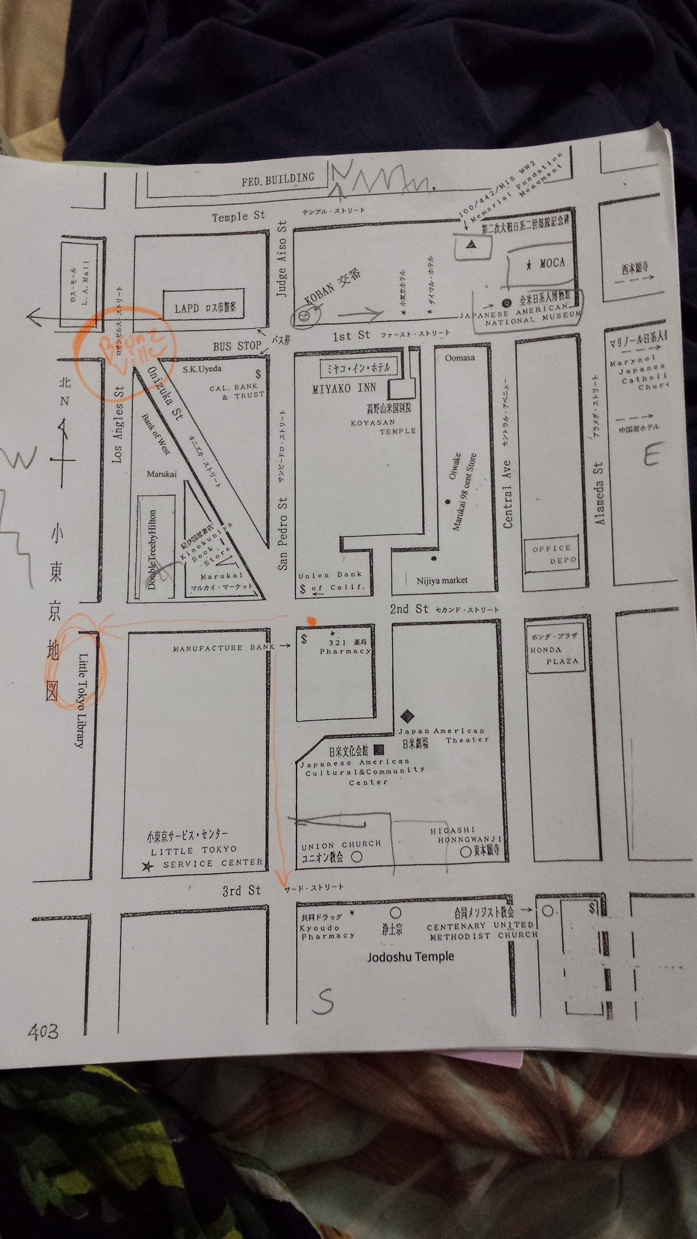
This is the map provided by the Little Tokyo Visitor Center. I asked them where Bronzeville was located. The Visitor Center did not have information about Bronzeville or where it was located.
This is the Map I used to navigate with.
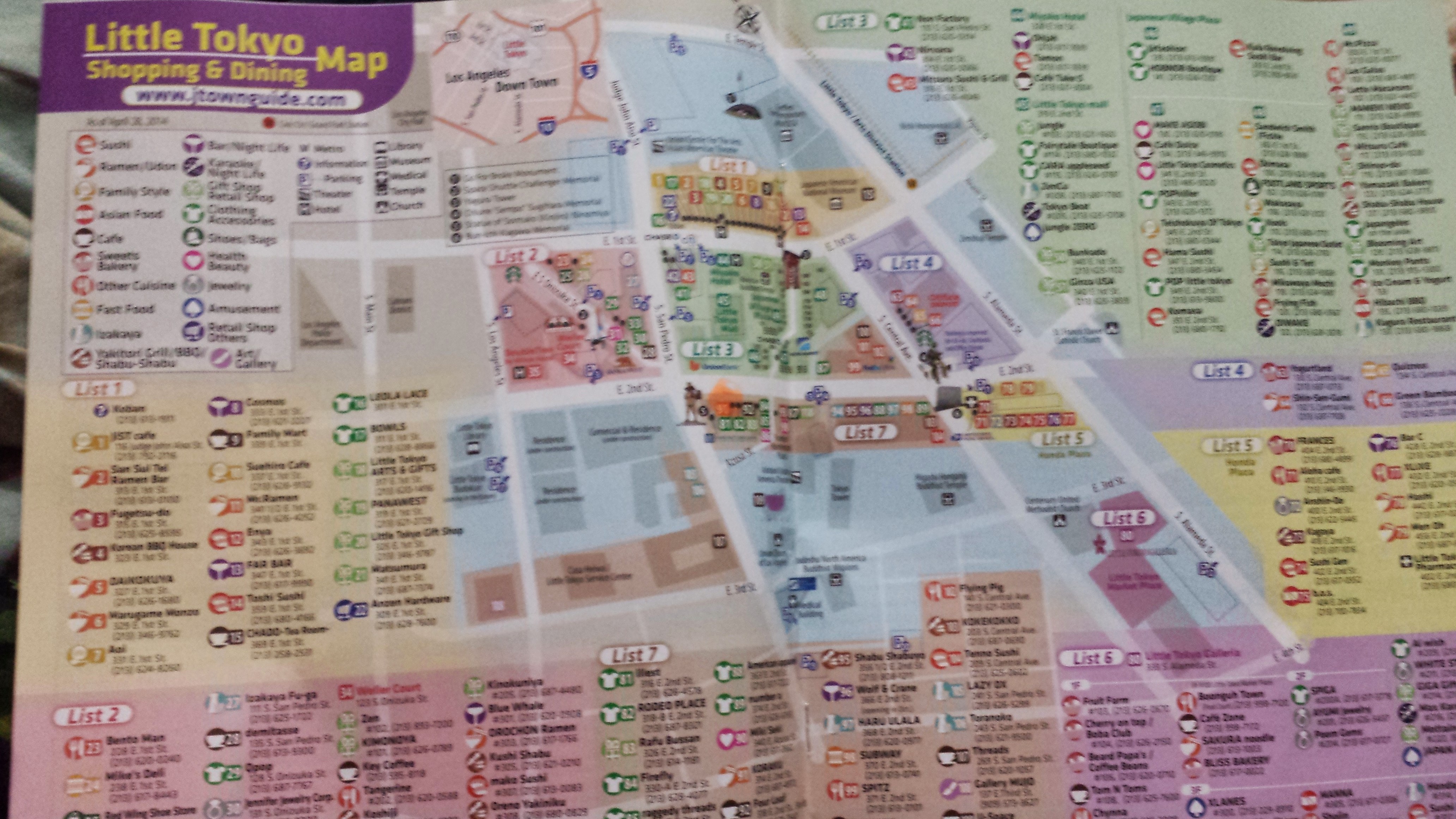
This is the map provided in a tour booklet. It highlights all of the shopping areas, restaurants, and anywhere else the tourist could spend their money on.
The different maps provide a different experience for the user. The Metro Maps are used for public transportation. The Map on the pole are for walking pedestrians searching for a particular district. The visitor center map, I feel is the most personal map because depending on what you are asking for they will highlight and write down where it is located. For me they highlighted the Japanese National History Museum and the Public Library. As for the Tour Map was created for tourists and it highlights the different gift shops and restaurants that tourists may be interested in. Each of these maps are created for a purpose. The user of these maps are at the mercy of the map maker who chooses what is to be represented and what is not to be acknowledged.
| Previous page on path | Little Tokyo: Space and Place, page 2 of 2 | Path end, return home |
Discussion of "Critical Maps Little Tokyo"
Add your voice to this discussion.
Checking your signed in status ...