The Digital PiranesiMain MenuAboutThe Digital Piranesi is a developing digital humanities project that aims to provide an enhanced digital edition of the works of Italian illustrator Giovanni Battista Piranesi (1720-1778).Works and VolumesGenres, Subjects, and ThemesBibliographyGlossary
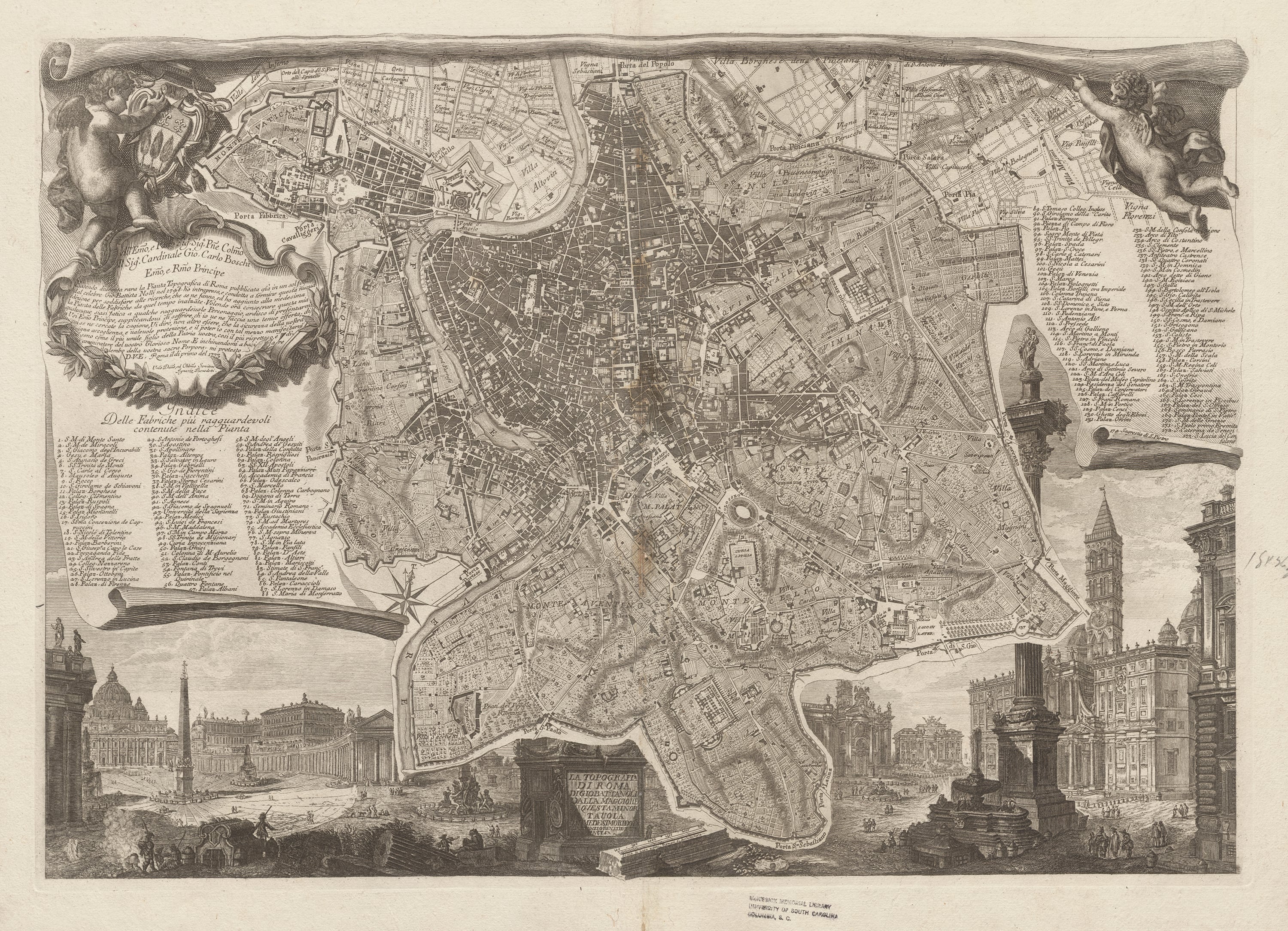
12021-08-12T06:59:56-07:00Topography of Rome1Giambattista Nolliplain2021-08-12T06:59:57-07:00Nolli’s “New Topography of Rome” (1748) established standard rules of cartography for centuries. It was the first map to use white to indicate streets and ink to indicate buildings. Nolli personally measured, surveyed, and documented every street, monument, palace, church, and garden. Piranesi based many of his inventive maps on Nolli’s design, and he engraved this map’s framing vistas, which display modern architectural works: the Trevi Fountain, the Basilica of Santa Maria Maggiore, and the piazza of St. Peter’s Basilica. The maps in this galleryimaginatively reconstruct ancient Rome, providing architectural blueprints of monuments such as the Colosseum, Pantheon, and the Forum, and they include references to additional maps, diagrams, and immersive views that permit viewers to experience first-hand the city’s history.