Madagascar (Part II)
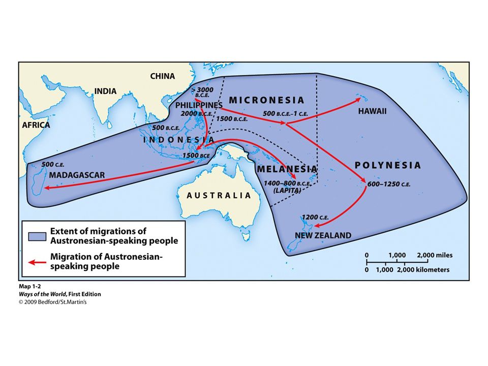
modern scholars have "brought to light the sophisticated non-instrumental navigational techniques which allowed Austronesian-speakers to progressively occupy the Pacific Islands, to reach and keep contact with remote and often tiny islands thousands of islands apart....[and through] reassessing eighteenth-century descriptions by Western explorers, it was also proven that the vessels that carried people into the Pacific had often been complex, large, plank-built canoes, not mere dugouts" (Manguin 54).
Analysis of the language of the island supports the connection to Malay-Java region of southeast Asia. It is not an African language, but rather a member of the South East Barito group of languages from the region of Borneo, with some influence from the Malay and Javanese languages; virtually all foreign loanwords (words taken and incorporated as-is, from another language) were adapted in such a form that continued contact between the residents of Madagascar and their ancestors in southeast Asia appears to have been somewhat regular after the initial settlement (Adelaar 78, 82).
Art of wayfinding
Dead reckoning video at 3.20 HAVE BOTH FULL VIDEO AND ANNOTATED (3.40-7.41) with stress on lack of longitude.
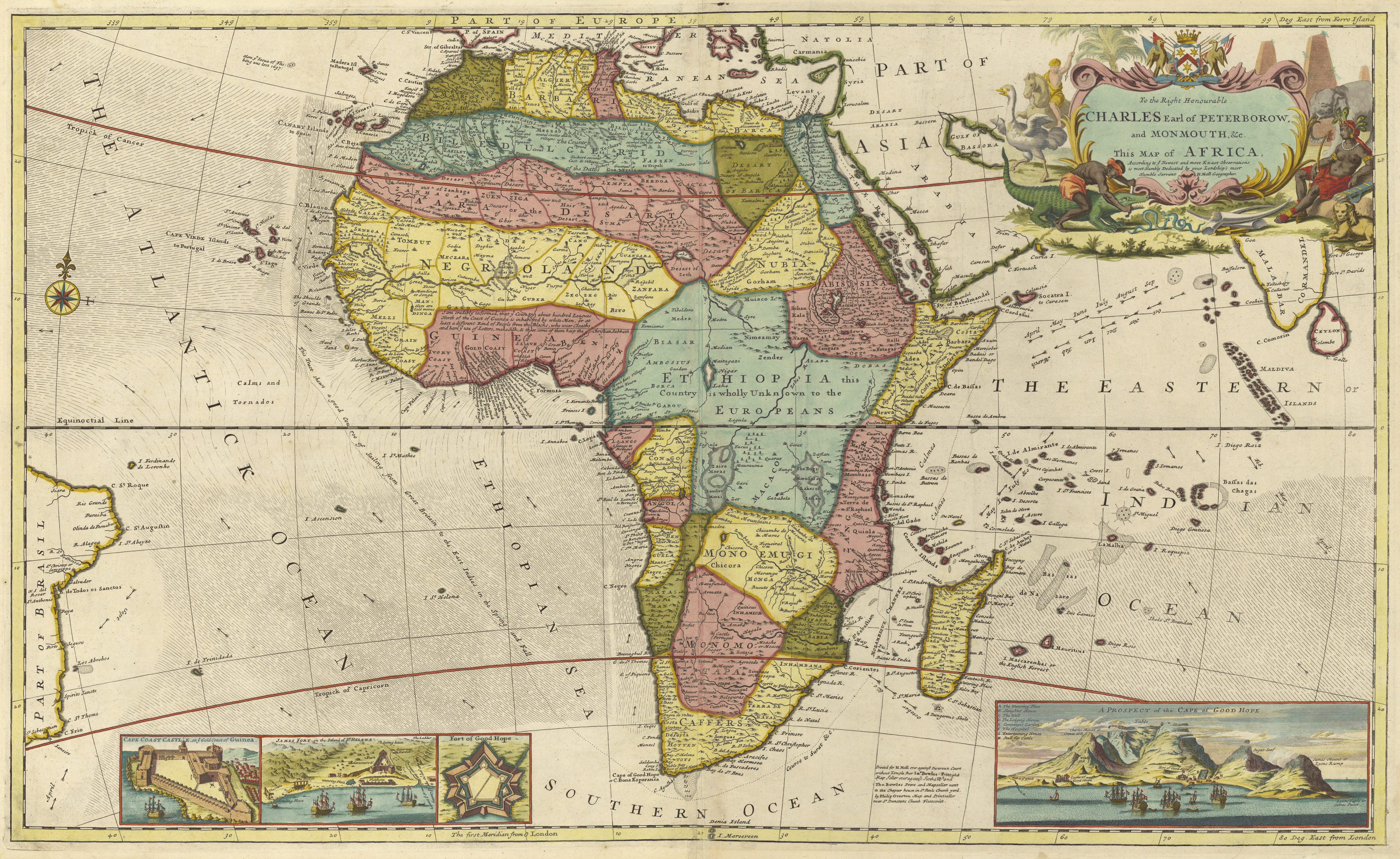
European understanding of physical geography quite good by mid-seventeenth century. Includes understanding of seasonal changes (which will be discussed in more detail in the next chapter). Representative Map. Concepts of Africa; useful visual via the Princeton exhibit that illustrates the changing European understanding of the continent. (Interested readers might enjoy the visual tour, given from-sixteenth to mid-nineteenth centuries, at http://libweb5.princeton.edu/visual_materials/maps/websites/africa/maps-continent/continent.html )
What was lacking, of course, was an equally nuanced understanding of the continent's culture, as European names (and soon, colonies) are mapped over African soil.
Monsoons- general overview with more detail LINK NOT WORKING
http://moocs.southampton.ac.uk/shipwrecks/2014/10/02/maritime-rhythms-indian-ocean-monsoon/
The seasons oceanic and atmospheric shifts due to monsoons made Madagascar an important stop for Europeans navigating their way into the Indian Ocean. As Jane Hooper points out, in Feeding Globalization, despite the island's significant links to the slave trade, "out of the more than eight hundred voyages to the island, only about a third of the English, French and Dutch vessels that stopped there between 1600 and 1800 carried traders in search of slaves. The others loaded valuable supplies of food, wood and water during their stays on the island" (3). These waves of European missionaries, slavers, merchants and pirates that would visit Madagascar, are discussed in Part III of this section.
Europeans first charted the island via a wave of Portuguese vessels, starting in 1498. Diego Diaz stumbled on the island in 1500, and found both supplies and willing native peoples. However, for much of the sixteenth century, voyages to the island remained largely "unintentional, as their ships landed on the island following harsh storms in the Mozambique Channel. Later voyages were sometimes intended to discover any survivors from shipwrecks" (Hooper 25). The Dutch, also among the first Europeans to explore the island, had similar experiences, as disease and low morale took a heavy toll on the crew of their first major expedition in the region. While one of the commanders, Frederik de Houtman, would eventually publish the first European translation of the Malagasy language, the expedition was marred by a fifty-percent casualty rate, violence with natives in southeast Asia and with Portuguese rivals, and Houtman's own incarceration for two years in Sumatra. While results were encouraging enough to be cited in the subsequent formation of the Dutch East India Company, maps of the expedition noted the heavy loses, labeling one part of the island "the Dutch graveyard because many of them are buried there."
AS A RESULT, SEEN LARGELY AS PROVISIONING STATION...PERFECT FODDER FOR PIRATES SEEKING PREY
BUT DECENTRALIZED AUTHORITY
, Johann Theodor and Johann Israel de Bry_thumb.jpg)