Maps, Charts, and Graphs in Modern America
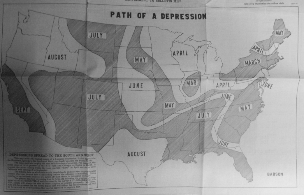
The combination of complex corporation organization and economists’ graphs and formulae led to the idea that a country’s economic life could be represented and analyzed independently of firms and governance. In the early twentieth century this idea developed into a new term: “the economy.” Many representations of “the economy” in the early twentieth century emphasized maps and spatial relations. Maps of the United States were recognizable, and different kinds of imagery could easily depict where economic activity was happening, whether by showing new businesses rising up out of states, illustrating the production or movement of goods, or by dividing up the nation not by spatial distance, but by the time it would take someone to travel by rail. These map-based images in the early twentieth century made the economy seem real by incorporating it into the familiar image of the United States.
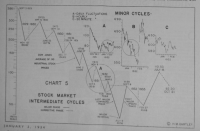
By the 1930s, numerical and graphical depictions of the economy joined, and largely replaced, geographical ones in public depictions of the economy. New line graphs and pie charts helped explain and popularize economic knowledge, especially in newspapers and other media. Nowhere was this truer than in the stock market, which rapidly moved from being the province of a few specialized traders to a popular economic pastime, as stock trading was widely advertised as a means of prosperity and stability.
It was these charts that tried to explain the otherwise unimaginable magnitude of the Great Depression. Both maps and charts were employed to try to show what had happened, particularly to explain how quickly the crisis had struck—and, by the mid-1930s, suggest how it might also eventually recover. The chronological x-axis of the graphs showed both vividly showed the crash, but also “ended” with a slight uptick that in the line graph, a kind of mathematical promise for recovery.