The Brownsville AffairMain MenuThe 25th Infantry RegimentBrownsville, TexasAugust 1906Roosevelt's ResponsePunishment and its AftermathThe Legacy of the Brownsville AffairMedia coverageImage Gallerythe Historical Museum at Fort Missoula2ed0a4c76b15fe2d208dedaebb1fcaaa8b4d9c38
"Map of Fort Brown , 1846" (Image description)
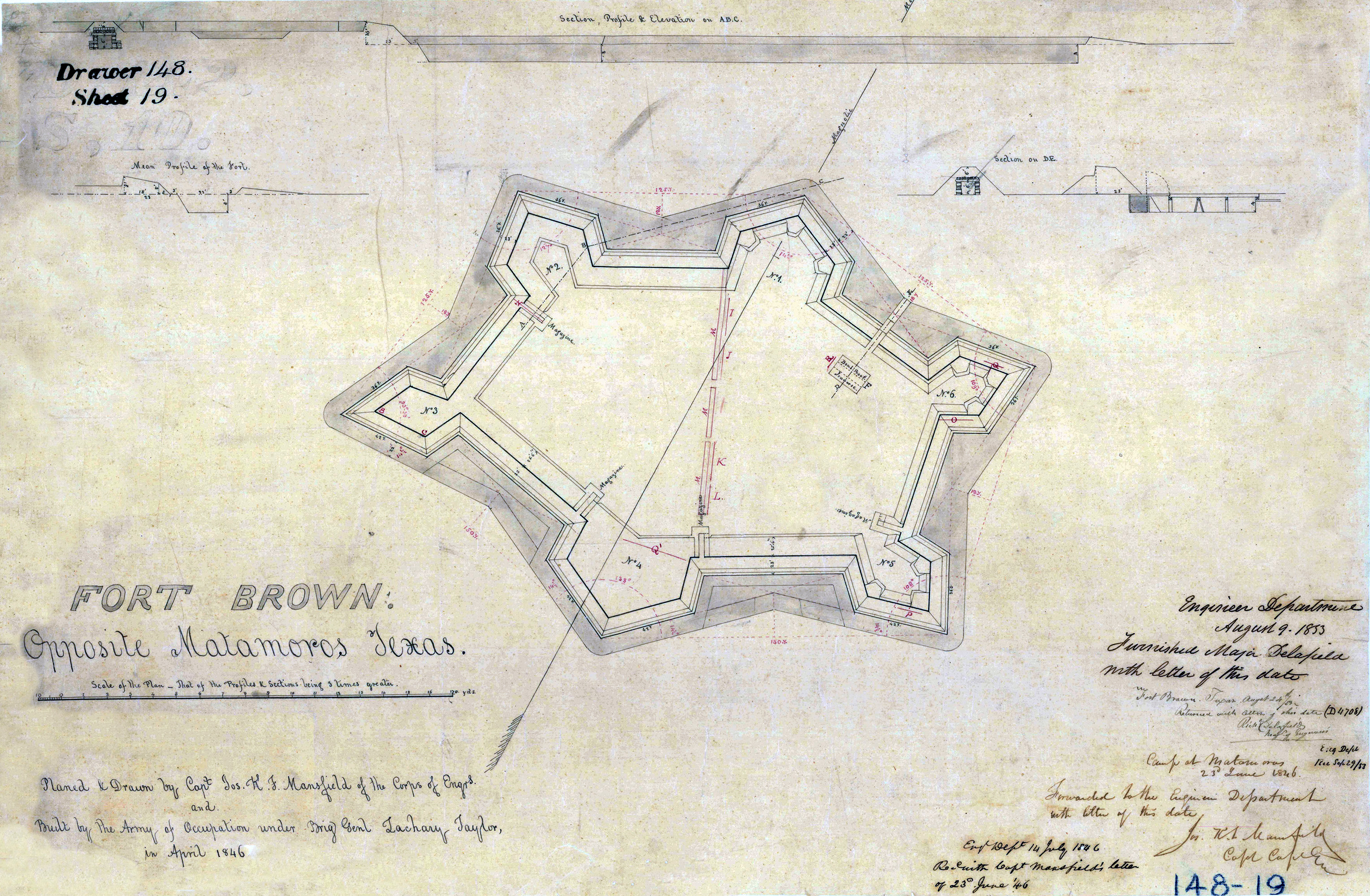
12020-09-14T08:33:50-07:00the Historical Museum at Fort Missoula2ed0a4c76b15fe2d208dedaebb1fcaaa8b4d9c38376432plain2020-09-14T08:35:00-07:00the Historical Museum at Fort Missoula2ed0a4c76b15fe2d208dedaebb1fcaaa8b4d9c38Hand drawn map of Fort Brown. The fort is roughly the shape of a six pointed star. The map is labeled "Fort Brown opposite Matamoros Texas | Planed & Drawn by Capt Jos. K. J. Mansfield of the Corps of Engrs and Built by the Army of Occupation under Brig Gen Zachary Taylor, in April 1846."
Contents of this annotation:
1media/ft brown 2.png2020-09-14T08:24:36-07:00the Historical Museum at Fort Missoula2ed0a4c76b15fe2d208dedaebb1fcaaa8b4d9c38Map of Fort Brown, 18467plain2020-09-14T08:36:44-07:00the Historical Museum at Fort Missoula2ed0a4c76b15fe2d208dedaebb1fcaaa8b4d9c38