The International Prester John Project: How A Global Legend Was Created Across Six CenturiesMain MenuOrientation to ProjectPath One: 1122-1235Path Two: 1236-1310 ADPath Three : 1311-1460 ADPath Four : 1461-1520 ADPath Five: 1521-1699 ADPath Six: 1700-1800 ADChristopher Taylor // christopher.eric.taylor@gmail.com946e2cf6115688379f338b70e5b6f6c039f8ba6f Global Middle Ages
Mercator Map
12015-12-20T15:51:57-08:00Christopher Taylor // christopher.eric.taylor@gmail.com946e2cf6115688379f338b70e5b6f6c039f8ba6f52811plain2015-12-20T15:51:57-08:00Christopher Taylor // christopher.eric.taylor@gmail.com946e2cf6115688379f338b70e5b6f6c039f8ba6f
This page is referenced by:
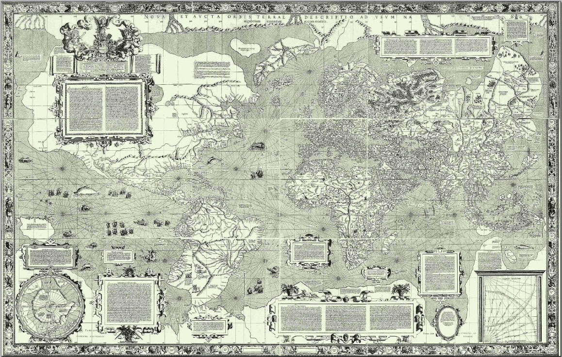
1media/MercatorMap1569.png2015-07-30T03:52:18-07:00Mercator World Map of 15697image_header2015-12-20T16:30:40-08:00Nova et Aucta Orbis Terrae Descriptio ad Usum Navigantium Emendate Accommodata (1569)
An early attempt to depict a cylindrical model of the globe, Gerardus Mercator's 1569 map depicts an Asian kingdom of Prester John.