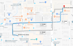
Neighborhood Walk
Starting point: Urbana Free Library
Walking path:
Notes:
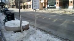
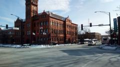
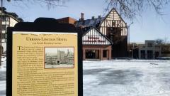
Since I’m currently living on campus, I chose to go outside of campus and walked around East part the city, where I’m planning to move coming summer. In the center of the campus where I’m currently staying, snow that covering streets were more or less cleared, so that I started my small walk with my ordinary shoes. It took me less than 5 minutes to regret my unprepared decision after I started my walk from Urbana Free Library, since the roads were still covered with snow, and some shade places were very icy and dangerous for those who not used to it. When I got off bus stop at Urbana Free Library, it was somehow surreal to see Urbana Landmark Hotel with “Welcome” sign at the front entrance fully covered with ice and snow that it seemed very difficult to approach.
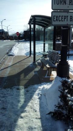
I usually walk fast, but those icy streets made me walk so slow that I thought of accessibility through this stroll. Accessibility in the campus is very advanced that we often take it for granted, but I saw (heard) a lot of big intersection without an assistive voice.
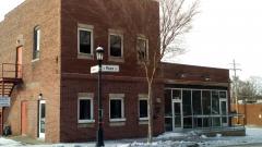
Although I generally feel very safe within the campus, streets outside of campus in the night seemed dark, and difficult to grasp where you are if you were an outsider. If we could add more light on the street sign, I felt it would be safer and easier to know your place without a smartphone.
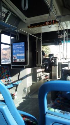
As a resident without own car, public transportation is very important and MTD is very convenient to go around. However, I feel the usability of MTD is heavily dependent on smartphone and once you use buses without smartphone it can become very difficult to use. Although announcement in the bus tells you next stop, it usually wouldn’t show or tell you a route chart, so that those who are not familiar with the neighbor would feel anxious whether you are on a right bus.