Evaluation
Much of Los Angeles and the Problem of Urban Historical Knowledge is an open-ended philosophical meditation on what we can truly know about the past. But it also contains an argument: that the literal mapping of places is "the key concept in the search for historical certainty" (Ethington 2000). On the website, he uses Los Angeles and its history as means of demonstrating the validity of complex epistemological theories. For his purposes, the actual urban history that he uncovers and documents is less important. Ethington's theory-heavy essay is far beyond the comprehension and interest of the general public. But his defense of mapping as an important historical method helped pave the way for future photo-mapping projects.
Vergara, the creator of Invincible Cities, is described by the MacArthur Foundation as a "photographer-ethnographer trained as a sociologist" (MacArthur Foundation 2002). He aims to create a visual history of urban America through images of "physical communities" (Vergara 2005). The built environment of a city, he says, is literally a concrete result of the choices made by residents and public officials, and "an essential element of an urban history told from the ground up" (Ibid.). The people who live in these communities are usually not central to his photographs.
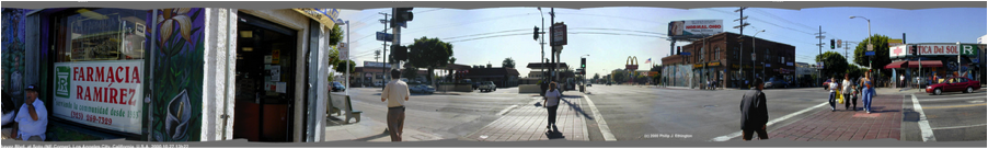
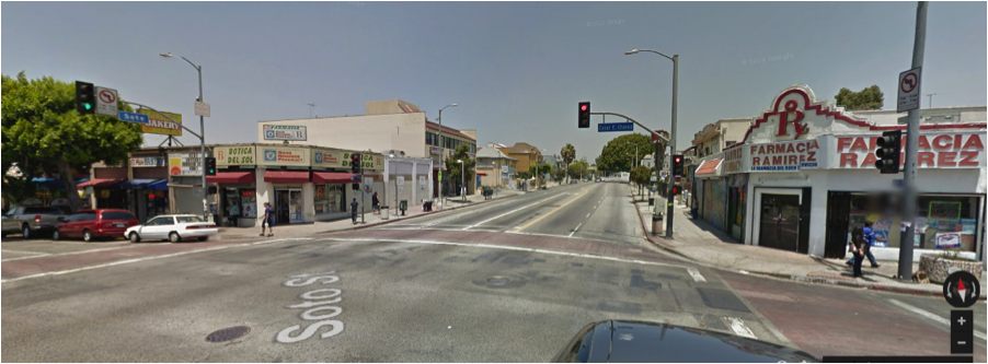
The photo-mapping section of Los Angeles... would be considered primitive if it was created today. Instead of the smooth animation found in Invincible Cities and Photogrammar, users must click on static maps in garish neon colors on a black background. One could argue that the site's panoramic images and photo sequences of Los Angeles streets have been made obsolete by the advent of Google Maps' Street View imagery. However, they display human faces that Google would automatically blur, and they capture a historical moment— the final months before September 11, 2001— that will never be displayed on Street View.
Ethington uses fascinating visual examples to show how buildings and landscapes in Los Angeles have changed over time. He superimposes images taken decades apart, and compares photographs to their corresponding location on a 1940 model of the city used for urban planning. This is a useful contribution to the historical and architectural study of the city.
***
Vergara, the creator of Invincible Cities, is described by the MacArthur Foundation as a "photographer-ethnographer trained as a sociologist" (MacArthur Foundation 2002). He aims to create a visual history of urban America through images of "physical communities" (Vergara 2005). The built environment of a city, he says, is literally a concrete result of the choices made by residents and public officials, and "an essential element of an urban history told from the ground up" (Ibid.). The people who live in these communities are usually not central to his photographs.
Desolate scenes and some hopeful ones as well are scattered throughout Vergara's photo-map of Richmond. Photographs of rusting shipyards, dismally fenced-in housing complexes and memorials for murder victims seem to convey a sad acceptance of the city's demise. But more uplifting images are easily found: religious murals; smiling children at a farmer's market; and unique Depression-era houses, usually in good condition, that Vergara categorizes as "Modest Masterpieces." Some of Vergara's photos have captions that offer his own opinions and interpretations.
Vergara's website is beautifully designed. Moving slowly down a street viewing photos one-by-one is just as easy as leaping to another photograph taken across the city. One starts to get a feel for the layout of the city, and an urge to visit the place and explore further. On the Harlem and Camden sites, 26 years of documentation allows visitors to see how exact locations have changed across the decades. Not so with Richmond, unfortunately; almost all of these photos were taken between 2004 and 2005. Invincible Cities is not perfect: there should be a search engine for locating photos, and I personally find Vergara's decision to photograph physical constructions more than people rather limiting. While the emptiness and decay of the ghetto landscape is important to document, a visual urban history with minimal emphasis on the human residents feels incomplete. Nevertheless, Vergara's site is a photo-mapping masterpiece, remarkable in its presentation of volatile urban spaces across time.
***
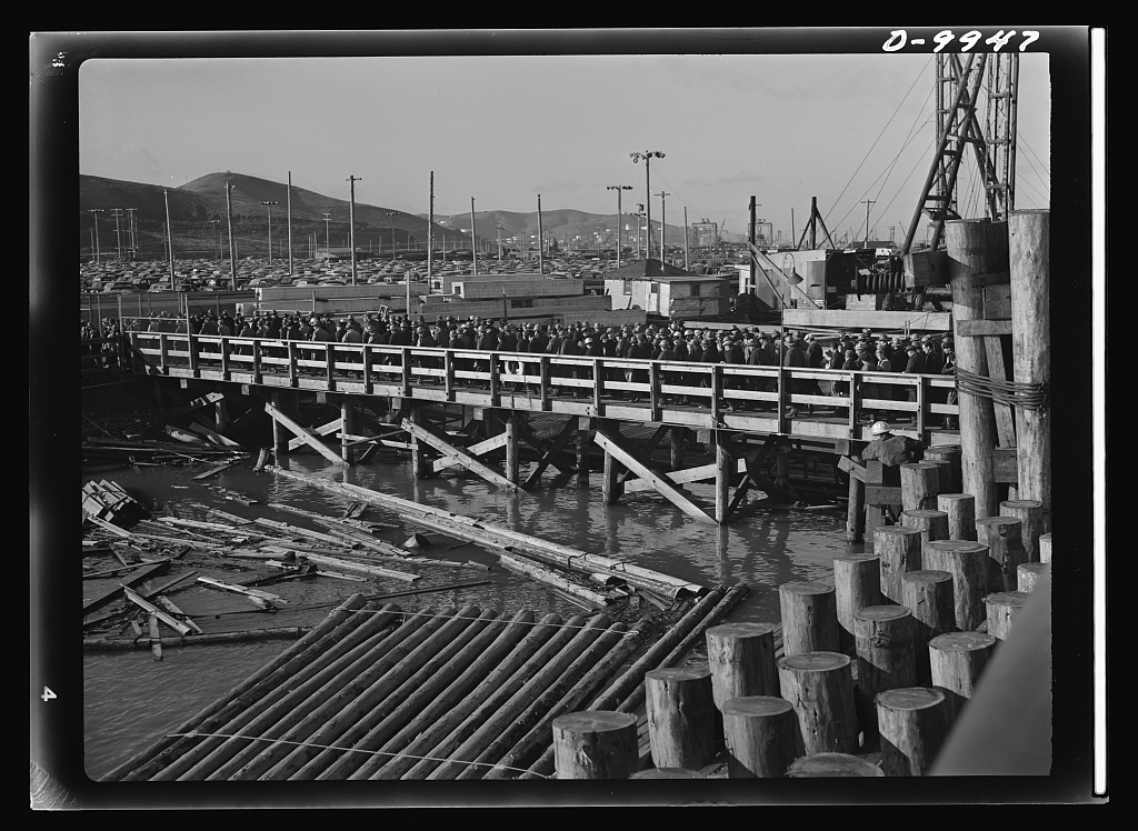
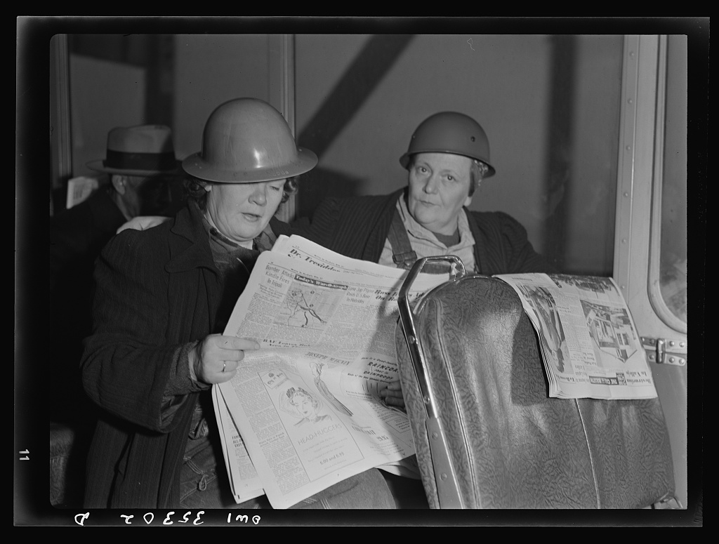
Photogrammar is designed to connect the public with the visual history of the U.S. (Yang 2014). Its clean design and user-friendly interface do a lot to advance this goal. But the photographic database is more useful for the study of California's agricultural history than that of its cities. Unlike Invincible Cities, it does not have street-level mapping, and fails to convey any sense of urban geography. Many of the photographs of California cities were commissioned by the Office of War Information, so there is a disproportionate focus on mobilization efforts and manufacturing. This is certainly the case in Richmond. All of the photos of the city feature workers at the shipyards and metalworks that employed 100,000 people during the war (Gillete 2005).
However, when I used Photogrammar's map to explore San Francisco and Los Angeles, I found photos by Dorothea Lange and John Collier that gave a fuller picture of these urban landscapes outside the workplace. Ironically, Lange's photography focuses on the impoverishing effects of the lack of work created by the Great Depression.
There are some technical flaws that need to be ironed out of Photogrammar. I found some additional images of Richmond using the photographer-based "dots" map; but the dot I clicked on before finding them was situated in Los Angeles. In addition, there are many colored dots and counties on the map that contain no photos when clicked. Overall, Photogrammar is an incredibly accessible and valuable historical resource; it's just not very useful for urban historians.
| Previous page on path | Mapping California's Cities in Space and Time by Joshua Mandell, page 2 of 5 | Next page on path |
Discussion of "Evaluation"
Add your voice to this discussion.
Checking your signed in status ...