Small Groups: ESRI Story Maps
Description:
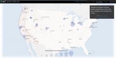
This small group session offers a tutorial and guidance to build a Story Map. Story Maps are configurable web apps that tell a story by combining maps, text, images, and other multimedia content. They can be built on the ESRI Story Maps website (https://storymaps.arcgis.com/en/) or through the “Share” link in ArcGIS Online. For this session, you can use your own data and online maps that you have created after the ArcGIS Online session on Wednesday, or you can use data and maps that are accessible via the ArcGIS Online Gallery.Download sample dataset here.
Sample Esri Story Maps:
Building Our Capital: A Look at the Origins of the National Capital Commission – Created by the Ottawa Improvement Commission (OIC), this story map traces the important milestones in the early history of federal planning in the Canadian Capital.Camera and Locomotive: Two Tracks Across the Continent – Created by the Library of Congress, this story map combines maps and photographs from the Library of Congress collections to gain a deeper appreciation for the connections between the railroads and photography during the construction of the transcontinental railroad between 1863-1869.
Connecticut’s Coast: Then and Now – This story map, created by Joel Stocker and Emily Wilson at the University of Connecticut, explores Connecticut’s changing shoreline through a series of interactive maps featuring historic and present-day pictures.
Flying the Atlantic: The pioneers of one of the busiest air corridors in the World – Created by Andy Skinner at ESRI, this story map uses pictures, maps, and scenes to explore the pioneers of transatlantic aviation and the development of one of the busiest air corridors in the world.
Fort Sumter, 1861 and Today – Created by ESRI, this map uses a swipe function to toggle between a modern satellite image of Charleston harbor and a map of the harbor from 1861.
Get Your Kicks ...: A trip down the Mother Road in Springfield, Missouri – Created by the City of Springfield, Missouri, this story map uses a dashboard format to view pictures and linked locations in a tour of sites along historic Route 66 in Springfield, Missouri.
Justice Deferred: Executive Order 9066 and the geography of Japanese American imprisonment and Japanese Internment: A View From Above – These story maps, created by ESRI, work together to tell the story of Japanese American imprisonment during World War II. Justice Deferred uses a combination of video, pictures, graphs, and maps, while Japanese Internment serves as a companion story map, allowing the viewer to swipe between historic maps and current geography of internment sites.
Legacies of Labor: Lebanese Factory Workers in Lawrence, Massachusetts, 1890-1950 – This project was created by the Khayrallah Center for Lebanese Diaspora Studies at North Carolina State University. It explores the history of the Lebanese immigrant working class and their struggles to become American in Lawrence, Massachusetts.
London's lost river: the Tyburn – Created by the Museum of London Archaeology (MOLA), this project presents theories to explore the story of the long-lost Tyburn River in the city of London. It combines images, interactive maps, and graphs to present several geoarchaeological theories about the possible routes of the river.
Spyglass on the Past: Washington DC 1851 and Today – This page, created by ESRI, overlays a georectified map of Washington, D.C. from 1851 on a present day satellite imagery. It uses an interactive “spyglass” to view the historic map.
For additional GIS projects, many of which are published as Story Maps, see the ArcGIS Online page on Day 2 of the DHRI.