Georectification
GEORECTIFICATION
with Nancy Um
Georectification is a process that allows for an image of a map to be referenced to a spatial grid. This process is useful for those who wish to integrate historic maps into their digital projects. In this workshop, we will georectify a historic map, export the georectified file, and then discuss ways in which these georectified maps can be integrated with other types of data on some of the platforms that we have already worked with, including Tableau and ArcGIS online. This session will not require any downloads, but will require that the participants register to use certain free platforms. This workshop has drawn from the information provided in the following excellent tutorials:- Mauricio Giraldo Arteaga, "From Paper Maps to the Web: A DIY Digital Maps Primer," NYPL Labs, January 5, 2015, https://www.nypl.org/blog/2015/01/05/web-maps-primer
- Kirsten Mapes, "Working with a Georectified Map (Part 1: Mapbox and Tableau)," December 6, 2016, http://www.kristenmapes.com/georectifiedmap1/
- Kirsten Mapes, "Working with a Georectified Map (Part 2: Carto and Esri Story Maps)," December 15, 2016, http://www.kristenmapes.com/georectifiedmap2/
- Lincoln Mullen, “Georectification,” Spatial Humanities Workshop," https://lincolnmullen.com/projects/spatial-workshop/georectification.html
Using the Map Warper
This workshop uses the New York Public Library Map Warper, which allows us to draw from the rich collection of digitized maps that the library holds. Please note that these maps are public and that your control points and georectified maps will be available to other users of this resource.- Visit the NYPL Map Warper: http://maps.nypl.org/warper/
- Click “Create Account” in the upper right corner. Follow the instructions to register for the site.
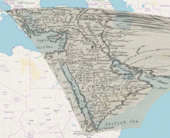
- Search for a map from their digitized collection. You should choose a map from a region that you are familiar with. Note that each map is marked by “Status,” in the right-hand column. Try to find a map with an “Unrectified” status. Maps that have been rectified will show a certain number of control points in the status column.
- The map that you selected will appear in the work window. There are a number of tabs at the top of the window. Click the “Rectify” tab.
- The screen will split into two. The map that you selected will appear on the left and the OpenStreetMap platform will appear on the right.
- Zoom in to the map on the right so that the view matches the scope of the historic map on the left.
- Now begin to add control points. For each control point, click the green marker in the upper right corner of the window and then place the marker on the map. Select the exact same location on both sides. Confirm each control point pair by clicking “Add Control Point” at the base of the map. After you do this, the pair of control points will appear on both maps with the same number.
- Add at least 4 control points. Try to choose control points that are spread throughout the map, including in its corners.
- When you have chosen all of your control points, click “Warp Image” to rectify the historic image. It might take a minute or two to complete this function.
- After the map was been warped, you may want to crop the map to fit the dimensions that you wish to use. Click the “Crop” tab and use the buttons in the upper right to draw a shape around the parts of the map that you wish to keep. Select “Mask map” to confirm your selection.
- Click the “Preview” tab to view the rectified map. You can use the transparency slider to adjust the opacity of your map.
Exporting your Warped Map
- Click the “Export” tab. You have several options for exporting your warped map. You can export the map as an image file. Here are the options: a hi-res unwarped GeoTIFF, a hi-res warped GeoTIFF, or a warped .png file (which is smaller in size). You can also export the map as a .kml file (which works with Google Earth) or a series of tiles that are accessible via a web address. The directions below provide some ways to work with these georectified maps and each one calls for a different export format.
Warp your own Map
- If you wish to upload your own map to be georectified, you may use the Map Warper, rather than the NYPL site.
- Go to mapwarper.net. This interface is the same as the NYPL's, but it is independent and can be used to warp any map that you have permission to use. You will also need to register and sign up separately at this site. As with the NYPL site, the maps on mapwarper.net are public. Your control points and georectified maps will be available to other users of this resource.
- All of the georectifying and export functions work the same way as the NYPL site. After uploading your map, follow the directions above to georectify your map and export it.
Using your warped Map in ArcGIS Online or Tableau
In order to use your georectified map in ArcGIS online or Tableau, you will need to export your georectified image as a GeoTIFF. Then, you will have to upload it to a web-based mapping platform, like Mapbox, which will transform it into a raster image and host it. Unfortunately, neither ArcGIS online or Tableau will allow you to upload a GeoTIFF directly to their interfaces.- Start with Mapbox. Navigate to https://account.mapbox.com/auth/signup/ and sign up for the free service. This is a “freemium” service, which means that it offers entry-level services for free, but advanced functions or extensive use will require a paid subscription.
- Click on your profile icon in the upper right corner and select “Studio.” Click on “Tilesets” in the upper right and then click “New Tileset.” Drag and drop the GeoTIFF file of your rectified map into the box. Your Map will appear as a tileset.
- Click on “Styles” in the upper right and select “New Style.” Choose any of the basic templates that you wish to use.
- A map will appear. Click “Add layer” and select your georectified map, which will appear among the list of choices. You may have to reorient the map to the area that corresponds to your georectified map. The georectified image should appear as a map layer. If the map appears to be black, it is not a problem. The map type that you originally chose will be saved when you publish.
- When you are satisfied with the map that you have generated, click “Publish” in the upper right corner of the screen.
- Now, the map may be used in ArcGIS online, Tableau, and some other platforms.
- Click “Share.” A new window should appear. Select “Use” and then click “Third Party.” You may choose ArcGIS, Tableau or another platform. Copy the URL that is generated, you will need to insert the generated URL in ArcGIS or Tableau.
- In ArcGIS online, click “Add Layer” and select “Add Layer from Web.” From the dropdown menu select “A Tile Layer” and provide the URL that you got from Mapbox for ArcGIS online. Your georectified map will appear on top of the selected base map. You can add datasets to this map and work with it as you normally would in ArcGIS online.
- In Tableau, click “Map” and select “Background Maps,” then “Map Services.” Click “Add.” and select “Mapbox Maps.” Paste the URL that was generated from Mapbox for Tableau and provide a name for your Style. Click OK. Produce your map as you would normally in Tableau and the georectified map will appear as a layer.
Using Georectified Maps in GeoJSON.io
You can also use your georectified map in geojson.io, which is a tool to publish interactive maps to the web. Follow the directions provided in this tutorial for more instructions:- Mauricio Giraldo Arteaga, “From Paper Maps to the Web: A DIY Digital Maps Primer,” NYPL Labs, January 5, 2015, https://www.nypl.org/blog/2015/01/05/web-maps-primer